
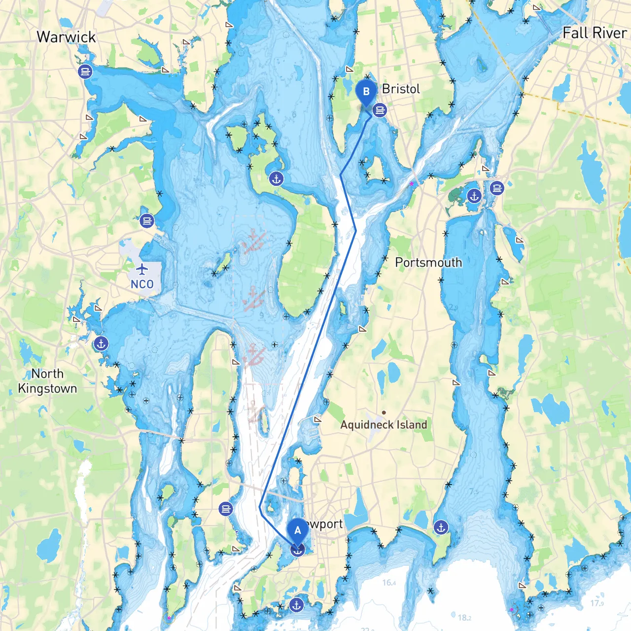
This journey from Newport to Bristol offers a splendid blend of scenic beauty and safe boating experiences. Covering a distance of approximately 10 nautical miles, this route is particularly suited for powerboats and sailboats alike, providing opportunities for both novice and experienced boaters to appreciate the stunning coastal landscape while anchoring safely along the way.
Starting Point: Newport, Rhode Island
Ending Point: Bristol, Rhode Island
2. Adjacent Waters - As you exit the harbor, stay in the marked channel to avoid shoaling areas. Look out for navigational aids like Red Nun marks and Green Can marks that will guide you through the darker waters leading towards the Sakonnet River.
3. Sakonnet Passage - Navigate through the Sakonnet Passage while watching for obstructions and ensuring you respect the marked speed limits, especially near the nature reserves. - Hazards to Avoid: Strong currents can occur; check the tide tables before proceeding.
4. Stopping Points - Potter’s Cove: This sheltered cove is situated about halfway to Bristol and is an excellent spot for rest, swimming, or picnicking — a perfect place to take cover if the weather turns sour. - Also consider stopping at Hog Island, observable off to your port side. It’s a serene place to relax or enjoy a swim.
5. Entering Bristol Harbor - As you approach Bristol, keep an eye on the iconic Bristol waterfront with its historic homes and parks. - Watch for the Bristol Harbor Light, which provides good visual guidance as you enter. - Navigational Aids: Be mindful of the various buoys marking the channel, and listen for local vessel traffic on channel 16.
This route from Newport to Bristol is not only safe but also filled with numerous opportunities for recreation and relaxation. With strategic stops and clear navigational aids, boaters of all experience levels can enjoy a captivating adventure while staying safe on the water. Whether you're soaking in the historic atmosphere in Newport or enjoying the charms of Bristol, this trip promises scenic moments that will become cherished memories.