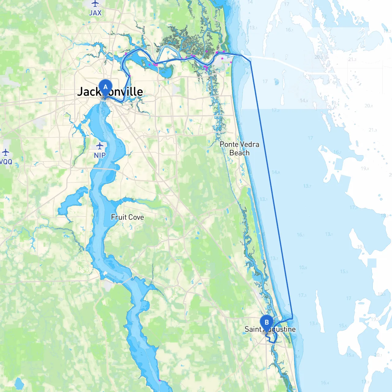
Pilotage Plan: Jacksonville, Florida to Saint Augustine, Florida
Route Overview:This route from Jacksonville to Saint Augustine is a delightful journey along the Intracoastal Waterway (ICW), making it ideal for leisure boaters and those seeking to enjoy scenic views while navigating through a haven of history and charm. The trip covers roughly 30 nautical miles and offers several opportunities for stops, shelter, and exploration.
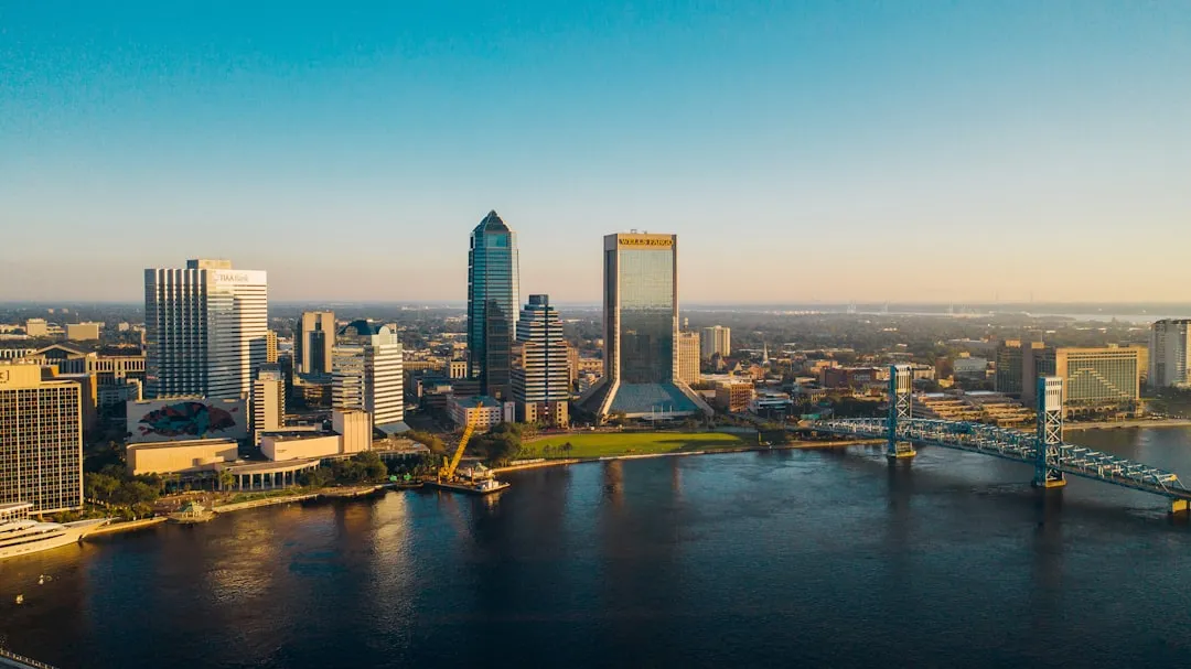
Starting Point: Jacksonville, FLAs you set sail from Jacksonville, ensure that your vessel is equipped with all necessary safety gear, including life jackets, flares, and a first aid kit. The St. Johns River is wide here, providing ample room for navigation, but be vigilant of commercial traffic as this is a busy port area.
Hazards and Navigation Considerations:1. St. Johns River Traffic: Expect frequent commercial vessels navigating the river. Maintain a safe distance and be aware of their wash, especially in narrow channels.2. Bar Pilots: Pay attention to any bar pilot flags around the river, signaling local navigational aids and traffic patterns. 3. Shallow Water: Always keep an eye on water depths as the ICW can be shallow in certain spots. Confirm your draft is suitable for these waters.
Points of Interest:
Best Sheltering Bays Along the Route:1. Landside Point: A great place to seek shelter if the weather turns foul, with multiple creeks that allow for a safe anchoring or mooring.2. Sister's Creek: A shallow creek, it affords protection and calm waters during inclement conditions, making it a suitable stopover.
Navigational Aids:While following the ICW, you will encounter various navigational markers—red and green buoys indicating safe channel entries and exits. Follow these carefully to avoid running aground. Notably:
Local Regulations and Restrictions:
End Point: Saint Augustine, FLAs you reach your destination, Saint Augustine welcomes you with its rich history and beautiful waterfront views. Visit the Old City, explore the Castillo de San Marcos, or simply enjoy the vibrant local dining scene. This destination is well-equipped for boaters, with docks and moorings readily available.
Conclusion:This route is particularly suitable for recreational and family boaters who seek a blend of safety, natural beauty, and cultural exploration. It's a perfect day trip for those looking to unwind, but be prepared and vigilant about safety while navigating this lovely stretch of Florida’s waterways. Don’t forget to check out boating apps like Savvy Navvy to enhance your navigation experience and ensure a smooth, enjoyable trip. Happy boating!