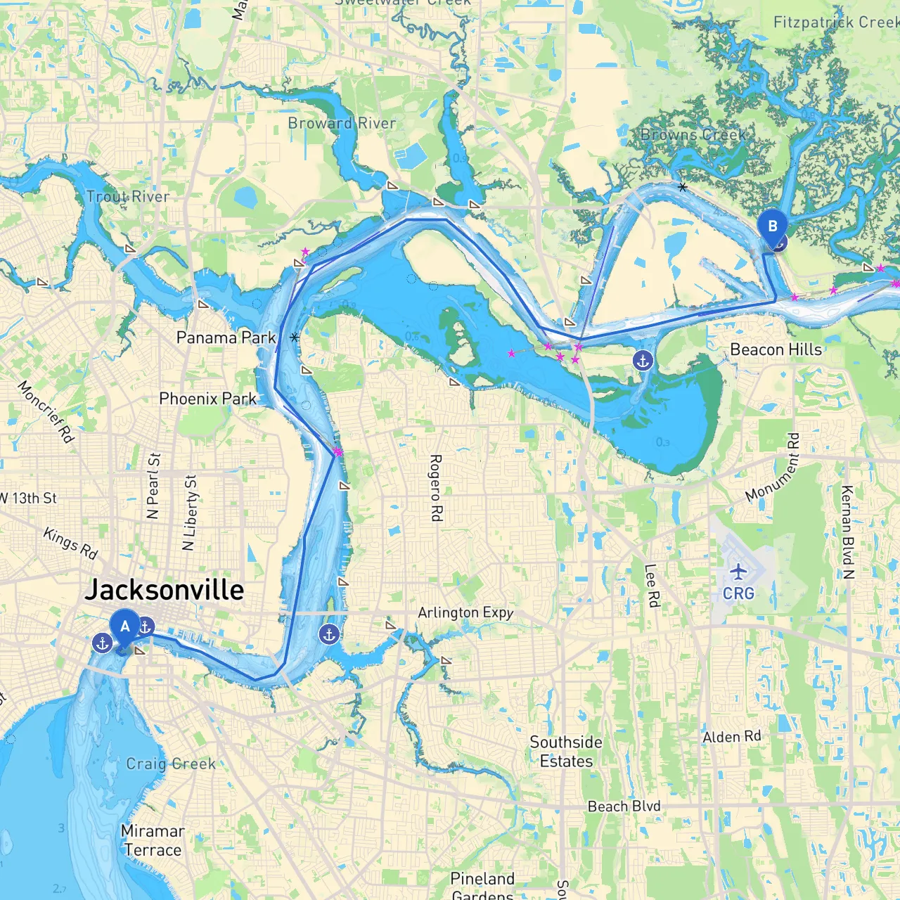
This pilotage plan takes you on a delightful loop starting and ending in Jacksonville, Florida, providing a great mix of scenic views, local attractions, and vital navigational considerations. This route is ideal for recreational boaters looking for a short yet fulfilling experience, suitable for both novice and seasoned mariners. With a mix of sheltered areas and lively landmarks, it ensures a safely navigable path while allowing for moments of fun and relaxation.
Starting Point: Jacksonville, FL (Coordinates: -81.665032614, 30.318684077)
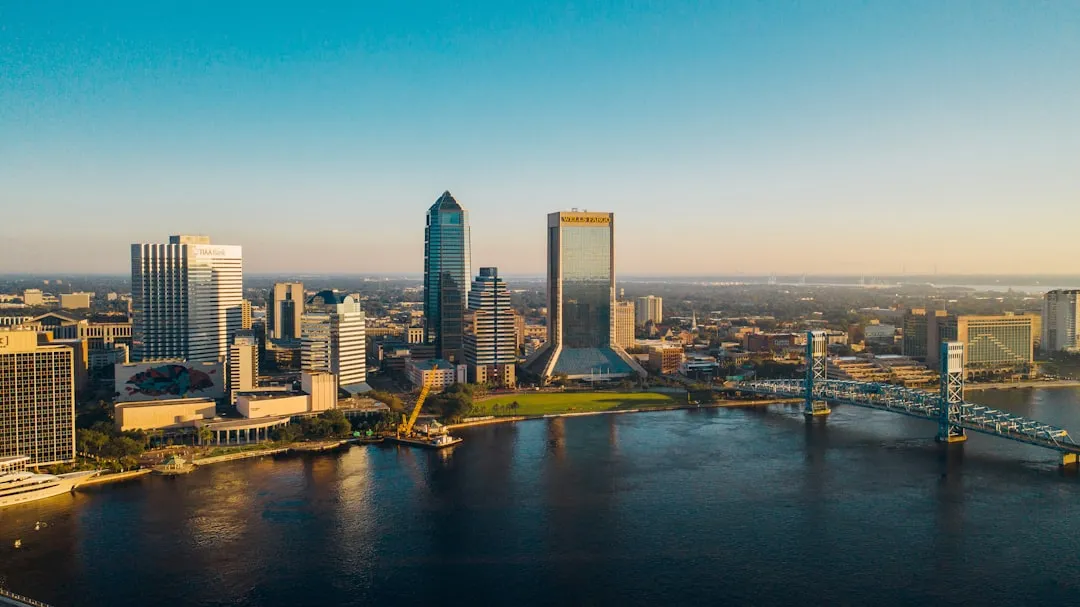
You will cast off from the bustling riverfront in Jacksonville. The St. Johns River meanders through the city, creating a majestic starting point. As you embark, consider the thriving wildlife and local cityscape.
Distance: ~5 nautical miles
As you navigate north, stay clear of any local traffic, particularly around the downtown docks and the Jacksonville Landing. The Ortega River is your first point of interest about 5 nautical miles from the starting point. A popular spot for locals, this river offers a charming atmosphere and several nautical services. It’s perfect for a quick stop to grab a meal, refuel, or even just stretch your legs.
Distance: ~3 nautical miles
Continuing upriver, you’ll find the Arlington River, another hidden gem rife with nature and tranquility. This area features a couple of small parks where you can safely anchor for a break or picnic.
Distance: ~6 nautical miles
As you leave the Arlington, begin heading east to the San Pablo River. This route opens up into a more secluded stretch, ideal for spotting dolphins and other marine wildlife.
Distance: ~8 nautical miles
Transitioning to the Intracoastal Waterway (ICW), you will find yourself in a broader, deeper channel with ample room for navigation. The ICW is famous for its beauty and diverse ecosystems. It’s also a popular route for larger vessels, so watch your wake and always stay alert.
Distance: ~12 nautical miles
After enjoying the mesmerizing views along the ICW, begin your return trip to Jacksonville. Once back, contemplate docking at local marinas where you can relax or enjoy some local seafood.
The boating route from Jacksonville to Jacksonville (via Ortega, Arlington, and San Pablo Rivers) is a perfect trip for boaters looking for a blend of safety, relaxation, and excitement. With ample opportunities to explore local parks and wildlife, along with organized navigation aids and sheltered areas, you'll feel confident and inspired as you cruise through this inviting waterway. Enjoy your trip and observe the beauty the waters of Florida have to offer!