
Pilotage Plan from Englewood, Florida to Venice, Florida
Overview: This delightful boat trip from Englewood, Florida to Venice, Florida offers a blend of tranquil waters, coastal beauty, and opportunities to explore interspersed with areas to seek shelter should weather conditions change. This route is particularly well-suited for experienced recreational boaters looking for a leisurely cruise, as well as families wanting to enjoy the beauty of Florida’s West Coast while always keeping safety as a priority.
Route Details:
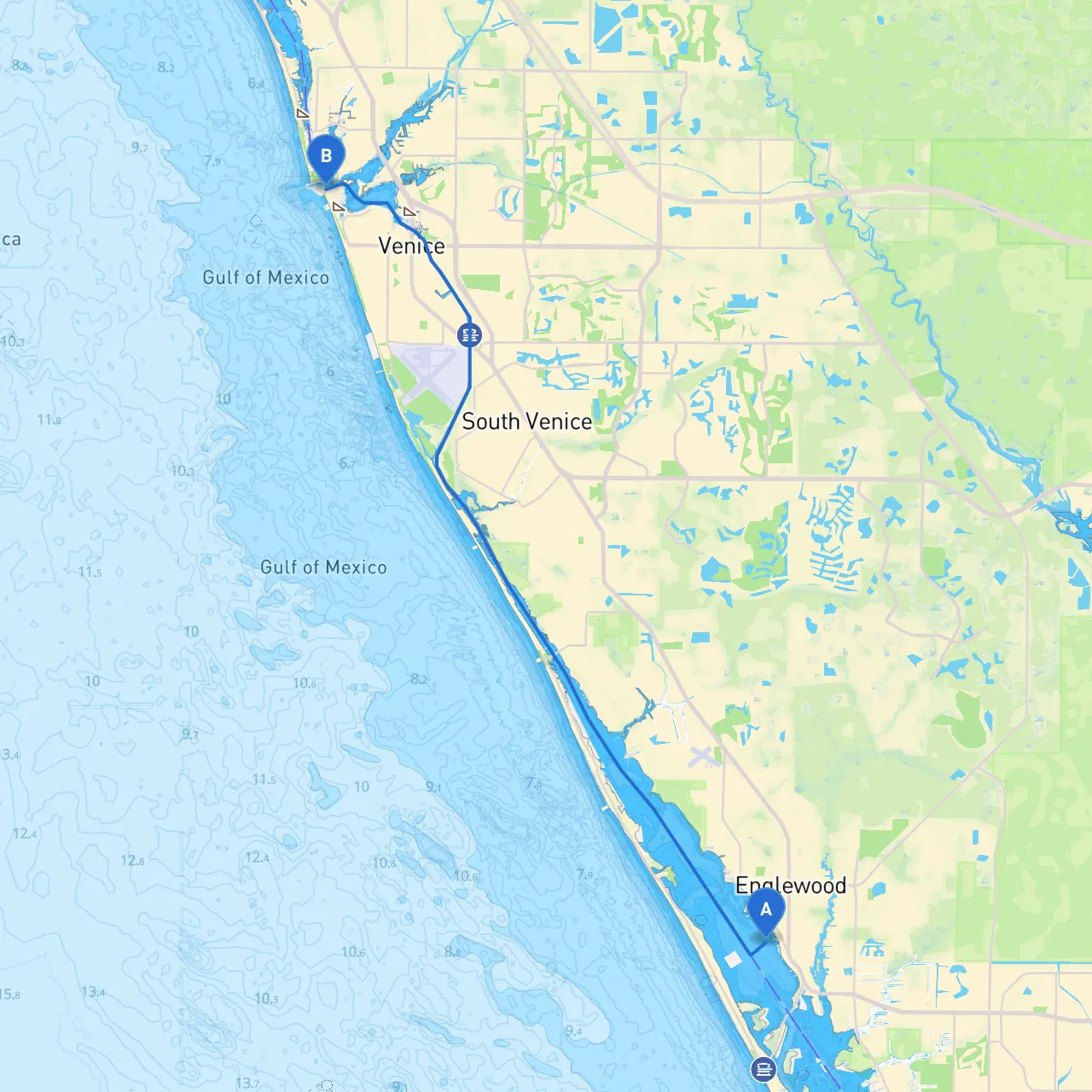
Starting Point: Englewood, FL Coordinate: -82.3587, 26.9497 Englewood serves as the perfect launch point. It is often characterized by its calm waters and beautiful natural surroundings. Make sure to perform a pre-departure check on weather conditions and vessel systems before embarking.
Navigational Points Along the Route:
1. Lemon Bay After departing from Englewood, you'll work your way into Lemon Bay. Keep an eye on your depth sounder as shallows can appear depending on tides. The bay offers picturesque views, and if time permits, consider stopping for a swim or a picnic on one of the secluded beaches before you proceed.
2. Stump Pass As you approach the southern end of Lemon Bay, you must navigate through Stump Pass. The inlet can be tricky and is subject to shifting sands, so closely monitor navigational aids and local charts. It’s a point where you’ll want to stay vigilant for other boaters and potential changes in the channel.
3. Gasparilla Sound Once you navigate through Stump Pass, you will find yourself in Gasparilla Sound. The sound offers good anchoring spots, making it an excellent location to stop and wait out any unexpected weather changes. Keep an eye out for shallow areas, especially at low tide.
4. Boca Grande Further ahead lies Boca Grande, a great area for additional fun activities such as shelling or visiting the historic lighthouse. The port here can get busy, so be mindful of ferry traffic. If you're inclined to explore, consider a short detour to visit the quaint shops and eateries in the village.
5. Charlotte Harbor While the route to Venice doesn’t take you through the broad expanse of Charlotte Harbor directly, it’s vital to stay aware of vessel traffic rules as you may encounter larger fishing boats and occasional sailboats. This is especially important as you get closer to the mouth of the harbor.
6. Skip's Marina This fantastic marina offers not only fuel and provisions but also a great place to rest and recoup before the final leg. It’s advisable to call ahead if you plan to dock or require services, particularly on weekends.
Final Leg to Venice, FL The final part of your journey will take you along the Intracoastal Waterway (ICW) towards your goal of Venice. Always adhere to markers and established navigational aids along the ICW. This part of the trip can be more congested with marine traffic, so follow the speed limits and watch out for manatees and other wildlife.
Arriving at Venice Coordinate: -82.4650, 27.11195 As you near Venice, prepare for the final approach, being cognizant of local boat traffic around the Venice Inlet. The scenic coastline here offers lighthouses and the popular Venice Fishing Pier.
Points of Interest and Shelters:
Safety and Regulations: Keep updated on local boating regulations. Always have your safety gear (life vests, fire extinguishers, etc.) checked and accessible. Follow all posted speed limits and observe no-wake zones. Monitor weather updates regularly; Florida’s weather can change rapidly, particularly during the storm season.
Apps for Navigators: Utilizing tools like the Aqua Map or Navionics can help you plot your route with precision. Additionally, I highly recommend using Savvy Navvy for navigating the waters and keeping track of tides and currents.
In summary, this trip from Englewood to Venice is a beautiful outing that allows for both relaxation and adventure, while always prioritizing safety and navigation accuracy. Enjoy the journey, and keep the thrill of cruising alive on Florida’s stunning shoreline!