
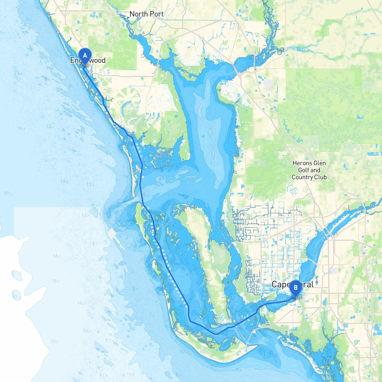
Your journey from Englewood to Fort Myers takes you through some stunning waters along Florida's Gulf Coast. This route is diverse, featuring beautiful natural surroundings, exciting glimpses of marine life, and safe harbors for shelter. It's suitable for experienced boaters who appreciate the beauty of the water while also prioritizing safety across this scenic route.
Starting Point: Englewood, Florida Coordinates: -82.3587, 26.9497
As you begin your trip, set your course long before hitting the open waters. Englewood provides good access to the Gulf of Mexico; however, local knowledge about tidal movements and boat traffic in Lemon Bay is critical.
1. Boca Grande Pass: One of the major navigational hazards, Boca Grande Pass can have strong currents. Watch for the dominant shipping traffic in the area, which may include large vessels. As you approach, you'll encounter the striking Boca Grande Lighthouse and can pause at Gasparilla Island State Park for a bit of exploration.
2. Charlotte Harbor: This momentous harbor showcases a rich ecosystem and serves as a refuge for boaters in case of inclement weather. Keep an eye out for shallow areas, especially when the tide is low. Consider making a stop at Punta Gorda, a lovely town with waterfront dining options and parks.
3. Pine Island Sound: This area offers a stunning interlude as you navigate toward Fort Myers. Look for glimpses of dolphins and manatees. The waters can be narrow and winding; use caution, particularly around the northern part.
4. Cayo Costa State Park: A potential anchorage point along your journey, Cayo Costa is both a beautiful natural reserve and a haven for wildlife. If time allows, a visit here for a swim or a stroll along the beach would be rewarding.
Throughout your journey, several critical navigational aids and markers will assist you:
Before departing, it’s important to check for local boating regulations and speed limits in certain areas, particularly around nature reserves and populated harbors. For instance, no-wake zones are frequently in place near marinas and residential areas, so be prepared to adjust your speed accordingly.
You might also come across gopher tortoises and other wildlife, especially in Cayo Costa. Please observe all "Do Not Disturb" signs to protect these important species.
Destination: Fort Myers, Florida Coordinates: -81.9380, 26.5357
As you arrive in Fort Myers, you enter a bustling hub with plentiful amenities including restaurants and marinas. The waterfront parks and the vibrant downtown area are great places to explore once you’ve secured your vessel.
This carefully planned route from Englewood to Fort Myers not only prioritizes safety but also offers an enriching experience filled with natural beauty and points of cultural interest. Keep your safety gear onboard, monitor the weather conditions, and enjoy the journey. With the right precautions and navigational tools, you will have a wonderful and safe adventure!