
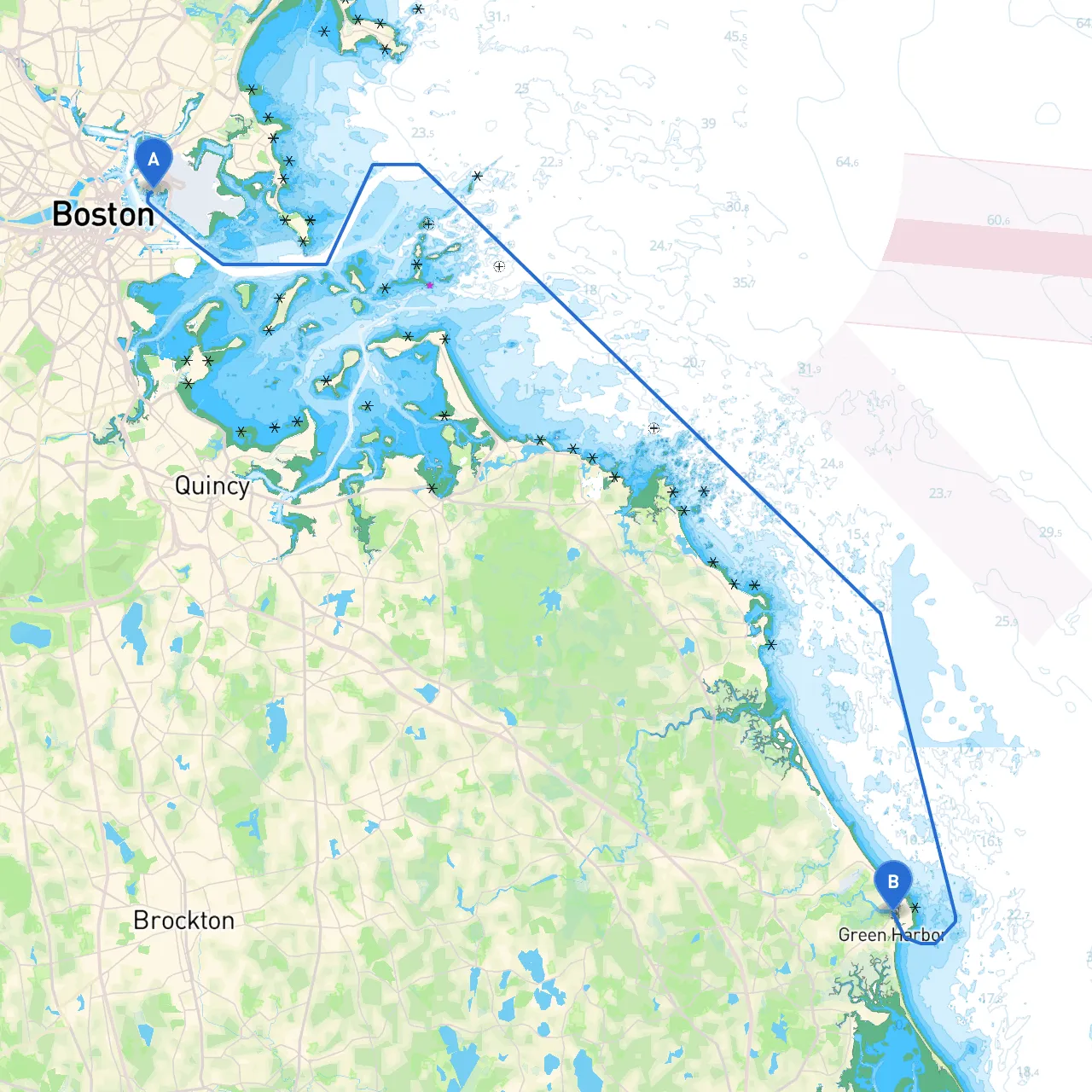
Pilotage Plan: East Boston, MA to Marshfield, MA
Departure Point: East Boston, MAYour journey begins in East Boston, a vibrant waterfront community with quick access to Boston Harbor. Anchor in the protected waters of Boston Harbor, where the Boston Light and the surrounding islands also provide excellent vantage points for introductory exploration.
Route OverviewThe trip to Marshfield, approximately 25 nautical miles south, primarily takes you through the Boston Harbor and down the Massachusetts coastline to the South Shore. This route is ideal for intermediate to experienced boaters, given the potential hazards presented by shipping traffic, weather conditions, and rocky inshore areas.
Navigational Considerations1. Boston Harbor: As you exit East Boston, pay careful attention to the busy shipping channels. Follow marked channels, noting navigational aids such as buoys and lights. The iconic Boston Light, the oldest lighthouse in the United States, can serve as a great landmark to stay on course.
2. Point Allerton and Hull Gut: As you navigate the entrance near Hull, be mindful of Hull Gut, where currents can be strong, especially during tidal changes. Look out for the navigational markers that indicate the safer passage.
3. Hingham and Weymouth: Continue your transit through Hingham Bay, a great shelter spot should you face inclement weather. This area has beautiful scenery and is a good pause point for a picnic or simply soaking in the coastal atmosphere. From Hingham, the route then leads to the Weymouth Fore River, which should be navigated with caution due to periodic commercial vessel traffic.
4. Cohasset and Scituate: As you progress south, the route will bring you close to Cohasset Harbor and Scituate, both scenic spots ideal for a short break. Scituate offers an active fishing community and attractions like the Scituate Lighthouse.
5. Final Stretch to Marshfield: Finally, navigate toward Marshfield, keeping an eye on the coastline for rocky outcroppings and sandbars. The entrance to Marshfield can be tricky due to shifting sand, so it’s important to stay alert and adhere to marked channels.
Shelters Along the Route
Points of Interest
Navigational Aids and Local RegulationsMonitor your charts for the various buoys marking the busy shipping lanes, ensuring compliance with local maritime regulations. For example, respect any no-wake zones or specifications on your vessel size concerning specific waterways.
Apps for Enhanced NavigationUsing modern technology can also enhance your navigation experience. Consider downloading:
This sailing expedition not only offers beautiful coastal vistas and a chance to explore the rich maritime history along Massachusetts’ South Shore but also emphasizes safety and cautious navigation. With good preparation, this trip will prove to be both exciting and safe. As always, heed all local weather alerts, keep a vigilant lookout for hazards, and enjoy your adventure from East Boston to Marshfield!