
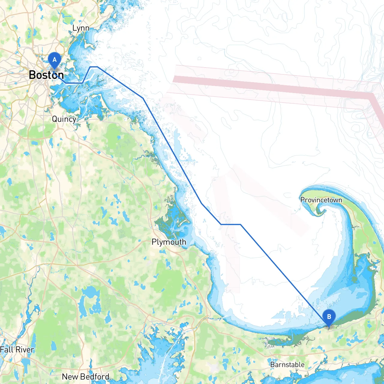
Departure: East Boston, MA Beginning your adventure on the Charles River at East Boston, you are greeted with the bustling sights of the city as you navigate out into Boston Harbor. This urban environment offers a fascinating blend of history and modernity, setting the stage for your journey ahead.
Leg 1: East Boston to Boston Harbor As you leave East Boston, your navigation will take you through the iconic Boston Harbor, filled with commercial and recreational vessels. Make sure to keep an eye on the busy shipping lanes and follow the marked channels to avoid the numerous wharfs and shallows, especially near Logan Airport. Enjoy guided navigation by paying attention to navigational aids such as buoys and range markers.
In this section, you can take a minor detour to explore the East Boston Ferry Terminal before heading towards Spectacle Island—a great spot for a picnic and some stunning views of the Boston skyline.
Leg 2: Boston Harbor to Plymouth Bay Once you’ve made your way clear of the harbor, your next leg will take you along the northern shore of the harbor before heading south toward Plymouth. This is where you’ll experience a significant change in scenery. As you cross into the waters of Cape Cod Bay, you will gradually feel the coastal charm of Massachusetts enveloping you.
Navigational aids remain crucial here, with the Gay Head Light and the iconic Plymouth Rock other nearby features to note as you approach the coastline. Plymouth Bay is an excellent halfway point to stop and grab a bite at one of the waterfront eateries or even anchor for a bit to enjoy the local culture and attractions like Plimoth Plantation, which provides a taste of history.
Leg 3: Plymouth Bay to Barnstable Harbor After departing Plymouth Bay, steer your course towards Barnstable Harbor. Remember to stick to the proposed routes due to varied depths and shoaling areas. This section can be challenging, with unmarked rocks and shallow areas, so consult your charts carefully. Barnstable Harbor is a boater-friendly area with several marinas and is perfect for docking if weather conditions change.
This area also offers several opportunities for beachcombing, quaint shops, and a beautiful view of the Cape Cod scenery. You can take a break here with activities such as paddleboarding or simply enjoying the fresh seafood in local eateries.
Leg 4: Barnstable Harbor to South Dennis, MA The final leg sees you heading toward South Dennis. As you make your way, you will navigate along the shoreline where marshlands and serene landscapes unfold. Keep your eyes peeled for the navigational markers leading you towards the Bass River—an area that presents several picturesque views and winding trails.
When nearing South Dennis, pay keen attention to the waters surrounding the numerous inlets and beaches. The rivers and marshes here do have occasional swift currents, especially during tidal changes, so maintain vigilance as you approach the shoreline.
Shelters and Points of Interest Along the Way
As a seasoned mariner, you know the importance of keeping safety as your top priority. Familiarize yourself with local regulations, including speed limits and any designated no-wake zones especially near harbors and populated areas. Always check the weather forecast before departure and remain alert for sudden weather changes.
Useful Navigation Apps To ensure smooth sailing, consider using savvy navvy, which is fantastic for route planning and provides critical navigation aids. Additionally, MarineTraffic offers real-time vessel tracking, and Navionics is excellent for detailed charting.
This route is particularly suitable for cruising enthusiasts looking for a blend of history and scenic beauty while maintaining safety. Enjoy your journey with the assurance that you are well-prepared for a safe and memorable adventure!