
Pilotage Plan: East Boston, MA to Newington, NH
1. Overview of the RouteThis journey from East Boston, Massachusetts to Newington, New Hampshire covers approximately 50 nautical miles of scenic coastal waterways. It's perfect for cruising enthusiasts looking for a leisurely yet captivating trip filled with lovely views, charming towns, and the richness of maritime history. This route primarily suits recreational boaters with moderate experience, as it involves navigating coastal waters and rivers but presents minimal hazards when approached with care.
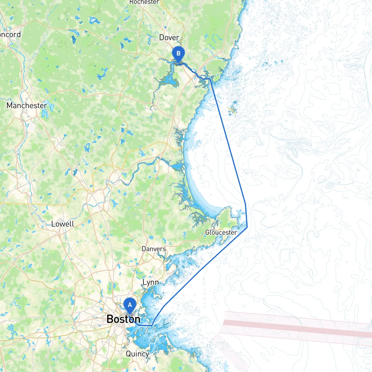
2. Departure from East BostonStarting from East Boston, with coordinates -71.0338, 42.3636, the first step is identifying the route through Boston Harbor. Before setting out, check the tide schedules for optimal conditions, as tidal currents in the harbor can be strong during certain times.
3. Navigational Aids in Boston HarborAs you sail out of East Boston, pay attention to prominent navigational aids:
Plan on making some defensive maneuvers while navigating through the busy harbor. Vigilance is key here, as you'll encounter ferries, cargo ships, and recreational boats.
4. Points of Interest Along the WayAfter exiting the harbor, you’ll pass by:
5. Shelter OptionsAs you continue north toward New Hampshire, be prepared for potential foul weather. Notable bays along the route where you can seek shelter include:
6. Navigational Considerations Along the RouteAs you approach the entrance to the Piscataqua River, watch for:
Be cautious of the Sarah Long Bridge where strict height restrictions are in place, so ensure you have an updated clearance for your vessel.
7. Arrival at NewingtonAs you get closer to Newington, NH (coordinates -70.8363, 43.1167), you’ll be greeted by a mix of rustic charm and vibrant green landscapes. Newington is a peaceful area perfect for a night’s rest or exploring the local history. Consider making a stop at Great Bay, which provides beautiful scenery and is an excellent location for fishing or birdwatching.
8. Safety and ComplianceBefore you head out, consult apps like Savvy Navvy, Navionics, or Waterway Guide for real-time data on tides, currents, and local traffic regulations. Always carry a VHF radio to stay connected, as a sudden weather change can impact your plans. Be mindful of the local boating regulations to maintain responsible and safe boating practices.
ConclusionThis route offers an enjoyable yet safe journey for intermediate boaters who appreciate scenery, history, and the pleasure of coastal exploration. By following this pilotage plan, you can navigate the varied waterways with confidence while knowing you have all essential safety considerations covered. Enjoy your adventure on the water!