Home
 /
Massachusetts
 / 

East Boston to Exumas by boat

East Boston to Exumas

Distance - 59.9 Nm

Avg Speed
5 kts
10 kts
20 kts
30 kts
Time Estimate
11 hr 58 min
5 hr 59 min
2 hr 59 min
1 hr 59 min
East Boston to Exumas

East Boston to Exumas

Pilotage Plan: East Boston, MA to Exumas, BS

Overview

This exciting journey takes you from the bustling harbor of East Boston, Massachusetts, to the serene and picturesque Exumas in the Bahamas. Covering a distance of approximately 1,200 nautical miles, this route is ideal for experienced cruisers looking for a mix of coastal navigation, offshore challenges, and stunning natural beauty.

Key Considerations

1. Safety First: Always check weather forecasts and sea conditions. Be prepared with a well-equipped vessel, including safety gear and navigation tools. Ensure your radio is operational for constant communication.2. Navigation Tools: While traditional charts are essential, consider utilizing modern boating apps, such as Savvy Navvy, for real-time navigation options and emergency contacts. Other advisable tools include Navionics and Windy for weather updates.

Route Breakdown

Section 1: East Boston, MA to Cape Cod Canal

  • Starting Point: East Boston, MA (Coordinates: -71.0338, 42.3636)
  • Distance: Approximately 20 nautical miles
  • Landmarks: Head out of Boston Harbor, keeping the U.S. Coast Guard stations in sight. Look for the iconic Bunker Hill Monument as you navigate.

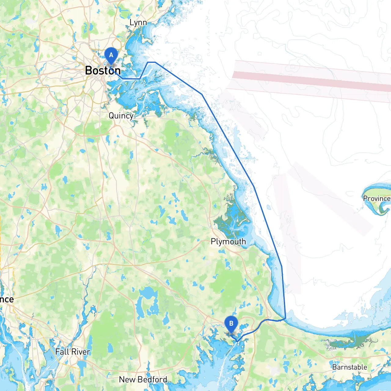
Shelter Options: If conditions deteriorate, consider seeking refuge in Plymouth Harbor, offering safe anchorage and amenities.

Section 2: Cape Cod Canal to New Bedford

  • Navigation Tip: Transit the Cape Cod Canal with caution due to strong currents, especially during peak tidal flow.
  • Shelter Bay: Buzzards Bay provides excellent shelter with numerous anchorages like Sandwich Marina where you can stock up on provisions.

Points of Interest: Check out the picturesque seaside towns along the way, such as Sandwich, where you can explore historic sites or enjoy local seafood.

Section 3: New Bedford to Block Island

  • Distance: Around 22 nautical miles
  • Anchorage: Block Island is a popular stop-off point with myriad beaches, hiking trails, and a vibrant community.

Attention Points: Watch for fishing vessels and lobster pots in the area. The light at Block Island is particularly significant in low visibility.

Section 4: Block Island to Montauk, NY

  • Distance: Approximately 12 nautical miles
  • Landmarks: Montauk’s historic lighthouse is a great navigation mark and is worth a visit.

Section 5: Montauk to Sandy Hook, NJ

  • Distance: About 40 nautical miles
  • Points of Interest: Experience the thrill of finding a great fishing spot off Sandy Hook. The scenic views of the New Jersey coastline are breathtaking.

Important Navigational Aids: Watch for the Sandy Hook Light and adhere to any navigational restrictions in place near the coast.

Section 6: Sandy Hook to New York Harbor

  • Navigational Caution: Heavy traffic from ferries and cargo vessels. Streamline your transit during marked currents for an efficient passage.
  • Shelter Spot: If weather turns, the harbors around Staten Island offer safe harborage.

Cultural Highlights: Take a moment to enjoy the skyline views of Manhattan and possibly dock at one of the marinas for a quick city excursion.

Section 7: New York to Atlantic Ocean

  • Distance: From the harbor to open sea (14 nautical miles)
  • Key Navigational Acquisitions: Pay close attention to Lighthouses and buoys marking the shipping channels.

Section 8: Atlantic Ocean to the Bahamas

  • Open Ocean Navigation: Head southeast for roughly 750 nautical miles. Chart your course carefully, avoiding known hazards such as the Gulf Stream, which presents powerful currents.

Landmarks: Look for the Bahamas Light and watch for large cargo ships.

Arrival: Exumas, Bahamas

Upon entering the serene waters of the Exumas, you'll enjoy a tropical paradise filled with stunning beaches, secluded cays, and vibrant underwater life.

Closing Thoughts

This journey is tailor-made for experienced cruisers with the capacity for offshore navigation. While the trip presents fantastic opportunities for adventure and exploration, safety must remain paramount. By using modern navigation aids, understanding local waters, and being prepared for any weather changes, this route promises not only tranquility but memorable experiences. Remember to always respect the local regulations of the waters you traverse and take joy in the beautiful landscapes that await at every turn. Safe travels!