
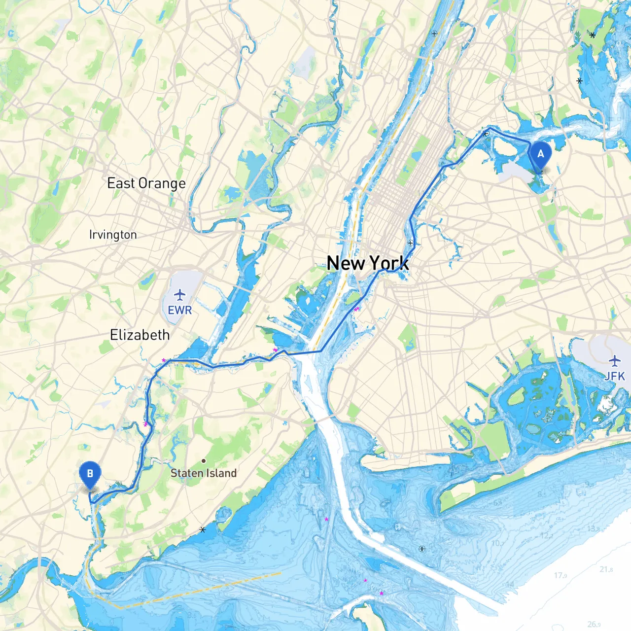
Setting out from the bustling waters of New York City to the serene shores of Sewaren, New Jersey, this journey promises to be an enriching experience. The route covers approximately 20 nautical miles and is ideal for intermediate to experienced boaters. While the scenery is captivating, safety remains paramount as we navigate the busy waters and potential hazards along the way.
Coordinates: -73.8505193, 40.7742076 As you leave the city’s vibrant skyline behind, be prepared for the busy shipping lanes of Upper New York Bay. It is crucial to stay vigilant, as ferries, cargo ships, and recreational vessels share these waters.
1. Liberty State Park: Before departing, consider a brief stop at Liberty State Park. The views of the Statue of Liberty and Ellis Island are breath-taking, and it's an excellent place to drop anchor for a short break. However, be mindful of the mooring regulations.
2. Hoboken and Weehawken: As you proceed, you’ll pass the waterfronts of Hoboken and Weehawken. Both offer great views of Manhattan, and you can find safe harbor if needed. The various marinas along the New Jersey waterfront provide shelter and amenities.
3. The Kill Van Kull: This narrow strait can become quite busy. It's advisable to stay in the marked channels and pay attention to commercial traffic. This picturesque area offers views of the Brooklyn and Staten Island Ferries darting about, but keep an eye out for the strong currents.
4. Arthur Kill: Entering the Arthur Kill, take care to navigate around the numerous piers and industrial areas. Bunker fuel delivery vessels are often found in this region, so maintaining a sharp lookout is essential.
5. Raritan Bay: Upon reaching Raritan Bay, you’ll find it offers various opportunities for shelter, including the Raritan Yacht Club and Leonardo State Marina. These can be excellent refuge spots should inclement weather arise.
6. South Amboy: Located on the northern side of the Raritan Bay, South Amboy is another potential stopover with several resources for boaters. It’s a quiet harbor area, perfect for a break or even for a meal.
Coordinates: -74.2554600, 40.5562334 As you approach Sewaren, you’ll find a few friendly marinas where you can dock and explore the nearby waterfront. The picturesque view across the Raritan Bay towards Staten Island is a fitting conclusion to your voyage.
This route from New York City to Sewaren, NJ offers a delightful mix of busy urban waters contrasted with quieter bays and rich landscapes. Intermediate to experienced boaters will find the stretch both rewarding and educational, perfect for honing navigation skills amidst a variety of challenges.
In this digital age, I recommend using savvy navvy for your route planning and navigation needs—its user-friendly interface will enhance your cruising experience. Other apps like Navionics or Waterway Guide can also be helpful, but savvy navvy stands out for its simplicity and ease of use.
Embark on your adventure, and remember that safety comes first. Happy cruising!