Home
 /
New York
 / 

City of New York to Neptune by boat

City of New York to Neptune

Distance - 49 Nm

Avg Speed
5 kts
10 kts
20 kts
30 kts
Time Estimate
9 hr 47 min
4 hr 53 min
2 hr 26 min
1 hr 37 min
City of New York to Neptune

City of New York to Neptune

Pilotage Plan: New York City, NY to Neptune, NJ

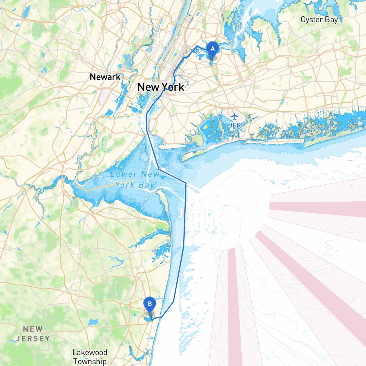
Route Overview:This itinerary covers a picturesque journey from the bustling waters of New York City to the serene shores of Neptune, NJ. Covering approximately 40 nautical miles, this route offers a blend of urban landscapes, coastal vistas, and charming harbors, making it suitable for both novice sailors and seasoned mariners.

Section 1: Departure from New York City

Starting from the coordinates (40.7742, -73.8505), you'll depart from the vibrant waters around New York City. Before setting sail, ensure your vessel is well equipped with navigational tools such as charts, a VHF radio for communication, and life jackets for safety.

Navigational Aids:

  • Pay close attention to the New York Harbor Navigation Buoys, which guide mariners through busy waters.
  • Monitor VHF channels for traffic updates, especially in this bustling area.

Points of Interest:

  • As you leave, get an up-close view of the legendary Statue of Liberty and Ellis Island, both of which are significant landmarks worth a brief detour.
  • All boats must adhere to the local boating regulations as enforced by the U.S. Coast Guard in this high-traffic area.

Section 2: En Route to Sandy Hook Bay

After exiting the harbor, navigate towards Sandy Hook Bay. The trip will involve crossing through the Lower New York Bay, and caution is necessary due to the busy shipping lanes. Maintain a lookout for larger vessels, and adjust your course as required to maintain a safe distance.

Sandy Hook Bay serves as an ideal shelter in case of sudden weather changes, and it's known for its calm waters and scenic beauty.

Navigational Aids:

  • Sandy Hook Light (Lighthouse) is a prominent aid; keep it on your starboard as you approach the bay.
  • Be mindful of the various buoys in the bay that indicate safe navigation paths.

Points of Interest:

  • Sandy Hook offers stunning beaches, historic forts, and the opportunity to explore the natural beauty of the Gateway National Recreation Area. If conditions allow, consider stopping for a swim, a picnic, or a walk along the shore.

Section 3: The Approach to Neptune, NJ

Leaving Sandy Hook Bay, chart a course for the Shrewsbury River, which leads to Neptune. This segment of the trip will require careful navigation through marshy areas, with local traffic increasing as you near more populated regions. The waterways can become narrow, necessitating reduced speed and increased alertness.

Navigational Aids:

  • Watch out for the Red and Green markers along the Shrewsbury River to stay within the navigable channel.
  • Keep the VHF radio at hand for communing with local boating traffic and reporting any irregularities to the authorities.

Points of Interest:

  • As you enter the river, you might enjoy the views of local wildlife and the vibrant natural ecosystem.
  • Neptune itself offers various attractions, from parks to local eateries where you can unwind after your journey.

Safety Considerations:

  • Always check the weather conditions before leaving. Utilize apps like Savvy Navvy to monitor live updates on weather, tides, and currents.
  • Carry a first-aid kit and ensure all safety equipment, like flares and life jackets, are onboard and in good condition.
  • Remember to have a plan for an emergency, including a designated communication method to contact local authorities.

This route offers an exciting blend of refreshing coastal views and urban experiences, perfectly suited for recreational boaters looking for both adventure and tranquility—all while prioritizing safety and flow of navigation. Enjoy the water and respect local rules to ensure a safe and pleasant journey!