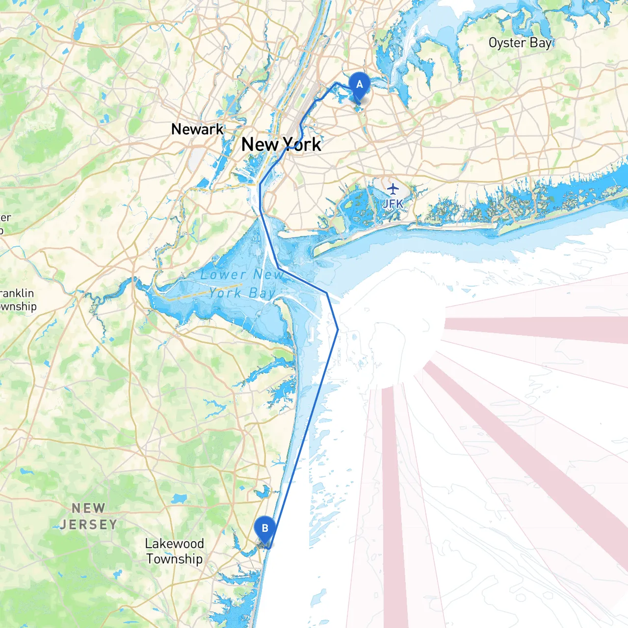
Pilotage Plan: New York City, NY to Point Pleasant Beach, NJ
Route Overview:This pilotage plan outlines an enjoyable yet safe route for boaters traveling from New York City to Point Pleasant Beach, New Jersey. This trip is both picturesque and straightforward, catering particularly well to intermediate to advanced boaters who possess sound navigational skills and are accustomed to urban waterways. As you embark on this journey, you'll navigate through a blend of bustling urban settings and serene coastal scenery, with numerous harbor features and landmarks marking your path.
Departure: New York City, NY
- Starting Point: Your journey begins at the coordinates -73.8505, 40.7742 in New York City. Before you leave, ensure you are well-versed with your boat's systems and the local weather forecast.
- Local Point of Interest: Before heading out, consider a quick detour around the Statue of Liberty for a delightful photo op or a scenic view.
Navigational Considerations:
- Hazards: Be cautious of heavy boat traffic in New York Harbor, including ferries and commercial shipping. Maintain a vigilant watch for anchored vessels and buoys designating no-wake zones.
- Navigational Aids: Pay close attention to the East River's navigation markers. The FDR Drive skyline to your west and Brooklyn's waterfront will give you clear sightlines to your next move.
Route to Sandy Hook Bay:
- From the East River, navigate south toward the Lower Bay, keeping clear of various oil tankers and large vessels in Upper New York Bay. The entrance to the Newark Bay is on your starboard side, which should be avoided unless necessary, as it is a commercial shipping lane.
- As you reach the Lower Bay, stay towards the central channel, where deeper draft vessels generally navigate. Look out for the Fairway and Sandy Hook Light, two prominent lighthouses guiding your way.
Shelter Options:If the weather turns inclement, you can find refuge in Sandy Hook Bay. The bay offers multiple anchorages with sound holding ground.
Next: Raritan Bay
- Upon rounding Sandy Hook, you will enter Raritan Bay. This area is known for its diverse marine life and offers a great chance for sightseeing. Look for the sandy shores of the Gateway National Recreation Area—a fantastic option for a short stop or picnic.
- Local Considerations: This area can become busy during weekends, so maintain awareness of other boaters, especially smaller craft and personal watercraft.
Notable Attractions: As you cruise through Raritan Bay, consider making a stop at the picturesque town of Atlantic Highlands for dining and exploring independent shops.
Final Approach: Point Pleasant Beach, NJ
- As you navigate eastward, keeping the shore on your starboard, be prepared for the transition from Raritan Bay into the open Atlantic Ocean as you approach Point Pleasant.
- Important Navigational Aids: Keep a keen eye on coastal buoys and be aware of local shoaling areas as you approach the entrance to Point Pleasant Canal.
- The Point Pleasant Beach area features multiple marinas where you can dock for refueling and services upon arrival.
Local Points of Interest:Once docked, enjoy the sandy beaches, vibrant boardwalk with local shops and eateries, and the aquarium. This coastal town offers numerous activities ranging from fishing to water sports, perfect for unwinding after your voyage.
Safety Reminders:
- Always equip your vessel with the necessary safety equipment, including life jackets, a first aid kit, and a VHF radio.
- Monitor weather updates regularly and be prepared to alter your course if conditions become dangerous.
- Adherence to local speed limits and designated navigation channels is crucial.
Boating Apps:For navigation, consider using Savvy Navvy along with other navigation apps like Navionics and Marine Traffic to stay informed about current weather, tidal changes, and local regulations.
This route blending urban exploration with the tranquility of coastal waters promises to be an adventure that respects safety while offering plenty of enjoyable experiences along the way. Enjoy your journey!