
Pilotage Plan for a Boat Trip from New York City, NY to Sea Bright, NJ
Overview of the TripThis journey takes you from the bustling cityscape of New York City to the serene shores of Sea Bright, NJ. It's a distance of roughly 25 nautical miles along one of the most vibrant coastlines in the Northeastern United States. This route will delight both seasoned sailors and novice boaters alike, due to its combination of urban navigational challenges and natural beauty.
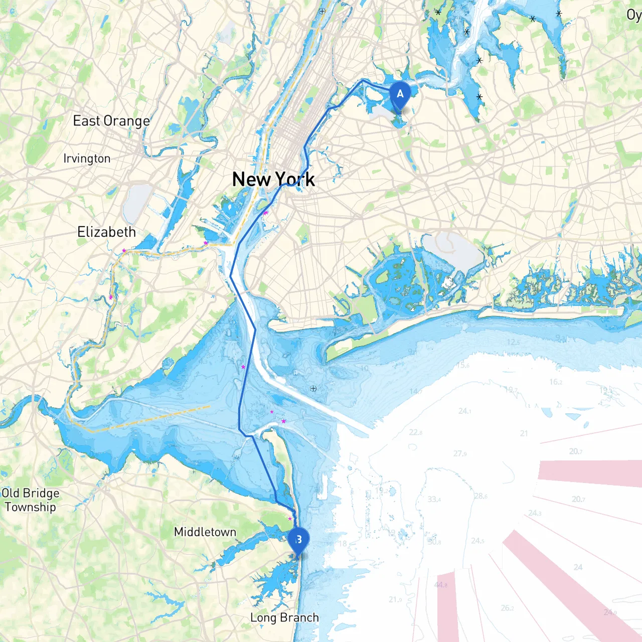
Departure ConsiderationsBefore setting off, ensure that you have thoroughly checked the weather forecast and tidal charts. The East River can have strong currents and busy traffic, especially from ferries and commercial vessels. Avoid departing during peak commuter hours for a smoother ride. As you start from the coordinates at around 40.7742° N, -73.8505° W, adjust the boat for a course towards the Lower Bay of New York Harbor where navigation becomes less congested.
1. Staten Island: Navigate past the northern part of the Staten Island Ferry route. The iconic ferry offers splendid views, so consider stopping at Staten Island if time allows for lunch or a brief exploration. 2. New Jersey Shore: As you move past the Verrazzano-Narrows Bridge, you’ll have a clear view of the New Jersey coastline.
Raritan Bay: Just after Sandy Hook, Raritan Bay offers a large expanse of calm water where you can find refuge if weather conditions turn unfavorable. There are several marinas in this area, like Leonardo State Marina, which are ideal for shelter, fuel, or food.
Navigational Aids: Along your route, keep an eye out for navigational lighthouses such as the Sandy Hook Lighthouse. Utilize buoys and markers to maintain a safe passage, especially around the shipping lanes leading to New York Harbor. Remember that all vessels must adhere to the "Rules of the Road" for safe navigation and to avoid collisions.
1. Entering the Lower Bay: As you make your way into the Lower Bay, you will gain an impressive view of the Manhattan skyline. Keep your speed down to maintain control and preserve the experience of cruising through one of the world's notable urban waterways.2. Hook of Sandy Hook: Once past the Gateway National Park's Sandy Hook, you're faced with the open ocean. The sandy beaches here invite a stop for a swim if the weather permits, providing a nice chance to relax.
As you close in on Sea Bright, the Shrewsbury River comes into play. Navigate carefully through the river entrance amidst possible currents and boat traffic. The shoreline will greet you with its charming seaside atmosphere, and the local marina and facilities make for an easy docking experience.
Stay informed about local regulations, especially regarding fishing and swimming in designated areas. Always be vigilant of posted speed limits and restricted zones around marinas and channels.
For safe navigation, consider using apps such as Navionics and iNavX, but always keep a backup like paper charts. Don't forget to download Savvy Navvy; it's user-friendly and great for planning your trip and understanding marine conditions.
This itinerary from New York City to Sea Bright is ideal for boaters seeking a combination of safety, scenic vistas, and opportunities for fun. While the approach through busy waters demands precautions, the payoff is the picturesque coastline and the tranquil beauty of Sea Bright. Happy boating!