
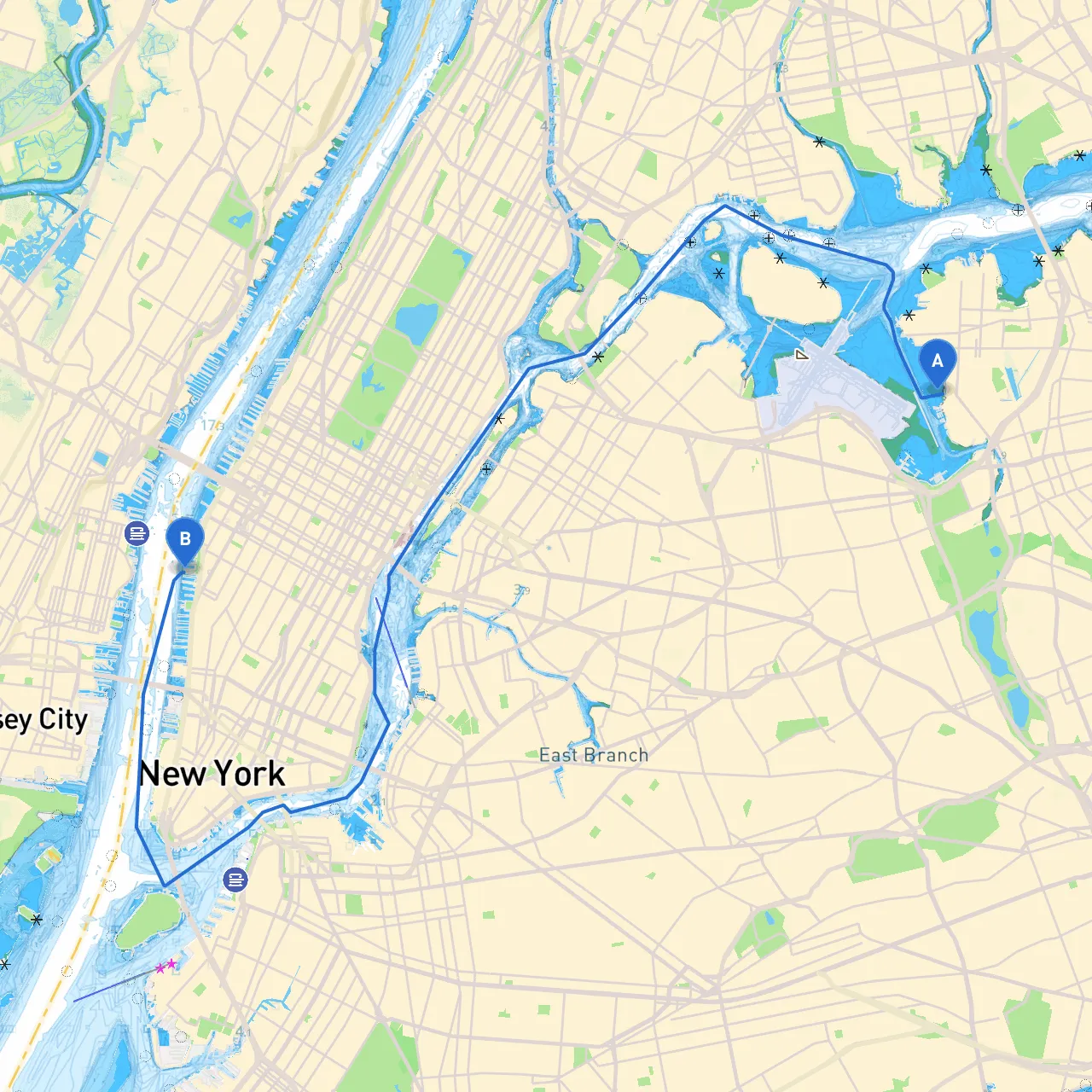
Pilotage Plan: New York, NY to New York, NY
Departure: City of New York, New York, United StatesYour journey begins at (long/lat: -73.850519300396, 40.774207581886), which sits along the East River. This bustling area is surrounded by some notable landmarks like the iconic skyline of Manhattan, a quintessential view for anyone setting sail in New York.
En Route Points of Interest:1. East River: As you head south from the East River, be prepared to navigate through its bustling waters populated with various vessels. The FDR Drive runs alongside, but there’s ample space for navigation. You may spot the historic Brooklyn Bridge, a popular photo op and an architectural wonder.2. Brooklyn Bridge Park: This expansive park provides a scenic spot to dock for a picnic or just enjoy the view of Manhattan. Keep an eye on weather conditions as this area can be busy with tourist boats and ferries.3. Sandy Hook Bay: If you're looking for shelter, consider steering a little further towards Sandy Hook Bay. This sheltered bay offers a good refuge should bad weather emerge unexpectedly.4. Governors Island: Make a stop at Governors Island, which is a short detour from your route. The island is not only a great place to learn about New York’s history but also has beautiful parks perfect for a leisurely stroll.
Navigational Considerations:As you approach lower Manhattan, be vigilant to the navigation aids along the way. Pay attention to buoys marking the shipping channels, especially the local traffic on the Hudson River. The tide can be critical in this area – make sure to review tidal charts beforehand to optimize your speed and safety.
Regulatory Considerations:Familiarize yourself with local boating regulations provided by the Coast Guard and New York Department of Environmental Conservation. Specific restrictions may apply along the East River and in proximity to commercial shipping lanes. Noise regulations may also be stricter in certain areas due to the bustling nature of New York's waterways.
Navigational Aids:Key aids to include in your planning:
Shelter Options:If inclement weather arises, you have several spots to consider:
Type of Boater:This route is ideal for intermediate to advanced boaters who are comfortable navigating busy waters and respond quickly to changing weather conditions. There are ample opportunities for shorter breaks and activities, which can be a draw for those looking to mix leisure with their journey.
Safety Tips:Always ensure you have a working VHF radio aboard, and keep on the lookout for traffic in tight spots. Prepare your vessel with enough safety gear, including life jackets, signaling devices, and emergency provisions. Regularly review your route using reliable navigation apps like Savvy Navvy, which can help plot your course accurately and provide real-time data about conditions.
Plan your trip mindfully, stay aware of your surroundings, and enjoy the journey through one of the most iconic maritime regions in the world!