Pilotage Plan: From New York City, NY to New Rochelle, NY
Overview:Embarking on this journey from the bustling heart of New York City to the serene shores of New Rochelle offers a unique opportunity for both experienced and novice boaters. This route provides stunning views of New York's skyline as you navigate the iconic waters of Long Island Sound. Safety is paramount, and we will ensure you’re equipped with vital knowledge about navigation, hazards, and points of interest along the way.
Departure from New York City
Starting your journey at the coordinates (73.8505, 40.7742), your first step is to exit the harbor safely. Be particularly aware of the heavy commercial traffic that frequents these waters, alongside potential ferries operating between various terminals.
Navigational Aids:
- Statue of Liberty and Ellis Island: Keep these landmarks to your southwest as you make your way out from the harbor; they are not only historical but also serve as a great reference point.
- Navy Pier: As you head toward the Upper New York Bay, gauge your distance from the Manhattan shoreline to avoid congestion.
Long Island Sound
As you make your way north towards the East River, be cautious of the many vessels that share these waters—everything from leisure craft to large freighters. The transition into Long Island Sound brings a different set of navigational considerations.
Shelter Locations:
- Haverstraw Bay: Facilitates a nice resting stop, about 20 nautical miles from NYC. This large bay is spacious and offers refuge from storms or rough weather conditions.
Navigational Considerations:
- Continue to monitor your AIS (Automatic Identification System) for approaching vessels.
- Pay close attention to the numerous buoys marking safe channels. Notably, the Hudson River, and the East River offer strong tidal currents, so timing your trip to minimize the tidal flow is advisable.
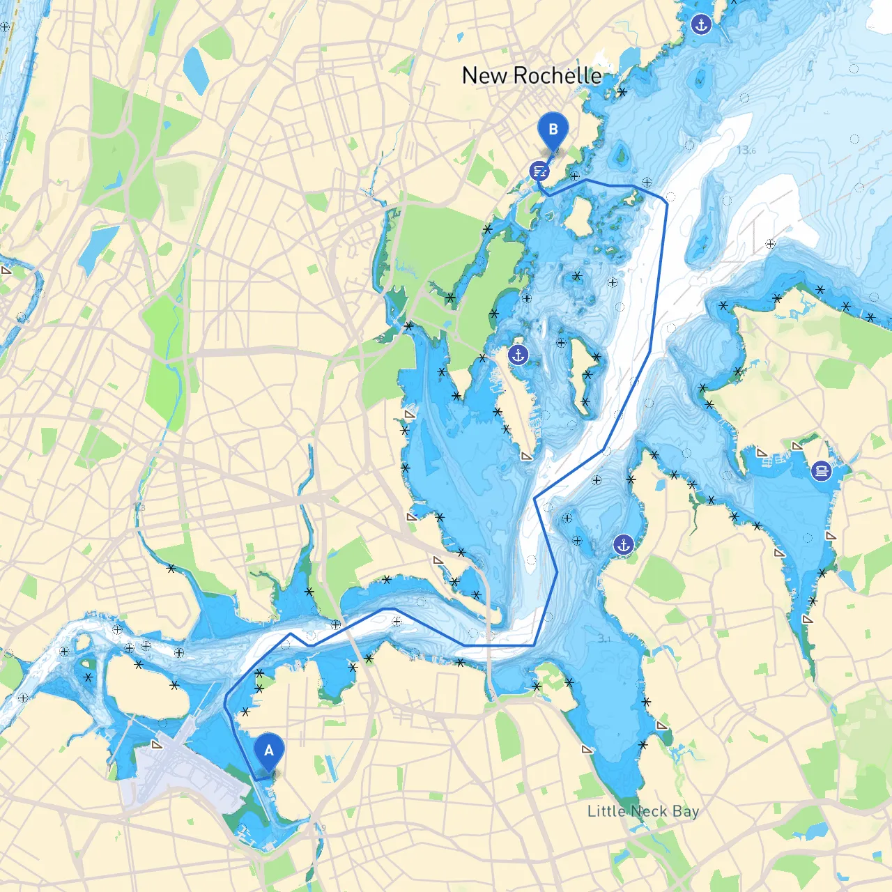
Approaching New Rochelle
As you near New Rochelle (Coordinates:
), you will encounter various navigational markers and signs. The proximity of beaches and parks in this area provides additional safety options should conditions worsen.
Points of Interest:
- Glen Island Park: A lovely park with facilities for picnicking and exploring. This makes for a great place to pause and recharge.
- The New Rochelle Harbor: Known for its smooth waters, it is a popular docking place.
Important Navigation Aids and Regulations:
: Watch for the approaching lighthouse lights, which are vital as you navigate towards the harbors.2.
: New Rochelle has specific mooring rules; be sure to check in advance for availability and required permits.
Safety Tips:
- Regularly check weather forecasts before and during your trip. Keeping an eye on changing conditions is crucial.
- Carry a well-stocked emergency kit, including flares, a first-aid kit, and a VHF radio.
- Consider downloading navigation apps like Savvy Navvy for real-time updates on tides and weather, along with additional local information, making navigation easier.
Conclusion
This route showcases a perfect blend of urban scenery and natural beauty, catering to those seeking both adventure and tranquility on the water. The trip is particularly suitable for recreational boaters who prioritize safety but also wish to experience both the thrill of navigating busy waters and the calming effects of nature. Enjoy your voyage from New York City to New Rochelle, where picturesque views and safe harbors await!