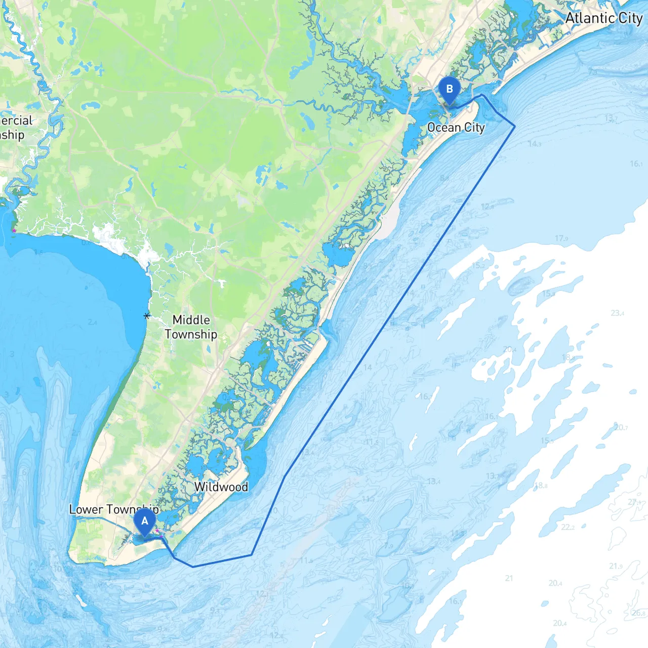
Pilotage Plan: From Cape May, NJ to Ocean City, NJ
Starting Point: Cape May, New Jersey, United States (Coordinates: -74.893446, 38.949017) Ending Point: Ocean City, New Jersey, United States (Coordinates: -74.580833, 39.292333)
Overview of the Route: This cruising route from Cape May to Ocean City is approximately 21 nautical miles along the New Jersey coast, making it an exciting day trip ideal for sailors and powerboat enthusiasts alike. It offers picturesque views, opportunities for wildlife watching, and access to charming seaside towns. Whether you are a seasoned sailor or a novice boater, this journey balances safety and enjoyment.
Before you set sail, check the weather forecast and tide charts. Understanding tidal currents and conditions is crucial, especially in this area where currents can affect your navigation and speed. The best cruising is typically in the late spring and early fall when weather conditions are milder.
Military Restrictions: Be aware of nearby military operations, primarily at the U.S. Coast Guard Training Center found near Cape May. Avoid any restricted zones marked on nautical charts.
1. Cape May Harbor: This is an excellent spot to take shelter if the weather deteriorates or if you need to adjust your plans. It offers several marinas and facilities for refueling or supplies. Enjoy the charm of Cape May with its historic architecture and beautiful beaches while you wait out any weather changes.
2. Hereford Inlet: Located slightly to the north of your path, Hereford Inlet serves as another safe anchorage. It’s worth exploring its scenic surroundings and perhaps taking a break on your journey.
3. Avalon and Stone Harbor: These towns are popular stops along the route. They both feature picturesque lagoons and can be great spots to drop anchor for lunch or to explore the local shops and eateries.
As you cruise along, you can enjoy beautiful views of the New Jersey shoreline. The following landmarks are noteworthy:
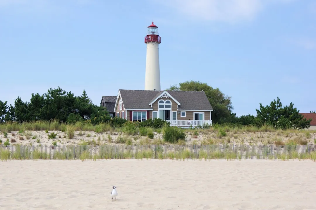
1. Navigational Aids: - Cape May Light (Daymark): This is a significant landmark to navigate by, guiding sailors as they make their way along the coast. - Sound Signals and Buoys: Pay attention to the various buoys marking the channel, particularly as you navigate out of Cape May and into the quieter waters near Ocean City.
2. Local Regulations: Familiarize yourself with local boating regulations. For instance, speed limits in marked areas, no-wake zones, and fishing regulations if you plan to cast a line along the way. Be sure to also watch for swimmers and small craft, especially near harbors and inlets.
3. Tides: Depending on the timing of your trip, tidal currents can be significant entering and leaving Cape May. Plan your passage during an outgoing tide for easier navigation towards Ocean City.
This route is particularly suited for coastal cruising enthusiasts looking for a leisurely day on the water with scenic vistas and safe stopping points. Families and solo adventurers alike will find plenty of opportunities for exploration, relaxation, and memories out on the water. Just remember, always prioritize safety: wear life jackets, keep communication tools handy, and stay alert to changing weather conditions.
Have a fantastic trip and safe sailing!