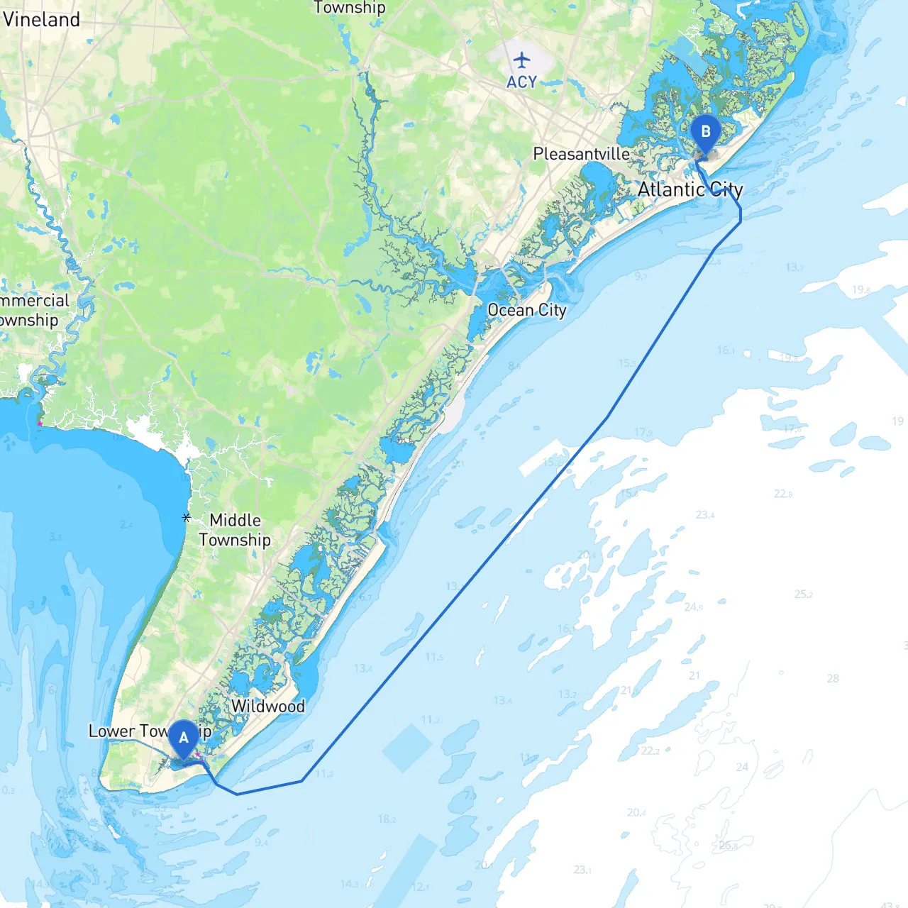
Pilotage Plan: Cape May, New Jersey to Brigantine, New Jersey
Embarking on a boat trip from Cape May to Brigantine offers a delightful experience along New Jersey's scenic coastline. This route is particularly suitable for intermediate to experienced boaters who are comfortable navigating estuarine waters and open coastal areas. The journey stretches approximately 21 nautical miles and allows for picturesque views, potential wildlife encounters, and several opportunities for shelter and exploration along the way.
Starting at Cape May, known for its Victorian architecture and beaches, you'll want to ensure your vessel is well-prepared before casting off. Inspect your navigation equipment, check the weather forecast, and ensure you have all the safety gear onboard as per local regulations. Familiarize yourself with local regulations, especially as this area is frequented by recreational boaters, fishermen, and occasional whale-watching tours.
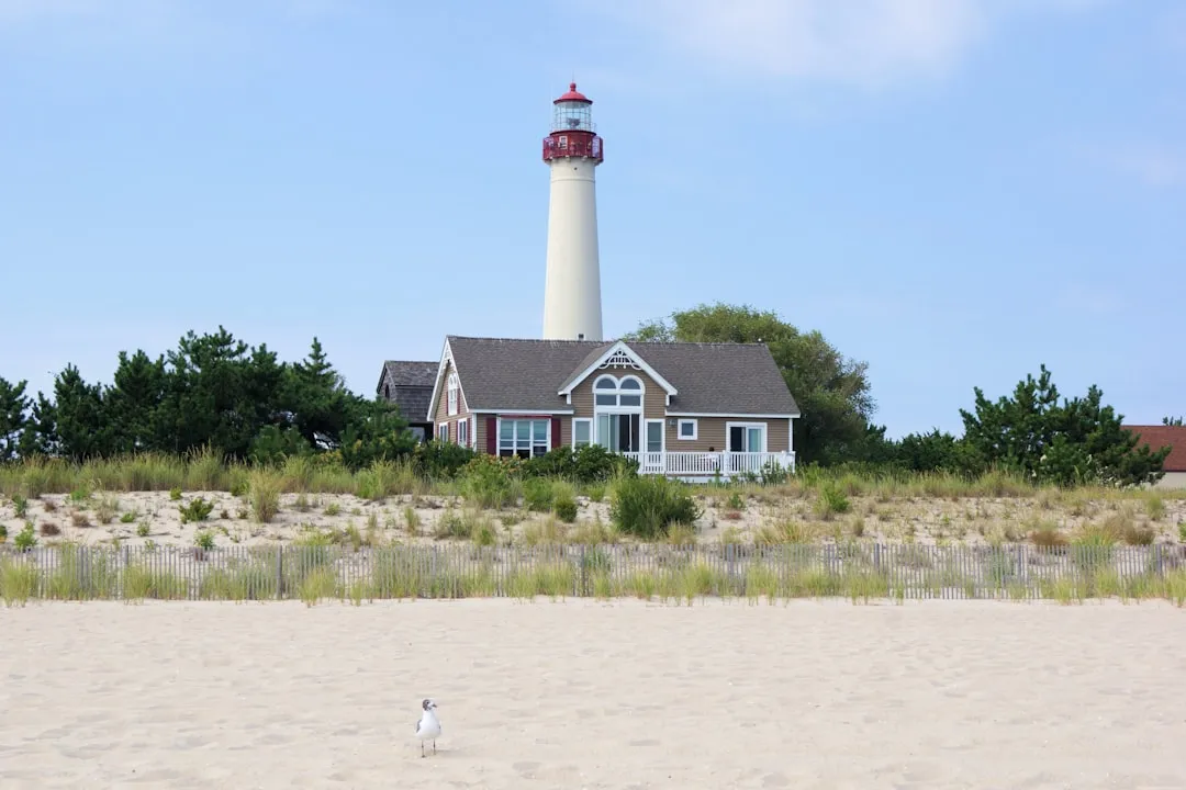
1. Leaving Cape May Harbor As you depart Cape May, navigate through the Cape May Harbor and pass the scenic Cape May Lighthouse. It serves as an excellent landmark to maintain visual reference to starboard upon departure. Make sure you remain vigilant for commercial traffic, especially near the harbor entrance.
2. Approaching the Delaware Bay Once past the harbor, head north along the coast towards the Delaware Bay. Keep an eye on buoys and markers such as the "Green 2" and "Red 3" which help delineate safe passages. The currents here can be strong, particularly around the inlet, so plan your timing accordingly with tidal influences.
3. Into Stone Harbor Bay As you continue northeast, a great place to consider for a stop or shelter would be Stone Harbor Bay, typically about halfway into your trip. This pleasant bay can provide respite if weather conditions suddenly change. It’s also a lovely area for a quick swim or to enjoy some bird watching in the quieter coves.
4. Navigating Toward Absecon Inlet After leaving Stone Harbor Bay, make your way towards Absecon Inlet, aware that there could be fishing vessels in the area. Look for navigational markers, specifically "Green 6" and "Red 5", to guide you safely. This inlet is crucial as it leads to the protected waters of the Atlantic City area.
As you navigate, consider a brief detour to explore the nearby attractions:
As you approach Brigantine, take care to follow the markers into the channel leading to the marina. Regulations here may differ slightly, so ensure to check any local rules regarding anchorage and fishing. Brigantine is known for its unspoiled beaches and the nearby Edwin B. Forsythe National Wildlife Refuge, making it a serene final destination.
Keep safety as your top priority throughout the journey. Always wear life jackets while navigating, and ensure that your VHF radio is in working order for communication. Monitor weather conditions actively; using marine weather apps is advisable. Along with the usual boating charts, consider downloading savvy navvy for real-time navigation assistance and local tidal information.
This route from Cape May to Brigantine not only prioritizes safety but also enhances your boating experience with beautiful views and opportunities to explore local treasures along New Jersey's coast. By following this pilotage plan, you can better navigate the waters while enjoying the delightful charms of the region—truly a perfect summation of safety and enjoyment!