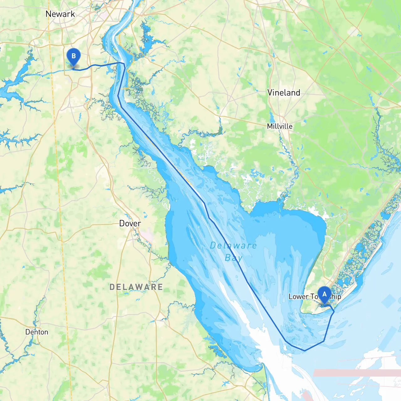
Starting Point: Cape May, New Jersey Ending Point: Bear, Delaware
This trip will take you from the charming seaside town of Cape May, known for its Victorian architecture and pristine beaches, up through the Delaware Bay and into the Delaware River, concluding at Bear, DE. The route is particularly well-suited for both experienced and intermediate boaters. You’ll traverse potentially busy waterways, experiencing various scenic views and points of interest while having safe harbors available should weather conditions change unexpectedly.
Course and Distance From Cape May, you'll head north along the coast into the Delaware Bay. The total distance is approximately 25 nautical miles, which can vary based on your exact route and conditions.
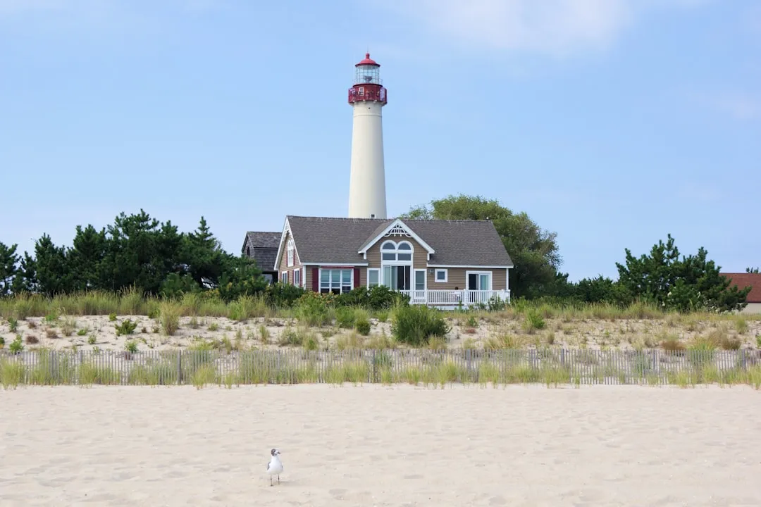
Notable Landmarks and Points of Interest 1. Cape May Lighthouse: This iconic structure at the tip of Cape May is a great first sight. It offers stunning views, and while you won’t anchor here, it makes for a picturesque start to your journey.
2. Delaware Bay: As you enter the Bay, you'll encounter large commercial vessels and fishing boats. Keep a lookout for the Delaware Breakwater, which offers a good point of navigation to mark your course.
3. Reedy Point: Crossing over into Delaware, this point on the opposite shore offers navigational significance and beautiful views of the surrounding landscapes.
4. Fort DuPont State Park: Just before you reach Bear, this former military fortification turned park features lovely walking trails and great spots for a picnic should you choose to anchor off for a short break.
Navigational Aids 1. Buoys and Markers: Pay close attention to the channel markers as you navigate toward the Bay. Stay in the designated shipping lanes to avoid any shallow waters and maximize safety.
2. Lighthouses: The Cape May Light at the start and the South and North Breakwater lights will help to guide you in and out of the respective entry points along the journey.
3. Charts: Use Marion's Charts or other reliable nautical charts to stay updated on local hazards and depth changes. Additionally, savvy navvy is a fantastic app for real-time navigation insights.
Local Regulations Be aware of commercial shipping traffic, especially entering the Delaware Bay, where large vessels will have the right of way. Be cautious of speed regulations in certain protected areas, particularly near wildlife reserves.
Should you encounter inclement weather, there are multiple shelters along your route:
1. Cohansey River: This river offers several spots to take refuge and wait out bad weather. It also has access points to the scenic areas of New Jersey.
2. Bayside Marina: Located further up in the Delaware Bay heading toward Bear, this marina provides transient slips and essential amenities.
3. Fort Delaware State Park: If weather turns, this area provides a natural harbor and a fascinating historical site to explore.
This route from Cape May to Bear promises not only an engaging journey through scenic waters but also plenty of opportunities to learn and relax if you choose to stop along the way. By prioritizing safety and awareness of your surroundings, you'd ensure a satisfying day on the water while absorbing the picturesque sights of New Jersey and Delaware.
Using navigational apps such as savvy navvy can be particularly beneficial in staying updated on conditions and helps manage your navigation with ease. Enjoy the voyage, keep safety as your focus, and embrace the adventure that awaits you on this captivating coastal cruise!