Pilotage Plan: Cape May, New Jersey to Delaware City, Delaware
Overview
This nautical journey from Cape May, New Jersey, to Delaware City, Delaware, combines manageable cruising distances, stunning coastal scenery, and the opportunity to shelter in various safe bays if conditions take a turn for the worse. It’s an ideal trip for recreational boaters, whether you’re a novice or an experienced cruiser, allowing you to immerse yourself in landscape-rich waters while ensuring safety at every turn.
Route Description
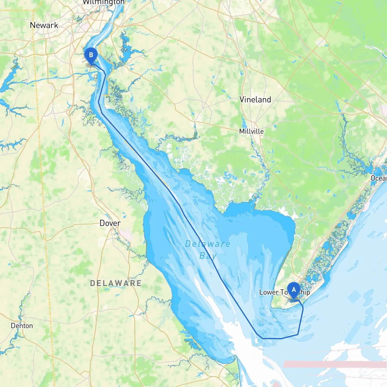
Starting Point: Cape May, NJ
- Coordinates: Long/Lat -74.8934, 38.9490
- Marina and Amenities: The Cape May Marina is a great departure point, providing excellent facilities, supplies, and potential last-minute checks on weather and tides. Before casting off, check local marine traffic via VHF and apps like savvy navvy for up-to-date conditions.
Leg 1: Cape May to The Cape May Canal
- Distance: ~5 nautical miles
- Navigational Considerations: As you exit Cape May, be mindful of the Cape May Inlet’s navigational hazards such as shifting sandbars. The channel is well-marked, but strong tidal currents can be present. The Cape May Canal offers an alternative route if weather conditions turn less favorable.
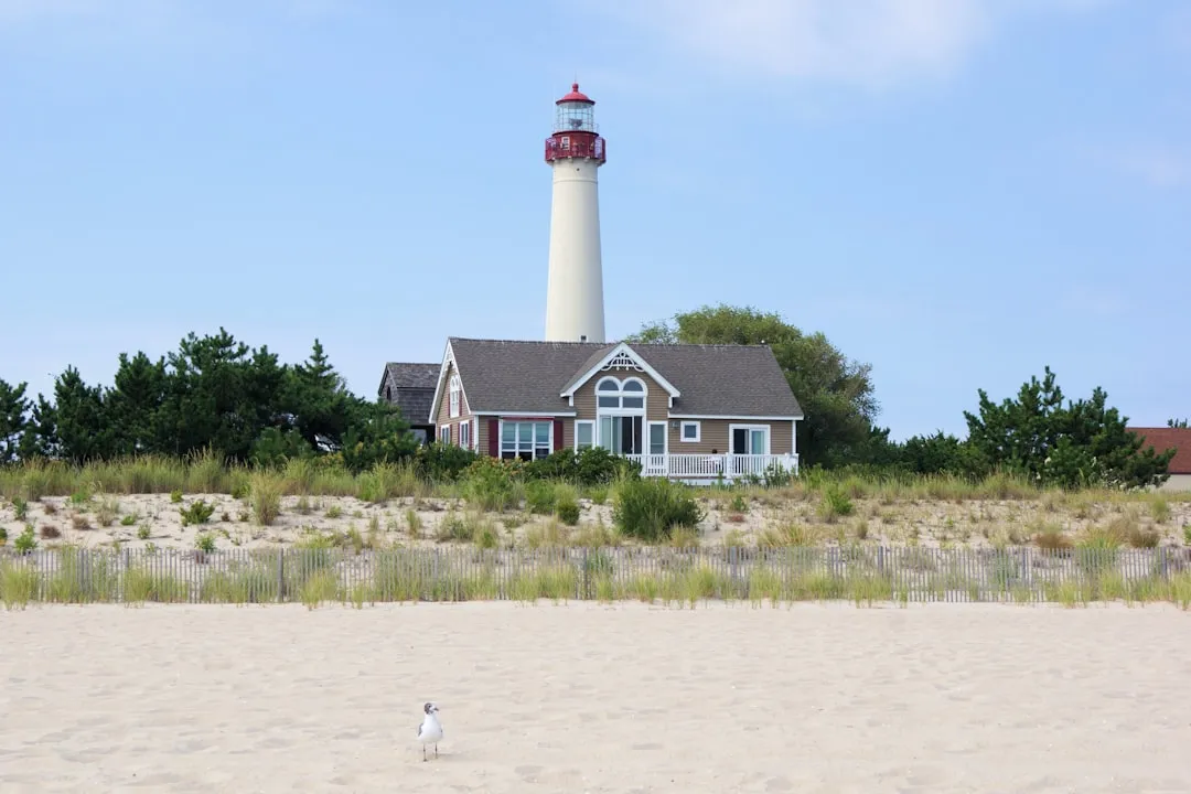
Point of Interest: Cape May Lighthouse
- This historic lighthouse, standing since the 1850s, is a lovely sight. Plan a brief stop if you want to stretch your legs; there are opportunities for photographs and beach strolls.
Leg 2: Cape May Canal to Miah Maull Shoal
- Distance: ~7 nautical miles
- Hazards: Pay attention to the navigational buoys as Miah Maull Shoal can be tricky due to its shallow waters, particularly at low tide. Make sure to consult your charts.
Shelter Bay: Townsend's Inlet
- If the weather suddenly worsens, consider diverting to Townsend's Inlet where you can find calm waters and ample anchorage. The area is suitable for a short term stop until the weather calms.
Leg 3: Miah Maull Shoal to The Delaware Bay
- Distance: ~8 nautical miles
- Navigational Aids: The entrance to the Delaware Bay can be challenging, so keep a close eye on the navigational aids—especially at the confluence where you’ll encounter ship traffic. Operating your VHF radio on channel 13 will help keep you updated.
In the Midst of the Bay: Points of Interest
- As you travel further into the Delaware Bay, you may want to pass by the C&D Canal, which connects the Delaware River to the Chesapeake Bay. Although it takes a bit of time, the scenery is picturesque, with vessels of all kinds navigating through.
Leg 4: Approaching Delaware City
- Distance: ~12 nautical miles
- Cruising Considerations: When approaching Delaware City, be cognizant of the low-lying areas and marshland around the floodplain. The Delaware City Marina provides excellent docking facilities for transient boaters.
Final Arriving Point: Delaware City, DE
- Coordinates: Long/Lat -75.59, 39.5725
- Marina and Amenities: This historic area has numerous dining options and local attractions, allowing for a perfect way to unwind after your journey.
Safety Recommendations
- Always check the weather forecast before you set sail, and be prepared with a contingency plan.
- Register your plan with someone who isn’t sailing.
- Stay vigilant for commercial traffic and adhere to all navigational rules.
- Ensure your vessel is equipped with proper safety gear, including life jackets, flares, and a first-aid kit.
Useful Apps
- Always have savvy navvy for route planning and real-time navigation assistance.
- MarineTraffic can help with tracking vessel movements while Windy provides excellent weather updates.
This route from Cape May, NJ to Delaware City, DE delivers both excitement and security, offering a fabulous experience on the water while promising safety should conditions shift unexpectedly. Enjoy the adventure, and may your nautical journey be filled with smooth sailing!