
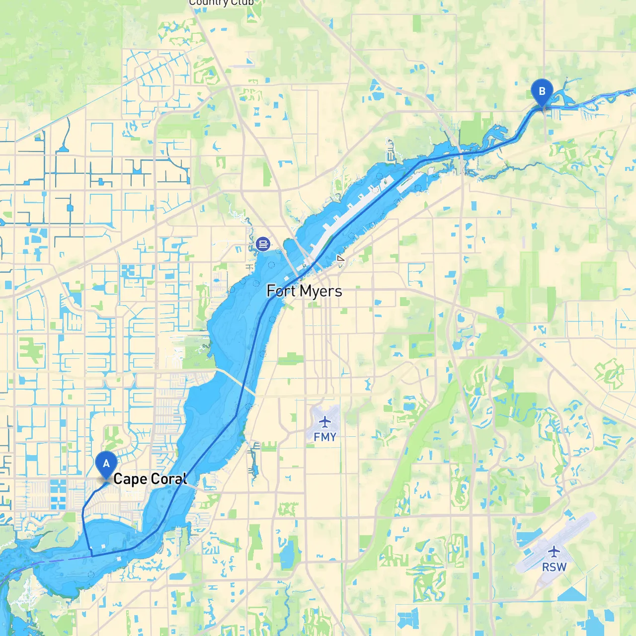
This pilotage plan outlines a scenic and safe route from Cape Coral, Florida, to Fort Myers, Florida, with an emphasis on safety, navigational aids, and points of interest along the way. This trip is particularly suitable for recreational boaters, families, and those looking to explore the beautiful waterways of Southwest Florida while keeping safety as a paramount concern.
Starting Point: Cape Coral, FL At the coordinates of 26.56075° N, 81.96425° W, Cape Coral is a vibrant city renowned for its extensive canal system. Prior to setting out, ensure all safety equipment is onboard, including life jackets, flares, a first aid kit, and a reliable communication device.
1. Departing Cape Coral As you leave Cape Coral, set your course towards the east, navigating through the protected residential canals. Keep an eye on local boat traffic and adhere to the no-wake zones, especially in densely populated areas.
2. Approaching the Matlacha Pass Heading southeast, you’ll soon navigate towards the Matlacha Pass. This area is notable for its shallow waters, so it's essential to pay attention to the navigational charts. Maintain a cautious speed and look for the posted markers such as the Matlacha Bridge.
- Point of Interest: Matlacha Island is a quaint and artistic community where you can stop to stretch your legs and enjoy local boutiques, galleries, and eateries.
( Important Note: The waters here can be tricky; shallow areas abound. Use your nautical charts and GPS to avoid any potential grounding.)
3. Navigating towards Fort Myers After passing Matlacha, head towards the intracoastal waterway leading to Fort Myers. This stretch can be quite busy, so keep a lookout for other vessels and maintain communication on marine VHF channels, particularly Channel 16 for any emergencies.
4. Sheltering in Times of Bad Weather Should inclement weather arise, the best option for shelter is the Boca Grande Pass or the waters around San Carlos Bay. Both areas provide enough cover to wait out a storm if necessary. The respective coordinates are approximately 26.654° N, 82.167° W for Boca Grande Pass.
- Fort Myers Beach also offers a sheltered harbor and is an excellent place to wait it out while enjoying the beach.
During your journey, pay close attention to the following navigational aids:
This boat trip from Cape Coral to Fort Myers is not just a journey; it's an opportunity to enjoy the natural beauty and vibrant culture of Southwest Florida. With a careful eye on navigational aids, respect for local regulations, and an understanding of when to take shelter, you can enjoy a safe and thrilling experience on the water.
For your trip, consider using helpful boating apps like savvy navvy, Navionics, and Boating Suite to enhance your navigation and keep you informed of real-time weather updates and marinas.
Happy cruising, and may you have fair winds and smooth sailing all the way to Fort Myers!