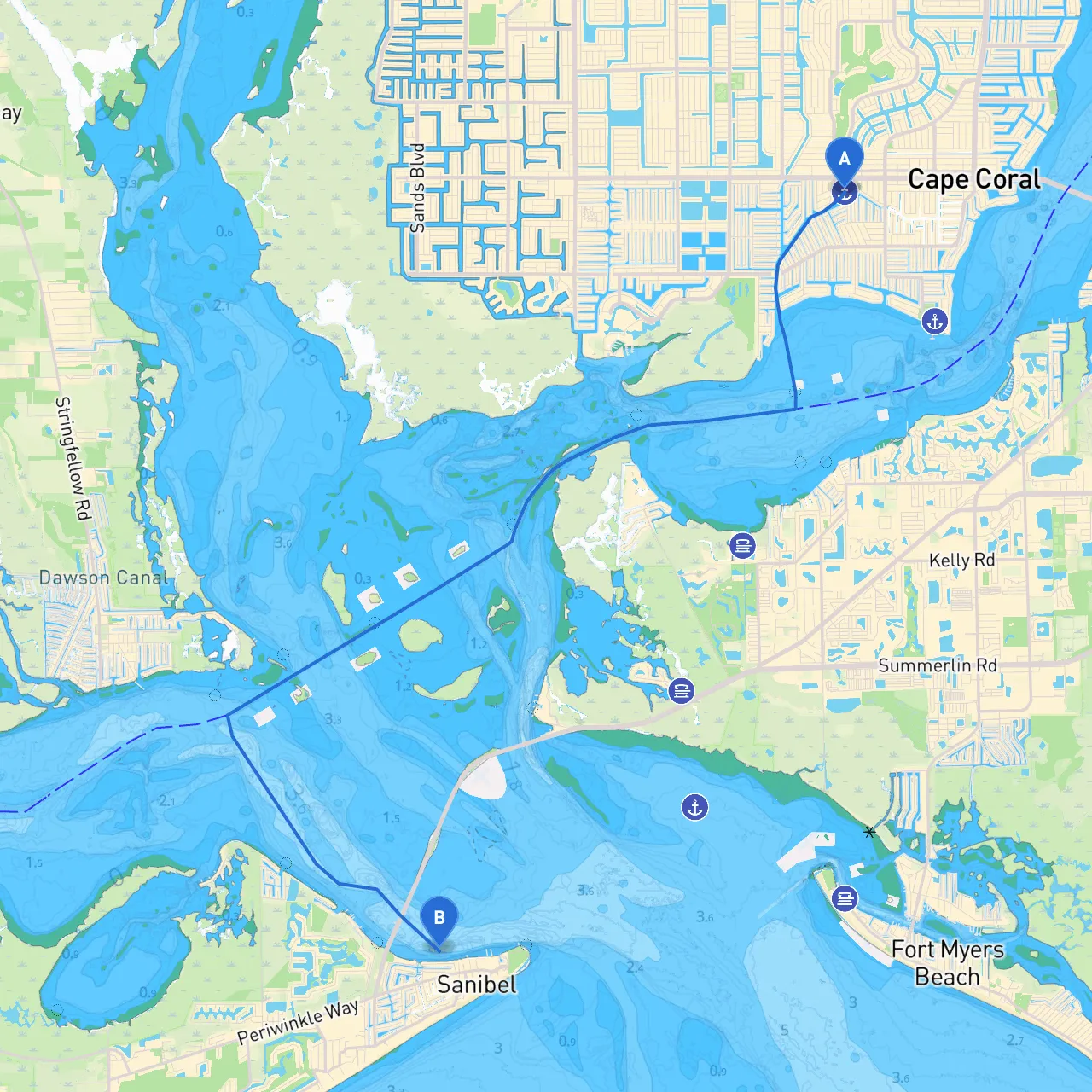
Start Point: Cape Coral, FloridaCoordinates: Long/Lat -81.96425, 26.56075 End Point: Sanibel, Florida Coordinates: Long/Lat -82.0281666667, 26.4536666667
This journey from Cape Coral to Sanibel is a delightful venture through some of South Florida’s most stunning waterways. The route is particularly suitable for recreational boaters looking for a mix of natural beauty and opportunities to explore the coastal environment.
1. Departure from Cape Coral:As you depart from Cape Coral, you'll be navigating through the Caloosahatchee River, which offers both the excitement of the boating community and the tranquility of nature. This river can be busy with pleasure boats, so keep an eye out for other traffic and adhere to speed limits in various zones.
2. Points of Interest Along the Way:
3. Navigational Aids & Hazards:
Should the weather turn or if you need to take a break, prepare to seek shelter at:
4. Arrival at Sanibel:Your approach to Sanibel will be marked by sandy shores and vibrant greenery. Make sure your charts show the Sanibel Causeway, as this structure is a key pinpoint in navigating your final stretch.
Adhere to all local boating regulations for both Cape Coral and Sanibel. This includes speed limits, especially in manatee zones, as they are prevalent in these waters. Ensure your boat is equipped with a proper safety kit, and all passengers have life jackets.
For navigation, consider using apps that enhance your safety and streamline your experience. A favorite recommendation is Savvy Navvy, which simplifies route planning and displays essential nautical information. Other apps to check out include Navionics and Windy, which provide valuable data on tides, wind conditions, and marine forecasts.
This waterway adventure from Cape Coral to Sanibel is a blend of stunning scenery and the excitement of the open sea. Following this pilotage plan ensures not only a safe journey but an enjoyable encounter with nature, local culture, and community spirit along Florida’s beautiful Gulf Coast. Whether you're an experienced sailor or a recreational boater, this route is perfect for those longing to connect with the water while prioritizing safety and fun. Enjoy your voyage!