
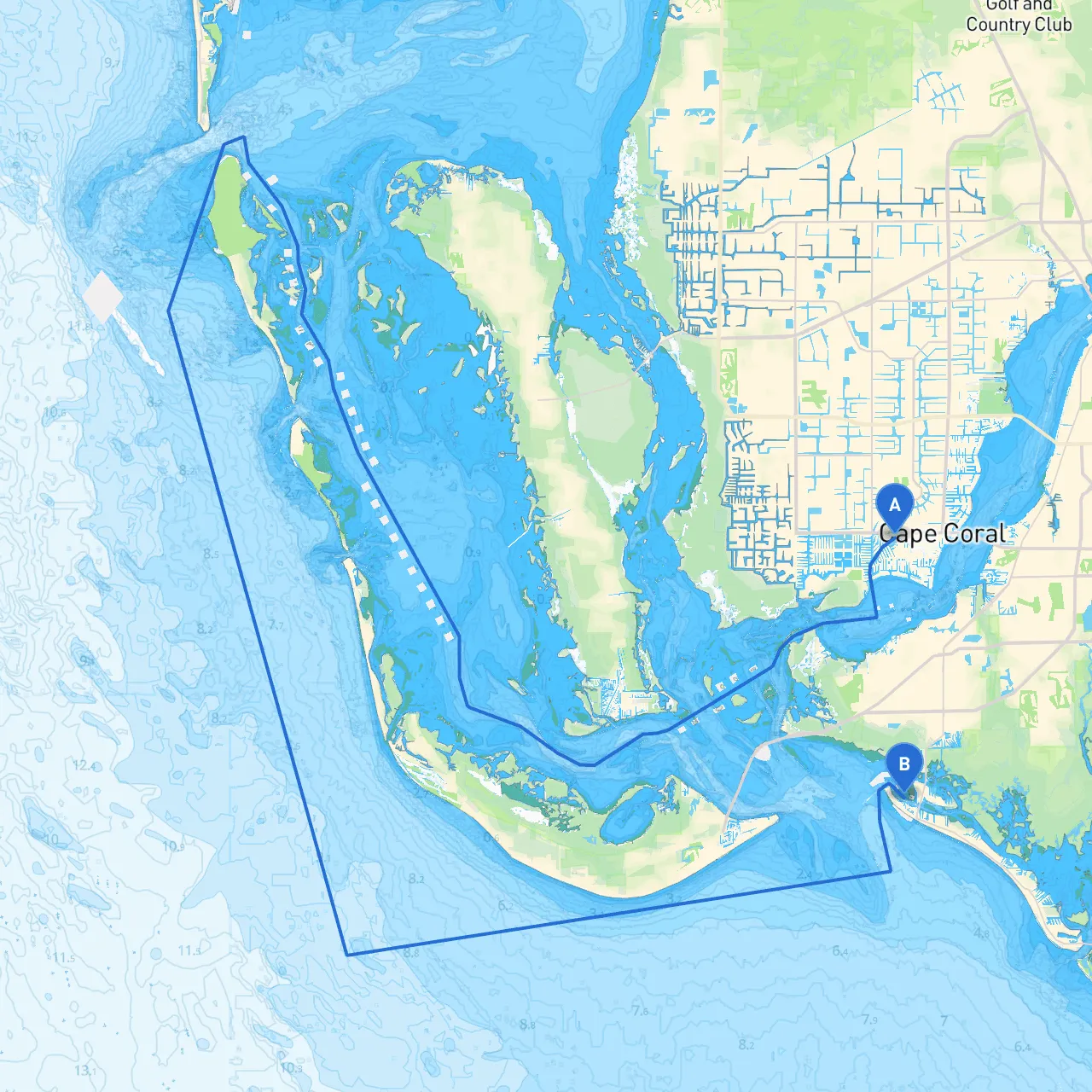
Starting Point: Cape Coral, Florida Ending Point: Fort Myers Beach, Florida
This route is ideal for recreational boaters, families, and anyone eager to explore the beautiful waters of Southwest Florida. It combines leisurely cruising with opportunities to immerse in the local wildlife and coastal charm.
The trip from Cape Coral to Fort Myers Beach is approximately 10 nautical miles and should take around 1.5 to 2 hours, depending on your cruising speed and the weather. Always prioritize a safety-first mindset as you enjoy the stunning scenery of the Caloosahatchee River and the Gulf of Mexico.
Weather Consideration: Always check the weather conditions before you set out. Thunderstorms can develop quickly in the summer months, so be prepared to seek shelter if conditions worsen.
1. Departing Cape Coral Begin your journey at the Cape Coral Yacht Club. As you leave, take care to remain within the marked channels. The waters near the yacht club can be complex, with many boats and obstructions.
Notable Landmarks and Points of Interest:
2. Caloosahatchee River As you head east, you will be navigating the Caloosahatchee River. Keep an eye out for local wildlife, particularly bird species often found along the shores. The depth in this part can vary, so frequent depth soundings are advisable to stay in the deeper, navigable channels as the river twists and turns.
Navigational Aids:
Hazards and Precautions:
3. Transitioning to Estero Bay As you approach the area near Fort Myers, the river opens into Estero Bay. This is an excellent area for spotting dolphins and other marine life. Estero Bay is less congested than the river, allowing a more leisurely pace. Here, you will find additional sheltered bays that offer refuge if the weather takes a turn.
Sheltered Bays to consider:
4. Approaching Fort Myers Beach As you make your final approach, be aware of the Fairweather or Speed restrictions in the more crowded areas, especially near marinas and residential areas. Entering the beach area, you will find ample facilities for dining, shopping, and enjoying the beautiful sandy shorelines.
Always adhere to Florida fishing and boating regulations, including speed zones and no-wake areas, to ensure a safe and enjoyable trip. It's also important to have all safety equipment on board, including life jackets for everyone, flares, a first aid kit, and a working VHF radio for emergency communications.
To aid in your journey, consider using the following apps:
This route from Cape Coral to Fort Myers Beach is a perfect blend of safety and enjoyment, making it suitable for families, novice boaters, and seasoned captains alike. The stunning scenery, wildlife viewing opportunities, and potential for fun stops along the way create an experience that is not only safe but memorable and enjoyable. Happy cruising!