
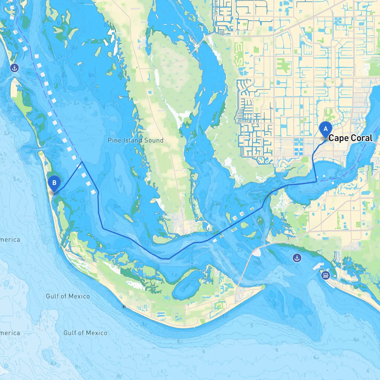
This route from Cape Coral to Captiva Island presents an ideal opportunity for boaters looking for a mix of scenic views, potential for fun activities, and safe harbor options along the way. The journey promises not only remarkable coastal landscapes but also manageable navigational challenges that make it suitable for both novice and experienced boaters.
Begin your trip from Cape Coral, situated at the coordinates of 26.56075° N, 81.96425° W. As you head out, keep in mind the dynamics of the Gulf Coast waters. Be aware of local boat traffic, especially in busy areas close to marinas.
1. Leaving the Caloosahatchee River: Your first leg of the journey will take you down the Caloosahatchee River. Watch for the tight curves and shallow areas, especially near the banks. Stick to the marked channel, as some areas experience a significant tidal range, influencing water depths.
2. Navigational Aids and Hazards: Pay close attention to navigational markers such as buoys and day markers providing guidance. The river can have strong currents, so plan your departure in alignment with slack tide for a more pleasant experience. Additionally, keep an eye out for crab pots and fishing gear that may be set in your path.
3. Shelter Bay - San Carlos Bay: As you approach the entry to San Carlos Bay, consider this sheltered area offering an ideal spot if the weather takes a turn. San Carlos Bay provides ample anchorage and access to local parks and beaches. If you decide to stop, check out the estuarine environment, perfect for kayaking and birdwatching.
2. Fishing Restrictions: If you're keen on fishing, be mindful of the local regulations—specifically around closed seasons and protected areas. Always check local guidelines and maneuver respectfully around other fishing vessels.
3. Arrival at Captiva Island: As you approach Captiva Island (coordinates 26.520833° N, -82.18805° W), you'll find a picturesque small island renowned for its charming atmosphere and beautiful beaches. Prepare for a thrilling entrance, navigating into picturesque seas dotted with boats and the occasional dolphin sighting.
With the proper precautions, this journey from Cape Coral to Captiva Island can be a vibrant and memorable boating experience, perfect for families and adventure-seekers alike. Enjoy the trip and navigate safely!