Pilotage Plan: Brentwood, CA to West Sacramento, CA
Overview
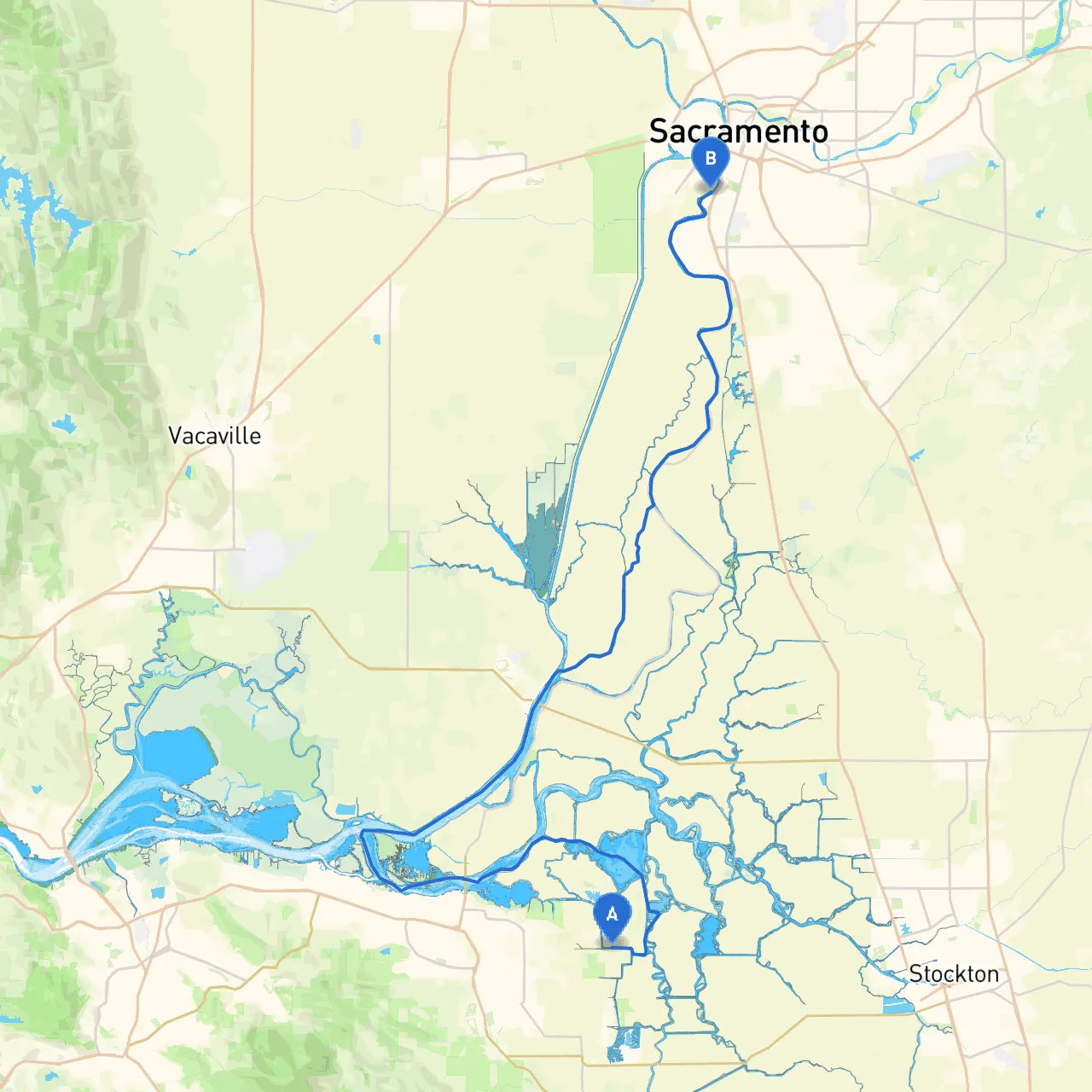
This trip from Brentwood to West Sacramento takes you through the serene waters of the Delta, a network of rivers and channels rich in natural beauty and teeming wildlife. It's an ideal route for recreational boaters who appreciate calm waters, unique landscapes, and opportunities for wildlife observation.
Route Highlights
You will embark from Brentwood, a charming stretch of water located at coordinates -121.6130, 37.9772. The journey will traverse significant waterways, including the San Joaquin River and the Sacramento River, well-suited to both novice and seasoned boaters. Essential navigational aids and potential hazards will be noted to ensure your trip remains safe and enjoyable.
1. Departure from Brentwood, CA
Start your journey from the Brentwood waterfront. Before setting out, ensure your vessel is prepared, checking for life jackets, buoyancy aids, and communication devices. The waterway near Brentwood is relatively calm, making it a perfect starting point for your adventure.
Notable Points of Interest:
- Brentwood Waterfront: Spend a moment enjoying the scenic views and perhaps grab a coffee at a local café before leaving.
- Bees Lake: Just south of Brentwood, this small lake offers a lovely view and is a tranquil spot for observing local wildlife.
2. Route Navigation and Major Waterways
As you head north toward West Sacramento, your primary navigation will take you along the San Joaquin River. Keep a keen eye on the following navigational aids:
Navigational Aids and Hazards:
- Buoy Markers: Pay close attention to the color-coded buoys along the river. These guide you safely through channels and indicate shallow areas to avoid.
- Tidal Influences: Given the tidal nature of the Delta, be aware of changing water levels, especially during periods of significant tidal action.
- Strong Currents: In some sections of the San Joaquin River, especially near Delta islands, currents can be strong, particularly after rains. Plan your speeds accordingly.
3. Potential Shelter Bays
Should weather conditions deteriorate or if you encounter unexpected challenges, several bays along the route provide safe havens:
- Disappointment Slough: This slough is located along the San Joaquin River and is an excellent place to seek shelter if the wind picks up.
- Skinner Lake: Just north of your route, this area offers calm waters and scenic spots for a break.
4. Beautiful Landmarks and Activities
Along your way to West Sacramento, you’ll find numerous landscapes and parks that are perfect for a short stop:
- Delta National Wildlife Refuge: Keep an eye out for occasional stops where you can take a moment to observe local fauna, as the Delta is a bird watchers' paradise.
- Tower Bridge: As you near West Sacramento, you’ll see the iconic Tower Bridge, a beautiful landmark that is a great photo opportunity.
5. Arrival at West Sacramento, CA
As you approach West Sacramento, you will be entering a more urban environment, yet the waterfront remains a peaceful escape. Upon arrival at coordinates -121.5199, 38.5363, familiarize yourself with local docking protocols, as marinas in this area may have specific regulations or fees.
Local Regulations:
- Idle Speed Zones: Watch for signs indicating areas where speed must be reduced, particularly near marinas and residential areas.
- Fishing Licenses: If you’re planning to fish during your journey, ensure you possess the appropriate licenses, as local regulations are strictly enforced.
Conclusion
This route from Brentwood to West Sacramento is an exceptional choice for both novice and experienced boaters looking to enjoy the treasures of California’s Delta. With varied landscapes, abundant wildlife, and adequate points for shelter, your trip emphasizes safety and exploration, making it a delightful experience on the water. Before setting out, ensure your vessel is well-equipped and consider using boating apps like Savvy Navvy or Navionics for up-to-date charts and tide information.
Enjoy your boating adventure, and navigate safely!