
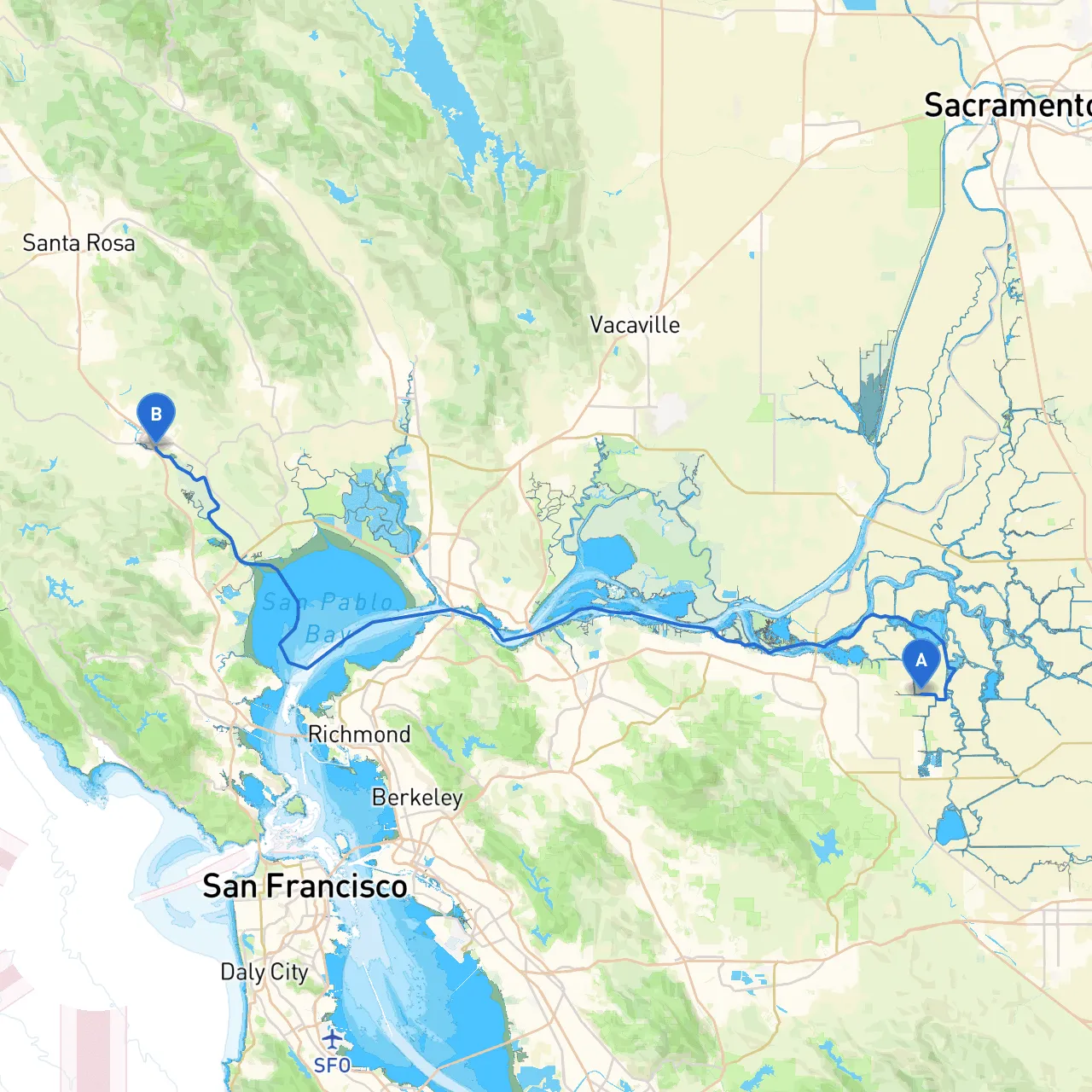
Welcome aboard! This pilotage plan details a captivating journey from Brentwood, California, nestled at the heart of the California Delta, to the historical town of Petaluma, known for its charming waterfront and vibrant arts scene. This adventurous route is particularly suitable for experienced recreational boaters looking for a mix of impressive scenery, fascinating landmarks, and safe havens to drop anchor if weather conditions turn.
Starting Point: Brentwood, CA Ending Point: Petaluma, CA Distance: Approximately 60 nautical miles, depending on the route taken and any scenic diversions.
1. Brentwood to Discovery Bay - Distance: 10 nautical miles - Description: Begin your voyage navigating the Mokelumne River, enjoying the serene vistas of the Delta. You’ll pass through Discovery Bay, a popular spot known for its peaceful canals and friendly waterfront community. This is an excellent location to stop, refuel, and take comfort in the local eateries. Should conditions deteriorate, the bay provides good shelter from the prevailing winds.
2. Discovery Bay to Isleton - Distance: 7 nautical miles - Description: Venturing further east, follow the Sacramento River to Isleton, a quaint town with a rich history. The town’s waterfront offers docking facilities and a variety of dining options. Take a break here to explore the delta's cultural heritage, and if the weather becomes inclement, this area provides adequate shelters and harbor facilities.
3. Isleton to Rio Vista - Distance: 11 nautical miles - Description: Continuing south past Isleton, keep an eye out for Rio Vista, where you can appreciate the views of the famed Rio Vista Bridge. This charming stop is famous for its fishing and offers a chance for recreational activities along the riverbank. It is an excellent point to reassess the weather conditions and determine if you need to make any adjustments to your itinerary.
4. Rio Vista to Benicia - Distance: 15 nautical miles - Description: Steering southward into the wider reaches of the Carquinez Strait, Benicia is your next destination. Renowned for its historical downtown and waterfront park, Benicia provides numerous docks and transient slips. If high winds or rough waters arise, the Benicia City Marina offers ample shelter and a confirmed safe haven.
5. Benicia to San Pablo Bay - Distance: 5 nautical miles - Description: As you embark onto the San Pablo Bay, pay attention to the navigational markers and be cautious of any potential currents. San Pablo Bay is known for its expansive waters and diverse wildlife, making it a picturesque segment of your journey. A perfect area to enjoy the sweeping views and the relative calm should you need to prepare for challenging conditions.
6. San Pablo Bay to Petaluma - Distance: 12 nautical miles - Description: Finally, follow the winding Petaluma River as it flows you toward Petaluma. The entrance to the river is marked, but stay alert for shallow areas and changing tides. Petaluma’s waterfront is bustling with activity, offering many opportunities to explore local shops, art galleries, and parks. The docks are accessible for transient mooring, providing an excellent stopping point to conclude your journey.
This trip represents a remarkable blend of adventure and leisure, with opportunities for both exploration and shelter. The track from Brentwood to Petaluma is not only breathtaking but also caters to the safety of the boater, making it a memorable journey through the heart of California’s waterways. Happy sailing!