
Pilotage Plan for a Boat Trip from Brentwood, CA to Martinez, CA
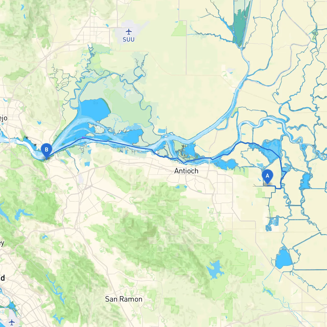
Route Overview:This scenic journey from Brentwood to Martinez spans approximately 15 nautical miles along the serene waterways of San Francisco Bay and the surrounding channels. The trip is well-suited for intermediate to experienced boaters who appreciate navigating in a mix of urban and natural settings while ensuring safety remains paramount.
Starting Point: Brentwood, CAYour adventure begins at the confluence of the Sacramento-San Joaquin Delta, an area known for its intricate network of channels. As you set out, ensure your vessel is adequately prepared—with safety equipment, flotation devices, and communication gear.
Launch Details:
Key Navigation Points:1. Franks Tract: After departing from Brentwood, head southwest through the shallow marshy waters of Franks Tract. It’s crucial to adhere to marked channels here due to shifting sandbars and wetlands. Pay close attention to local navigational markers that indicate safe pathways.
2. Bethel Island: On your route, you’ll pass near Bethel Island, a quaint spot that warrants a brief stop. Here, if time allows, take a break by checking out local eateries or simply enjoying the views of the Delta.
Shelter and Points of Interest:
Navigational Considerations:1. Channel Depth: Maintain awareness of the fluctuating tides, especially in shallow areas like the Delta. Suggesting a draft of no more than 4 feet can help avoid grounding in sandy areas.
2. Markers and Aids: Use of navigational aids is crucial. Familiarize yourself with buoy placement along your route. Following standard navigational conventions—red right returning—will keep you on course.
3. Traffic Patterns: Expect some commercial activity in the navigable waters. Maintain a safe distance from larger vessels and monitor VHF radio channels to remain informed about nearby traffic.
4. Local Regulations: Be certain to adhere to any seasonal closures or restrictions within wildlife protection areas, especially around sensitive ecological locations such as wetlands.
Arrival: Martinez, CAAs you close in on your destination, the approaches to Martinez will reward you with beautiful bay views and a welcoming marina atmosphere. Upon arrival at Martinez Marina, you’ll find ample facilities for boaters, including fuel stations, and a friendly community atmosphere.
Safety Reminders:Always carry the necessary navigation charts or use trusted boating apps for real-time data—Savvy Navvy stands out for its intuitive interface and accuracy in navigational plotting. Other useful apps include Navionics and MarineTraffic for monitoring vessel traffic and conditions.
This route, with its blend of natural appeal and manageable navigation, is ideal for those who prioritize safety while craving a touch of adventure. Keep your awareness high, follow the outlined considerations, and you’re sure to enjoy a fulfilling day on the water from Brentwood to Martinez. Happy boating!