
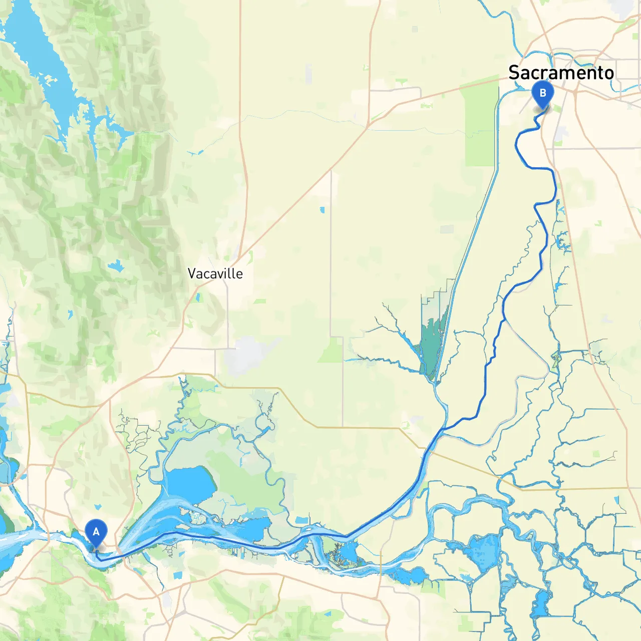
Pilotage Plan from Benicia, CA to West Sacramento, CA
Embarking on a boat trip from Benicia to West Sacramento offers a unique blend of stunning views, diverse wildlife, and the opportunity to explore the beautiful waters of Northern California. This route is particularly suitable for small cruisers and sailboats, as well as powerboats. In this pilotage plan, we prioritize safety and provide navigation tips while highlighting points of interest that can elevate your boating experience.
Starting from Benicia, you’ll find yourself surrounded by the scenic Carquinez Strait. Be prepared for potential strong currents and navigational challenges, especially as you pass beneath the Benicia-Martinez Bridge. Always keep a lookout for large vessels as this strait can be quite busy.
Safety Tip: Ensure you have life jackets for all passengers and maintain a vigilant watch for other boat traffic, especially in this narrow passage.
1. Suisun Bay: As you navigate out of the strait, you will enter Suisun Bay—a great place to anchor and take shelter from inclement weather. The bay is rich in wildlife, and if time permits, a brief exploration on land at the nearby Delta Breeze Park adds an adventure twist to your trip.
2. Morrow Island: A notable landmark in Suisun Bay, Morrow Island is an uninhabited area perfect for spotting birds. It’s a fantastic spot for nature lovers to take a moment away from the nautical journey.
3. The Delta: As you start transitioning into the Sacramento-San Joaquin River Delta, you will be in one of California's most extensive estuary systems. The expansive waterways offer a chance to enjoy local flora and fauna.
Should the weather take a turn, the Delta offers numerous sheltered coves and marinas where you can safely moor your vessel. Notable shelters include:
As you approach West Sacramento, navigate carefully past the confluence of the Sacramento and American Rivers. This area is navigated by numerous commercial vessels, so remain alert and utilize your nautical charts for precise navigation.
Keep an eye out for the Camelot Park area where you can spot recreational activities. Your journey concludes at a beautiful urban setting, allowing for additional exploration of this vibrant city.
Final Thoughts:
The journey from Benicia to West Sacramento not only provides picturesque scenery and wildlife encounters but also emphasizes the importance of safety. Whether you’re an experienced mariner or slightly less seasoned, this trip combines the beauty of Northern California's waterways with the thrill of nature exploration.
To enhance your trip, consider downloading boating apps, including Savvy Navvy, which provides simplified navigation maps, weather forecasts, and tide information. Additionally, consider apps like Navionics and MarineTraffic for additional navigational resources.
Prepare well, stay safe, and enjoy the adventure that awaits you on the waters!