
Pilotage Plan: Benicia, CA to Oakland, CA
Departure: Benicia, CAYou’ll start your journey from the picturesque Benicia, nestled along the shores of the Carquinez Strait. This area is steeped in history, with charming waterfront views and a vibrant marina. Before you set off, make sure you have checked local weather conditions and tide tables as the currents can be quite strong, especially in the strait.
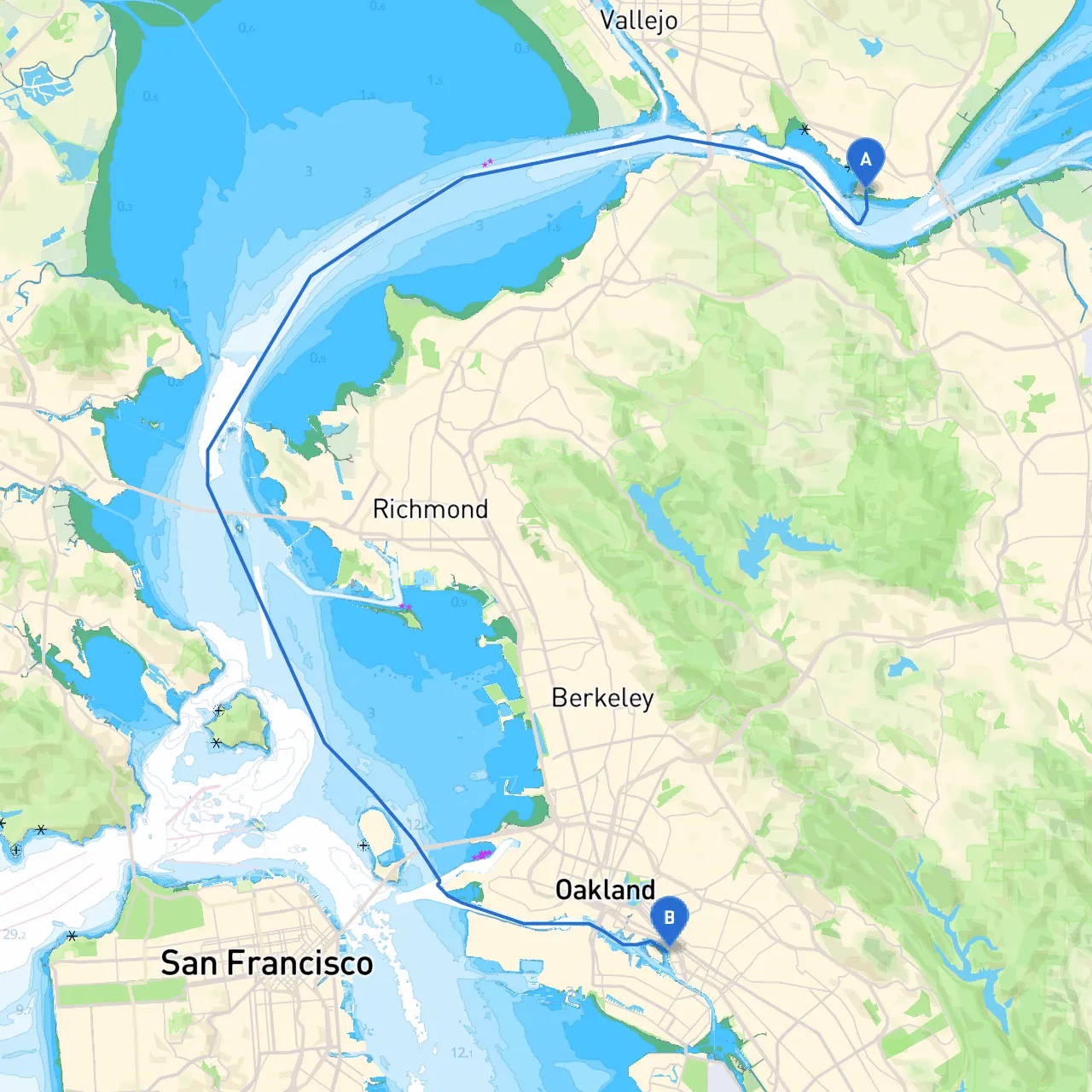
Route OverviewThe trip from Benicia to Oakland covers approximately 12 nautical miles through the San Francisco Bay. This route is well-suited for recreational boaters and those looking for a leisurely day on the water while also emphasizing safety.
Sections of the Journey
1. Leaving BeniciaAs you depart, keep an eye on your navigation aids. The Benicia City Marina is equipped with well-marked channels. Make sure to use your charts and consult local nautical maps to keep track of hazards, especially the shallow areas near the northern bank. Head southwest towards the Carquinez Bridge, where you’ll find a splendid view of this engineering marvel.
2. Navigating the Carquinez StraitAs you approach the Carquinez Strait, be aware of the tidal flows. You may experience strong currents here, particularly during peak tide changes. Look out for the red and green buoys marking the channel leading through the strait. The visuals of the wildlife and California's natural beauty flank both sides, offering a serene environment.
Notable Landmarks:
3. Entering San Pablo BayOnce through the strait, you’ll enter the larger San Pablo Bay. The winds can pick up here, so be ready to adjust your sail or throttle as needed. It's advisable to stay on the eastern shoreline to avoid being caught in the busy shipping channels. There are several anchorages available in this area, perfect for sheltering from adverse weather. Consider Lower San Pablo Bay's nicer anchorages—if the winds become challenging, you can turn in here to ride it out comfortably.
4. Approaching Richmond/San Rafael BridgeNext, you’ll be headed toward the Richmond-San Rafael Bridge. The bridge itself is not only a significant landmark but also indicates that you will soon be moving into more sheltered waters toward Oakland. Ensure you monitor the bridge passage heights and tidal conditions.
Notable Bays:
5. Navigating towards OaklandAfter crossing under the bridge, keep a lookout for buoys and signs indicating the port of Oakland. This area is usually busy with commercial traffic, so maintaining a vigilant watch is crucial. Expect to encounter the busy Oakland Inner Harbor as you approach the end of your journey.
Arriving in OaklandAt last, your destination! The Oakland Marina is welcoming, with amenities that cater well to visiting boaters. The nearby Jack London Square offers historical landmarks, shops, and dining options. It’s an ideal finish to your journey.
Safety Considerations:
ConclusionThis trip from Benicia to Oakland is a fantastic choice for the adventurous boater, balancing natural beauty with navigational challenges. Safety should always come first, but taking in the views, wildlife, and stopping at some local highlights will make for a memorable ride. Enjoy your time on the water, and always respect the maritime environment!