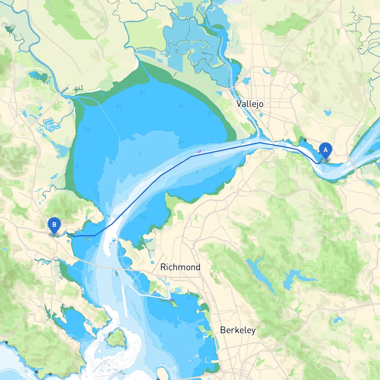
Pilotage Plan for Boat Trip: Benicia, CA to San Rafael, CA
Route Overview:Starting from Benicia, we will navigate through the picturesque San Francisco Bay, culminating at San Rafael. This route is well-suited for experienced boaters familiar with tidal waters. It's also an exciting excursion for recreational boaters seeking views, wildlife watching, and potential sheltered stops should the weather take a turn.
Starting Point: Benicia, CA
- Coordinates: -122.15766, 38.04462
- Port Facilities: Benicia is equipped with essential amenities such as mooring facilities, fuel docks, and maintenance services. Check the local weather forecast before departure; the bay can experience quick changes in weather conditions.
1. Leaving Benicia:As you pull away from Benicia, initially keep a watchful eye on your surroundings for incoming vessel traffic, as this area can be busy.
- Navigational Aids: Markers indicating the navigation channel and recommended depth (see the channel depth during low tide to avoid grounding) are essential to note.
2. The Straits of Carquinez:Once you reach the mouth of the Carquinez Strait, be prepared for tidal currents that can be strong, especially during a flood tide. The picturesque views of the hills alongside create a beautiful backdrop.
- Shelter Options: If conditions worsen, consider diverting into Vallejo or heading into Mare Island Strait, where you can find protection from wind and waves.
3. Approaching Richmond Bridge:Continuing toward the Richmond-San Rafael Bridge, keep an eye out for traffic entering and leaving the channel.
- Points of Interest: The Richmond area offers several marinas and local eateries on the waterfront – perfect for a lunch stop. Watch for the San Pablo Bay – it can generate chop, so bringing your boat at a slower pace through this section is advisable.
4. Entering San Pablo Bay:As you traverse San Pablo Bay, you may experience varying wind conditions, particularly in the afternoon. Pay attention to the local currents, which can shift.
- Shelter Recognition: In case of inclement weather, Point San Pablo or the waters around Point Richmond may offer some shelter during rough conditions.
5. Navigating Towards San Rafael:You’ll proceed towards the San Rafael Canal. This segment has a peaceful scenic charm, with many wildlife sightings, including birds and seals.
- Navigational Aids: Keep close watch for the markers leading into the canal and adhere to the speed limits to avoid disturbing the residential areas lining the waterway.
- Local Regulations: Be aware of no-wake zones, especially as you approach the marina areas to ensure a smooth entry without causing disturbance.
6. Final Destination: San Rafael, CA
- Coordinates: -122.51252, 37.96739
- Marina Facilities: Upon arrival, San Rafael offers varied facilities, including mooring, repair services, and dining. It's also worth checking for any local events and festivities that may be happening.
Safety Considerations:
- Always carry a reliable VHF radio for communication.
- Update charts and ensure all navigation instruments (GPS, compasses) are functioning properly.
- Monitor local weather and tidal conditions continuously; incorporate tools like savvy navvy or other trusted boating apps for real-time updates.
- Ensure life jackets and safety equipment are on board and easily accessible.
This route from Benicia to San Rafael blends adventure with tranquility, perfect for boaters who enjoy exploring nature while staying mindful of safety. The breathtaking views, varied wildlife, and nearby amenities make this journey more than just a simple trip – it's an experience that embodies California’s vibrant marine lifestyle.