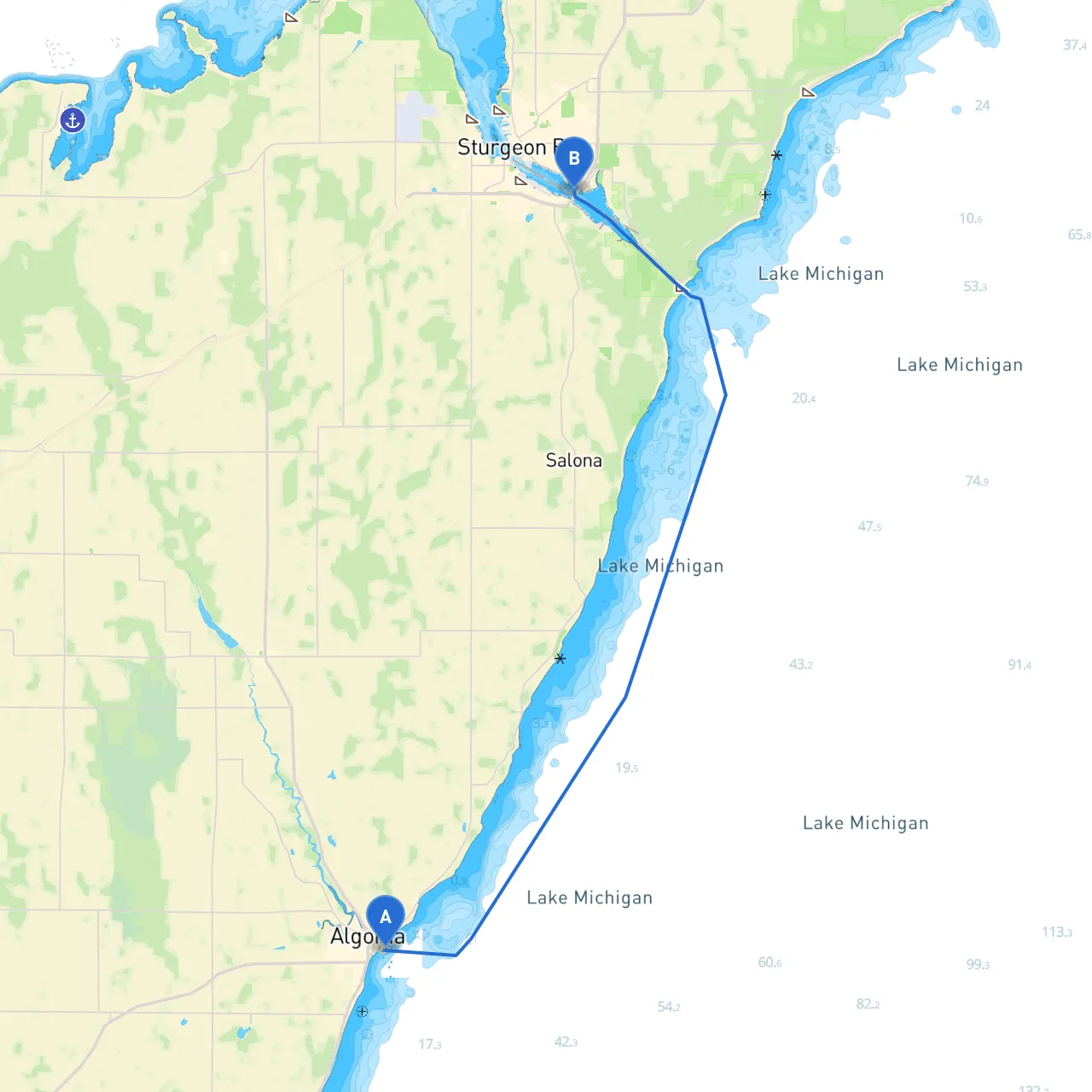
Pilotage Plan: Algoma, Wisconsin to Sturgeon Bay, Wisconsin
Route OverviewThis carefully planned route incorporates a beautiful stretch of Lake Michigan's coastline, offering a balance of stunning scenery, safe boating waters, and various points of interest. The distance between Algoma and Sturgeon Bay is approximately 16 nautical miles. This trip is ideal for both intermediate and experienced boaters, as the waters are generally sheltered, but it still requires attention to navigation and local regulations.
Section 1: Departure from Algoma
Starting PointLocation: Algoma, WI (Coordinates: -87.431533, 44.606633)Lessons from Past Journeys: Departing from Algoma's harbor, you'll want to ensure that your vessel is properly equipped with life jackets, a VHF radio, and other safety gear. The harbor is well-marked, and your journey begins with a gentle passage out into Lake Michigan.
Notable Landmarks
- Algoma Pierhead Lighthouse: As you set out, take a moment to admire this historic lighthouse, which serves as a beacon for vessels navigating these waters.
Weather Considerations
- Always check the marine forecast before departure. The weather can change swiftly on Lake Michigan, especially in the spring and fall. Familiarize yourself with local weather buoys' readings to gauge wind and wave conditions.
Section 2: Heading Towards Sturgeon Bay
Safe Shelters Along the Way
- Kewaunee Harbor: About halfway to Sturgeon Bay, Kewaunee Harbor offers excellent shelter should the weather turn inclement. This is a friendly little harbor known for its welcoming atmosphere, facilities, and services for transient boaters.
Points of Interest
- Cave Point County Park: As you sail closer to Sturgeon Bay, a detour to Cave Point will reveal stunning limestone cliffs and picturesque views of Lake Michigan's turquoise waters. This area is great for hiking or simply enjoying the landscape.
Section 3: Navigational Aids & Hazards to be Aware Of
Navigation Aids
- Buoys and Markers: Maintain a vigilant watch for buoys marking the shipping channel along your route. They are crucial for safe navigation. Pay particular attention to the red and green marker buoys that denote safe passage, particularly in areas with significant boat traffic.
Common Hazards
- Be aware of underwater structures and shoals as you navigate towards Sturgeon Bay. Local charts — both digital and paper — are essential for identifying hazards. Avoid any unmarked areas as they can lead to grounding, particularly in adverse weather conditions.
Section 4: Arrival at Sturgeon Bay
DestinationLocation: Sturgeon Bay, WI (Coordinates: -87.35645, 44.82145)
Local Attractions
- Once you have successfully docked in Sturgeon Bay, take the time to explore the Door County Maritime Museum, which gives a fantastic insight into the area's maritime history.
Weather Safety
- Consider the prevailing winds when positioning your boat at the dock to ensure that you are sheltered from incoming weather fronts.
Important Regulations and Considerations
Local Regulations
- Make sure to adhere to Wisconsin's boating regulations, which include limits on alcohol consumption while operating a vessel and regulations governing personal flotation devices.
Recommended Apps
- For navigation and real-time weather updates, utilize savvy navvy alongside other boating apps like Navionics and Windy. These tools will greatly aid in safe navigation and enhance your overall experience.
Conclusion
This route from Algoma to Sturgeon Bay is not only scenic but rife with opportunities for safe exploration and adventure. It champions both the thrill of boating and the necessity of safety in a responsible manner. Finally, ensure your vessel is seaworthy, your crew is trained in safety procedures, and you are prepared for an enjoyable and memorable trip on Lake Michigan!