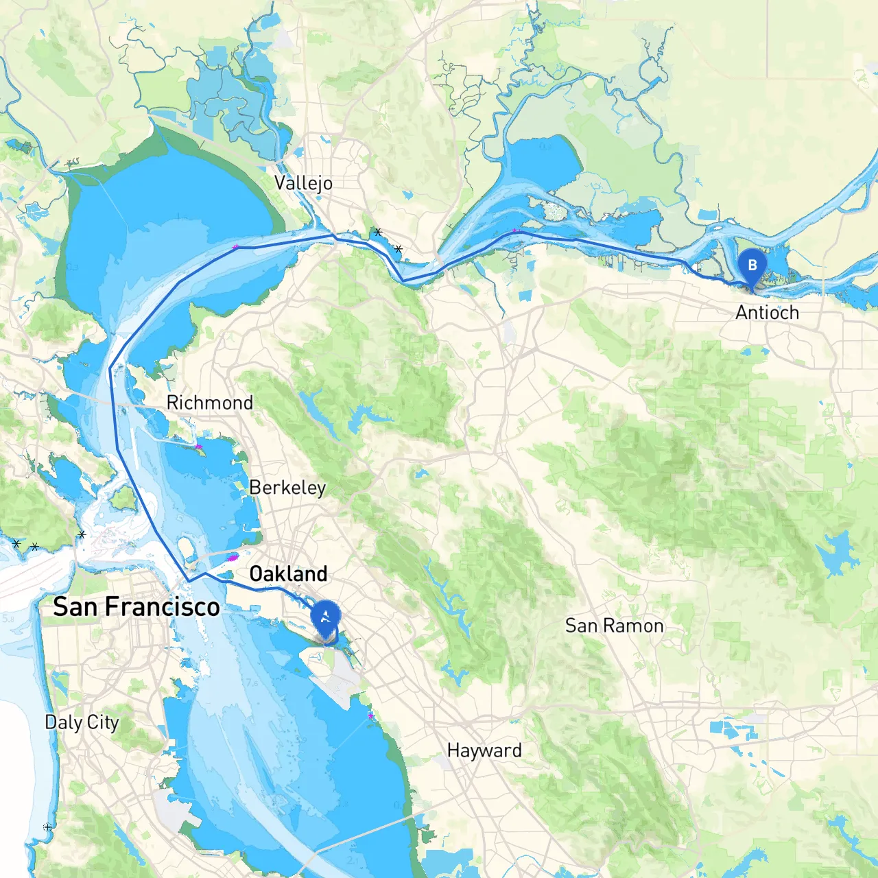
Pilotage Plan: Alameda, CA to Antioch, CA
OverviewEmbarking on this trip from Alameda to Antioch promises to be a rewarding adventure for both seasoned and novice boaters alike. The route offers a beautiful blend of nature and urban landscapes, all while navigating through rich maritime history and diverse wildlife. While safety is paramount, there are numerous opportunities for exploration along the way.
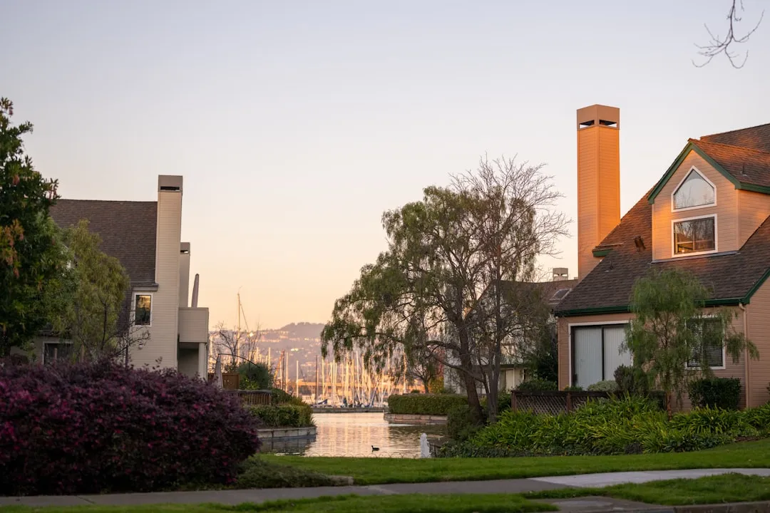
Starting Point: Alameda, CAKick-off your journey in Alameda, a charming island city that offers a variety of amenities for boaters. Before setting sail, ensure your vessel is well-prepared, with adequate supplies, fuel, and safety gear.
Route Description (Alameda to Antioch)
1. Departure from Alameda As you leave Alameda, head into the Oakland Estuary. Watch for local traffic and maintain a vigilant approach with navigational aids prominently displayed along the way, including buoys and markers guiding you into San Francisco Bay.
2. Navigating the Oakland Estuary The Oakland Estuary is an excellent place to refine your piloting skills. Here, you’ll encounter a mix of commercial vessels and recreational boats. Keep an eye on the channel markers and be mindful of local regulations, particularly the speed limits in various zones to ensure a safe passage.
3. Point of Interest: Jack London Square After navigating through the estuary, consider a brief stop at Jack London Square. This vibrant waterfront area features shops, restaurants, and beautiful views of the bay. It’s a perfect spot to stretch your legs, enjoy a meal, or gather more supplies if needed.
4. Getting into San Francisco Bay From Jack London Square, continue through the estuary towards the south. As you approach the main body of San Francisco Bay, steer towards the San Francisco-Oakland Bay Bridge. Maintain a close eye on your charts, particularly for water depth, and adhere to any traffic patterns established in the bay.
5. Hazards in San Francisco Bay Be aware of strong currents and tidal variations that can occur around the bridge. The area can also be subject to sudden weather changes, so it's wise to keep an eye on local marine forecasts. If conditions worsen, consider seeking shelter in nearby bays, such as San Leandro Bay or Richmond Harbor.
6. Navigating through the Central Bay Continue northward through the central bay. Keep in mind to stay within the marked channel, avoiding shoals and shallows, particularly around the islands of Alcatraz and Angel Island. The channels can often be busy, so practice defensive navigation.
7. Turning towards the Sacramento River After passing under the Richmond-San Rafael Bridge, you will turn east towards the Sacramento River entrance. This marks a transition from the vastness of the ocean to a more sheltered waterway. Make sure to check for commercial shipping traffic as larger vessels frequent this area.
8. Point of Interest: Mare Island As you navigate further upstream, consider a stop at Mare Island. It is steeped in maritime history and offers an opportunity to explore its old naval yard and scenic views of the water.
9. Entering the Sacramento-San Joaquin Delta After leaving Mare Island, navigate your way into the heart of the Delta. Pay attention to changing tide levels and always ensure you stay in the marked navigation channels as the waterways can be narrow and winding.
10. Final Approach to Antioch As you near your destination, the river widens, and you may encounter beautiful views of the surrounding natural areas. As you approach the Antioch Bridge, be vigilant of other boaters and any fishing activities.
Arrival at Antioch, CACongratulations! You have arrived at Antioch, a vibrant city with rich cultural diversity and beautiful waterfront parks. Make sure to dock safely and check for local regulations regarding fishing, water sports, and other activities.
Safety ConsiderationsThroughout your journey, always keep a VHF radio on hand, monitor marine weather updates, and remain aware of your surroundings. Stay informed on local regulations, keeping in mind that speed limits and no-wake zones are enforced in many areas.
Recommended AppsFor a smooth navigation experience, consider utilizing apps such as Savvy Navvy, Navionics, and NOAA Weather. These will help you track your position, navigate routes safely, and keep you updated on current weather conditions.
This adventure from Alameda to Antioch provides a mix of safety-conscious navigation and the allure of the bay area’s scenic beauty. Enjoy the journey and stay safe on the water!