
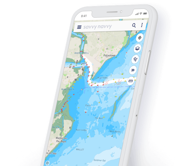
Our savvy charts™ are sourced from hydrographic offices and designed with usability in mind. North sea maps are available within our coverage, for a full list of areas we cover visit our chart coverage map.


Alongside our detailed north sea maps and other chart coverage around the world, savvy navvy also provides members with data from thousands of tidal stations. The information is displayed with a visual tidal stream overlay and on our tidal graph, which clearly shows the date and time of tidal highs and lows.

savvy navvy uses your device GPS location to show your position so you can easily check north sea map information, heading, Speed Over Ground (SOG) and Course Over Ground (COG). Ideal for sailing in familiar waters where you just need a quick reference point.

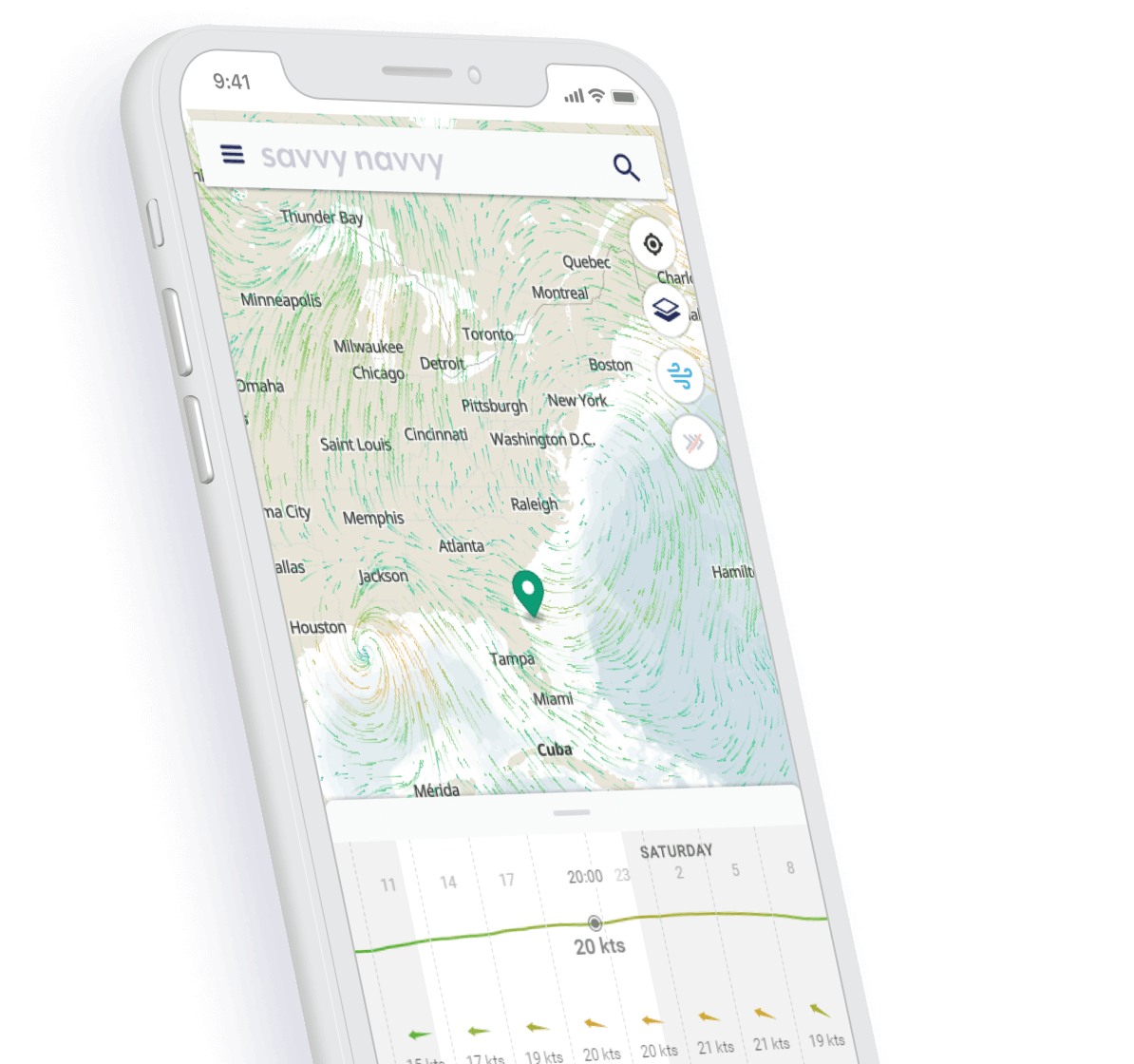

Easily view wind strength and direction as well as the changing wind prediction throughout the day across the whole of the North Sea with savvy navvy’s graphic wind animation.

Using the GFS weather model you can quickly view the weather conditions, temperature and wind information. Simply drop a pin anywhere on your north sea map (chart) for specific weather forecast information for that area. Use the slider to view the changing weather forecast over the coming days.


Planning a trip at sea can be time-consuming, but with savvy navvy you can plot a route in seconds. Our algorithm takes into account weather information, tide data, your boat settings and chart data to suggest the best route to take.

See at a glance the best time to depart based on your route, wind & tidal conditions, see the demo.

Remove the stress of being late. When plotting a route with savvy navvy you will automatically receive an estimated arrival time so you can let your friends and family know when you’ll be at your destination.
There are few things more stressful than worrying about running out of fuel. That’s why we’ve added features where you can set your fuel efficiency and cruising speed. savvy navvy will then show your predicted fuel usage when you plot your route so you can plan ahead to take plenty of fuel in reserve.
Get an automatic CTS when you plot a route across the North Sea with savvy navvy as well as details on tidal streams, highs and lows. Click “Preview” for an easy to see an overview of your route.
Cruise around like a local. With our Navily features you can take a look at detailed marina and anchorage information such as north sea map (chart) details, holding, moorings, fuel docks, restaurants, wind angle protection and much more.
Just like Google Maps, savvy navvy has the option to toggle into “satellite” mode or Night mode, so you can view your charts in even more detail.
Download weather and north sea map (chart) data for the area you plan to go boating to continue using all the savvy navvy features you love. When you are back in range of signal simply update your chart and weather packs to ensure you’re using the latest information.
If you would like to use your savvy passage plan in conjunction with your chartplotter you can “Export your route” to download a GPX file which can then be uploaded.
The tide waits for no person and neither should you when you need our help. We are here to help, wherever and whenever you need us! We have a chatbot in the app that is managed by our team of customer support specialists, contact us any time.
We provide our members with access to savvy charts™ wherever we have coverage. Click on our chart coverage map to view all our locations.
The savvy navvy boating app is available on Android or iOS with a 14-day free trial.
Download savvy navvy on your iPhone or iPad today and start planning your next sail.

Download savvy navvy to your Android phone or tablet and supercharge your navigation.

savvy navvy doesn't just cover the UK, our chart coverage is Worldwide, including English Channel Charts, East Coast Charts, Mediterranean Charts, the Baltic Sea and the Adriatic Sea.


