Pilotage Plan for a Boat Trip from Wilmington, NC to Southport, NC
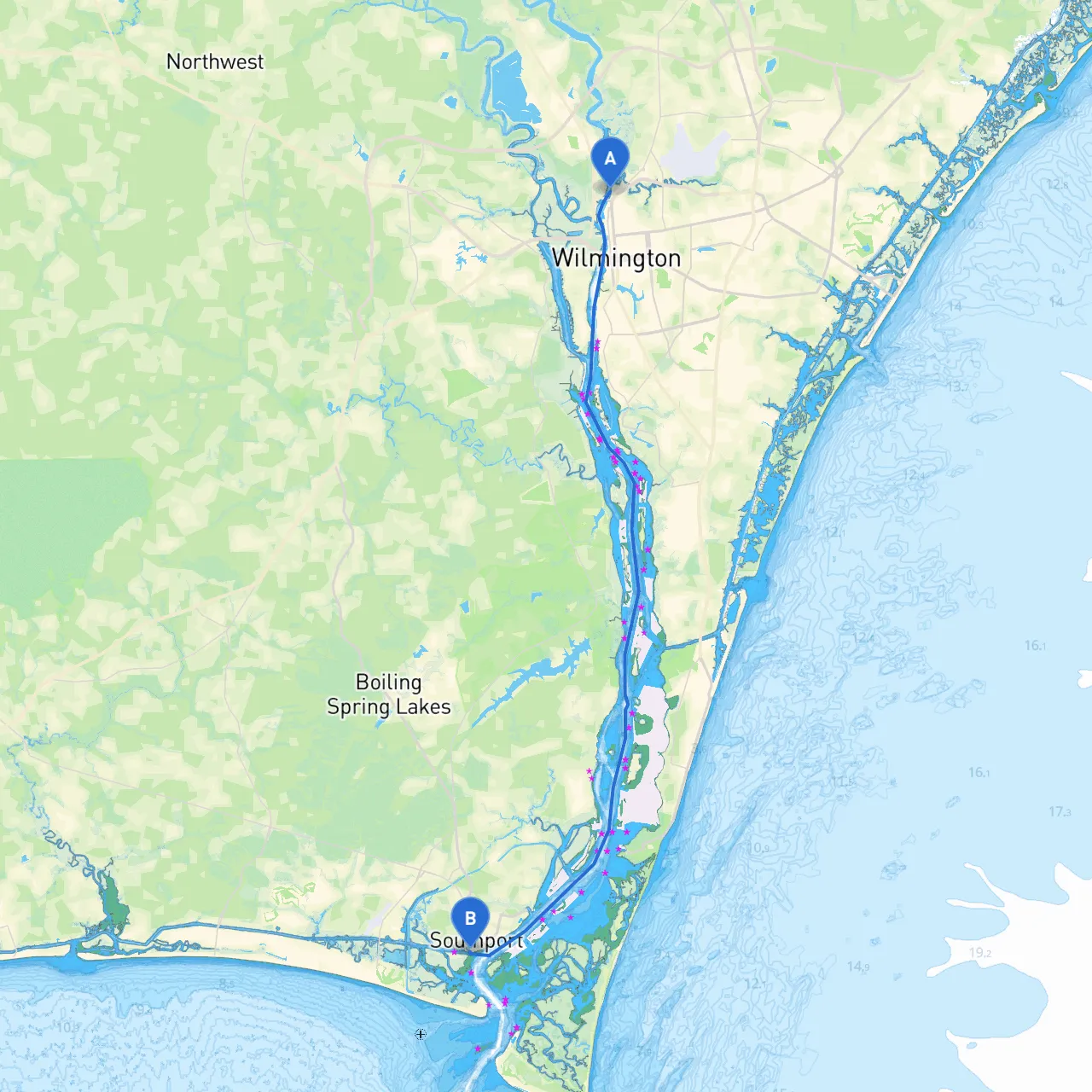
Route Overview:This itinerary takes you from the charming port city of Wilmington, North Carolina, through the scenic waters of the Cape Fear River, and culminates in the picturesque coastal town of Southport. This journey is approximately 20 nautical miles, making it a perfect day trip or a leisurely overnight adventure. The route is suitable for recreational boaters and families, with a mix of scenic views and navigational challenges that cater to both novice and experienced skippers.
Departure: Wilmington, NC (34.255° N, -77.948° W)
Starting Point:Wilmington is well-equipped for marine enthusiasts with its bustling downtown, multiple marinas, and plenty of amenities. Before casting off, ensure your vessel is well-stocked with safety gear, including life jackets, a VHF radio, and an emergency kit.
Points of Interest:
Initial Section: Cape Fear River Navigation
Navigational Aids:
Hazards:
Shelter Options:
Mid-Route: Intracoastal Waterway and Shallower Waters
As you navigate towards Southport, you’ll transition into sections of the Intracoastal Waterway. Here, the scenery brightens with marshlands and wildlife.
Points of Interest:
Avoiding Hazards:Be cautious in areas prone to strong currents, especially when passing under bridges. The Southport-Fort Fisher Ferry operates nearby and should be respected in terms of marine traffic rules.
Arrival: Southport, NC (33.916° N, -78.023° W)
Final Approach:As you approach Southport, be mindful of the speed limit in the harbor area, which is typically 5 knots. Local authorities are vigilant, and maintaining a slow pace helps everyone enjoy the waters safely.
Points of Interest in Southport:
Regulatory Considerations:Before you set out, familiarize yourself with local boating regulations. The area may have specific speed limits, especially around marina zones. It may also be worthwhile to check for any seasonal restrictions on fishing or wildlife areas to ensure compliance.
Emergency Preparedness:In case of sudden weather changes, always monitor local weather reports and have a reliable marine communication device. The VHF radio is not just useful for emergencies but vital for real-time navigational updates.
By sticking to this pilotage plan, you are bound to experience the beauty of North Carolina’s coast while maintaining a safe and enjoyable experience on the water. Consider using navigation apps like savvy navvy for easy route planning and up-to-date navigational charts during your journey.
Happy cruising, and safe travels!