
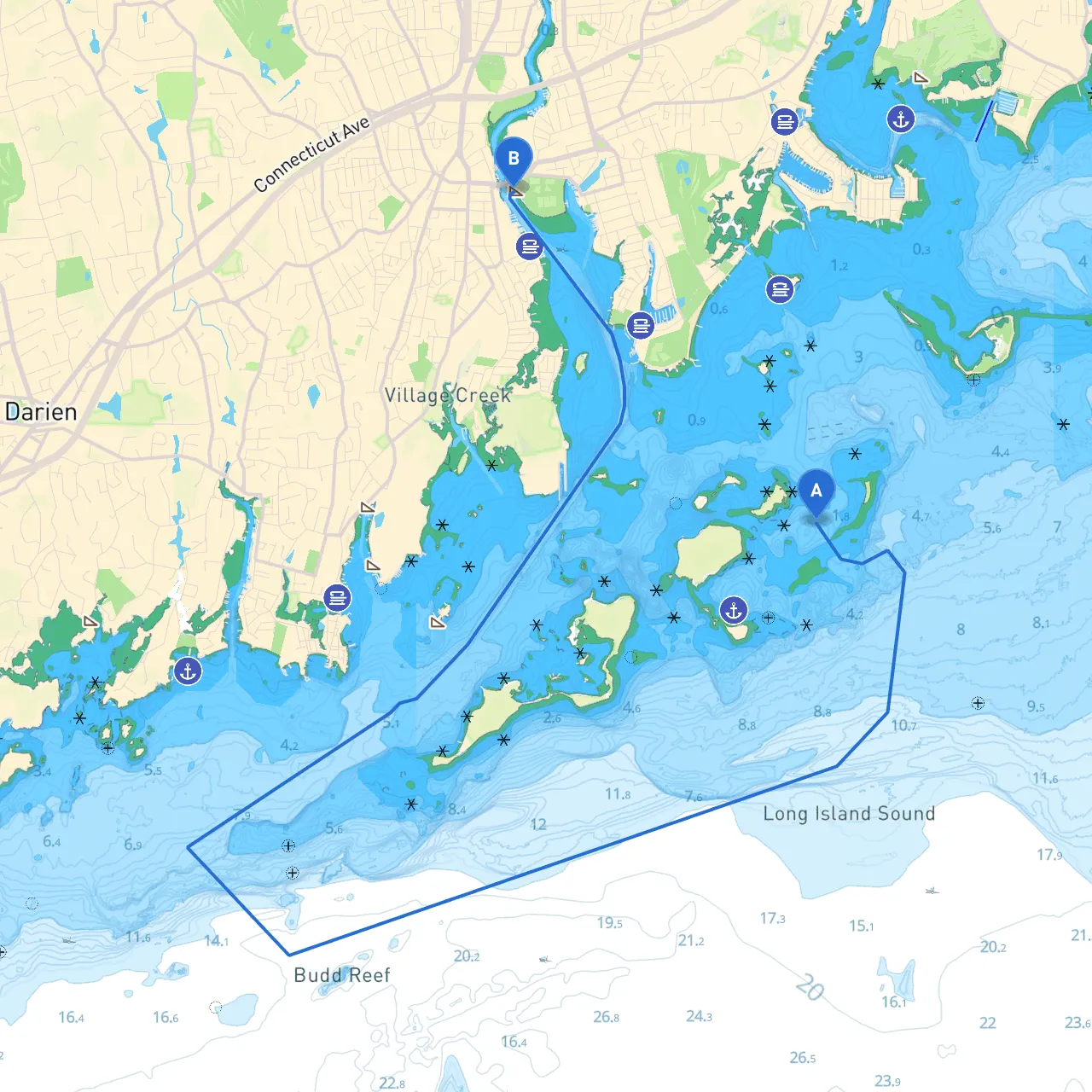
This charming route from Westport to Norwalk, Connecticut, covers a distance of approximately 10 nautical miles along the scenic coastline of Long Island Sound and is ideal for recreational boaters seeking a leisurely trip with safety as a priority. Perfect for day cruisers, this journey offers lovely waters and fascinating points of interest while allowing for convenient shelter bays should the weather turn inclement.
Coordinates: -73.3779, 41.06877
As you set off from Westport, it's advisable to start your journey during daylight hours to enjoy the views and ensure visibility. The waters are generally calm, but ensure that you have checked the local weather forecast for any changes in conditions before departure.
Points of Interest:
1. Leaving Westport Harbor: Head east from Westport Harbor, observing the navigation markers. Pay close attention to the channel buoys that guide you out of the harbor, as various fishing and recreational boats may be present.
2. Entering the Long Island Sound: Once you clear Westport Harbor, you will enter the Long Island Sound. This stretch generally has light to moderate traffic but could face sudden wind changes, especially as you pass nearby shorelines. It's essential to keep a keen lookout for sailboats and personal watercraft.
3. Navigational Aids: Along your route, key aids to navigation include: - Baker Point Lighthouse: A notable landmark that serves as an excellent reference point. It's approximately 4 nautical miles from Westport Harbor, and you should keep it to your starboard as you approach Norwalk. - Green and Red Marks: Adhere to the designated marks, especially as you approach the Norwalk Harbor entrance.
4. Hazards: Be aware of shallow areas near Norwalk and pay close attention to depth soundings, as you approach the entrance to the harbor. There might be shifting shoals, particularly after heavy rains or during changing tides.
Saugatuck River: As you navigate towards Norwalk, if you encounter rough weather, the Saugatuck River offers a temporary haven. It's accessible via the head of the river, with sufficient depths for navigating upstream but ensure you check your draft.
Norwalk Harbor: This is one of the safest harbors along the route, with excellent facilities, should you need to head in due to weather changes. The harbor is well-marked and offers several safe anchorages and marinas.
Coordinates: -73.41353, 41.0982
Upon reaching Norwalk, you will find a vibrant waterfront filled with activities. Sono: The South Norwalk district is known for its picturesque charm and a variety of restaurants and shops.
This route from Westport to Norwalk is carefully designed for both leisure and safety. With its stunning views and the opportunity for quick shelter, it makes for a perfect day trip for recreational boaters. By staying aware of navigational aids, local conditions, and potential hazards, you can enjoy a memorable boating experience while prioritizing safety at every turn. Safe travels!