
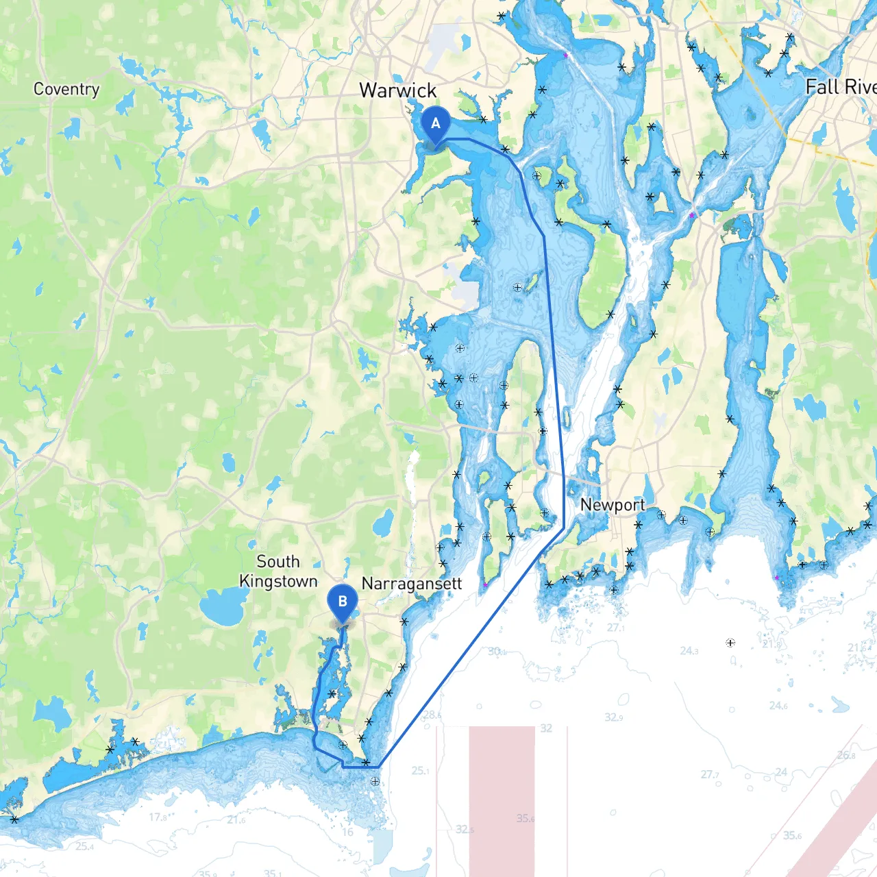
Pilotage Plan from Warwick, Rhode Island to Wakefield, Rhode Island
Embarking on a boating adventure from Warwick to Wakefield, Rhode Island opens a gateway to picturesque waters and charming coastal scenery. This route, approximately six nautical miles long, is ideal for recreational boaters and provides ample opportunities for exploration, while prioritizing safety and awareness of local navigation challenges.
Coordinates: Longitude -71.4332, Latitude 41.6693 Warwick is positioned on the western shore of Narragansett Bay, offering easy access to a robust network of waterways. Key navigational aids here include the Warwick Light and nearby buoys marking the established channels.
1. Navigational Considerations - As you leave Warwick, maintain a watchful eye on the local navigational markers, particularly the buoys indicating the main channels. It’s vital to stick to the marked paths to avoid shoal areas. - The waters can experience varying currents, especially around the Conimicut Point, so ensure to check tide charts and plan around these conditions.
2. Points of Interest - Conimicut Point: A great spot for wildlife observation. Keep an eye out for seabirds and migrating shorebirds. While anchoring here, make sure to maintain a clean environment and adhere to any local waste disposal regulations. - Apponaug Cove: This sheltered cove offers an excellent stopover should the weather show signs of turning. It's ideal for a picnic anchored among the lush surroundings or a brief exploration of the scenic shoreline.
3. Shelter Options - If rough weather strikes, look towards Apponaug Cove as your primary shelter. Other sheltered areas worth noting along your route include North Kingstown’s Mill Cove, providing a tranquil environment to regroup and wait out the weather.
4. Approaching Wakefield - As you enter the waters near Wakefield, there are no major hazards to be noted, but always remain cautious as the area can see an increase in recreational traffic, especially during weekends.
Coordinates: Longitude -71.4960, Latitude 41.4272 Your journey concludes at Wakefield, a quaint coastal town rich in history and home to various attractions. Look out for the local marinas, which are great for docking, refueling, or grabbing a meal after a day on the water.
This route from Warwick to Wakefield not only showcases the beautiful waters of Rhode Island but also emphasizes safe boating practices. With ample points of interest and sheltered bays, it is suitable for boaters of varying experience levels. By staying aware and prepared, you can enjoy a memorable day on the water, enriched by the charm of Southern Rhode Island's coastline.