
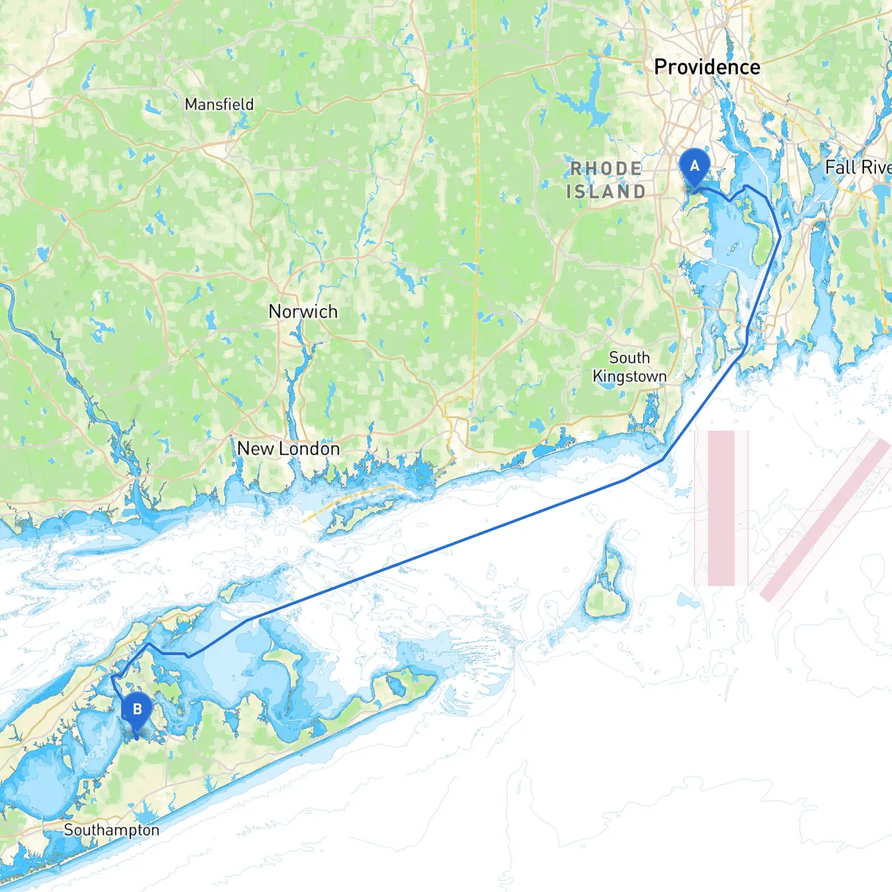
Pilotage Plan: Warwick, Rhode Island to Noyack, New York
Welcome aboard! We’re about to embark on a scenic journey that winds from the charming shores of Warwick, Rhode Island, through the rich waters of Narragansett Bay, past stunning coastal landscapes, and finally arriving in the picturesque hamlet of Noyack, New York. This passage is perfect for recreational boaters, whether you’re a beginner exploring new waters or a seasoned sailor wanting to enjoy the scenic vistas.
Starting Point: Warwick, RI Coordinates: -71.4332, 41.6693
As you set sail from Warwick, be sure to navigate carefully through the local channels. The area is known for its busy residential boating traffic, so awareness is key. Keep an eye out for the floating yellow "no wake" buoys as you venture into Greenwich Bay.
1. Greenwich Bay Channel: Although it is generally safe, be mindful of shifting sandbars, especially at low tide. Charts will indicate the least depth areas.
2. Approaching Narragansett Bay: Once you clear the bay, make sure to follow local guidelines as you enter the main passage. Be vigilant of ferries and larger vessels navigating to and from Block Island.
Estimated Route Duration: 5 to 6 hours (depending on conditions and stops)
1. Narragansett Bay Transit: After passing the Conimicut Lighthouse, make your way past the east and west passage markers. Pay close attention to the channel markers because the currents can be tricky, particularly during tidal changes.
2. Stonington Harbor: If the weather begins to turn sour, Stonington Harbor is an excellent refuge. It's well-marked, and the local marina offers amenities if you need a place to dock.
3. Long Island Sound: As you approach Long Island Sound, stay vigilant for smaller boats and fishing vessels. The sound is lively with recreational craft, and weather conditions can change quickly.
4. North Fork of Long Island: Look out and enjoy the views of the beautiful North Fork as you steer toward Noyack. Depending on the time of year, you might catch glimpses of migratory birds or even dolphins!
Ending Point: Noyack, NY Coordinates: -72.3472, 40.9993
As you draw nearer to Noyack, keep a lookout for the approach to the marina. This area offers a friendly local atmosphere with nearby attractions such as vineyards, quaint shops, and serene parks for post-sailing relaxation.
For enhanced safety and convenience, consider using reliable boating apps like Navionics, Windy, and Savvy Navvy to keep up with weather information, tidal charts, and your current location.
This route not only offers a delightful blend of sailing and scenic exploration but promotes safety as you experience the beauty of the Rhode Island and New York coastline. Stay safe, cruise responsibly, and enjoy your adventure on the water!