
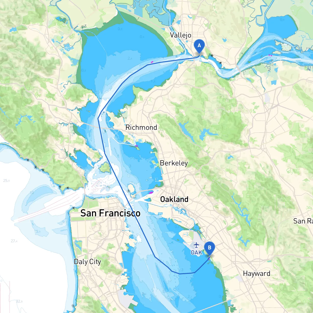
Embarking on a boat trip from Vallejo to San Leandro offers a fantastic adventure for seasoned boaters and novices alike, providing a unique mix of scenic views, navigational challenges, and opportunities for safe harbor along the way. This route, approximately 20 nautical miles, weaves through the picturesque San Francisco Bay, allowing you to enjoy the beauty of the Bay Area while adhering to safety and navigational protocols.
Starting from Vallejo, your journey takes you southward, traversing the northwestern part of the San Francisco Bay. You'll navigate through passing points that offer both safety and points of interest. Here’s how the trip unfolds:
Starting Coordinates: Latitude 38.0677, Longitude -122.2137
Before you set sail, ensure that your vessel is equipped with all necessary safety gear, including life jackets, first aid kits, and a well-maintained communication device. Join the Vallejo Yacht Club if you’re not already a member to get local insights and current navigational conditions. Check local weather reports to avoid unexpected storms, which can arise quickly in this region.
As you make your way towards San Leandro, consider the following notable points and potential shelters:
1. Point Richmond: A fantastic spot to catch your breath or have a leisurely lunch. The area is home to the historic Rosie the Riveter Museum and various waterfront parks. The Richmond-San Rafael Bridge offers breathtaking views perfect for a photo opportunity.
2. Marina Bay: If the weather takes a turn for the worse, Marina Bay near Richmond is an excellent shelter. The Marina is well-equipped and offers amenities like restaurants and fuel docks.
3. Alameda Point: As you approach Alameda, this area is rich with history. Check out the USS Hornet Museum or take a stroll through the charming town. The Alameda Marina is a great place to stop if conditions worsen or for a leisurely break.
4. San Leandro Bay: As you get closer to your destination, the waters here are generally calm, but be wary of tidal influences. The bay has a designated no-wake zone, so maintain a slow speed as you enter.
Arrival Coordinates: Latitude 37.6985, Longitude -122.1899
Upon arrival, adhere to local harbor regulations and familiarize yourself with docking procedures. San Leandro Marina is welcoming to transient boaters; don’t hesitate to ask the dock hands for assistance in tying up.
Utilizing boating apps such as Savvy Navvy can enhance your trip by providing up-to-date weather conditions, tidal information, and navigation capabilities. Additionally, the Coast Guard app is invaluable for emergency contacts and alerts. Always have a VHF radio on hand to stay connected with nearby vessels and the Coast Guard.
This route is particularly suited for cruisers looking for a blend of tranquility and urban maritime experience. The diverse natural beauty of the Bay Area combined with the lively culture of the waterfront towns ensures a rewarding experience. Always prioritize safety: check your equipment, stay aware of weather updates, and navigate responsibly.
By choosing this adventure, you are guaranteed a memorable journey filled with both serenity and excitement, rewarding you with scenic vistas, local cultures, and the joys of boating in one of the most beautiful waterways in the U.S. Enjoy your trip, and happy sailing!