Home
 /
Florida
 / 

Tarpon Springs to St. PETE BEACH by boat

Tarpon Springs to St. PETE BEACH

Distance - 37.2 Nm

Avg Speed
5 kts
10 kts
20 kts
30 kts
Time Estimate
7 hr 26 min
3 hr 43 min
1 hr 51 min
1 hr 14 min
Tarpon Springs to St. PETE BEACH

Tarpon Springs to St. PETE BEACH

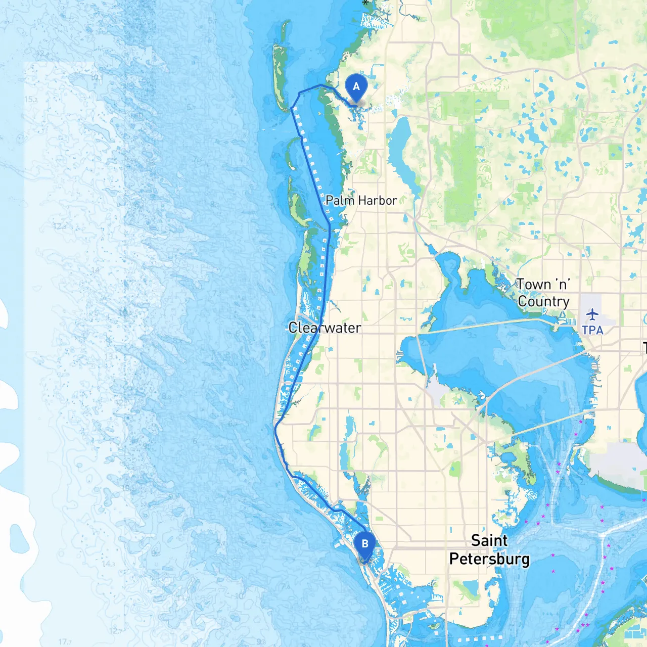
### Pilotage Plan: Tarpon Springs, FL to St. Pete Beach, FL**Trip Overview**This journey from Tarpon Springs to St. Pete Beach along Florida's beautiful Gulf Coast offers a delightful mix of tranquility and adventure. This route is especially suitable for experienced boaters looking to explore local wildlife, charming coastal communities, and picturesque waterways. While the distance is relatively short, safety and navigation should remain the top priorities.---**Starting Point: Tarpon Springs, FL****Coordinates:** Latitude 28.1608, Longitude -82.7689**Departure Considerations:**Before setting off, review weather conditions, especially potential storms or sudden wind shifts that can affect the route. Ensure your boat is equipped with all necessary safety gear, including life jackets, flares, and a functioning VHF radio. ---**Route Overview**This journey primarily follows the Intracoastal Waterway (ICW) southward, known for being well-marked and relatively sheltered from the open Gulf waters. As you leave Tarpon Springs, keep a keen eye on the surrounding landmarks and navigational aids, as these will dictate safe passage along the winding channels.1. **Entering the Anclote River:** After departing Tarpon Springs, you’ll navigate through the Anclote River. Watch for the prominent Anclote Key Lighthouse visible on the horizon to your starboard side—it's both a great photo opportunity and a reassuring navigational reference. **Hazards:** Be cautious of shallow areas and keep to the marked channel.2. **Port Richey and Hudson:** Continuing southward, you’ll pass by Port Richey, a quaint area perfect for a quick stop should the weather change or you need a break. Here, you can find dockage and dining options if time allows.3. **Navigating Towards the ICW:** Maintain your course towards the ICW junction. This section is dotted with markers, as well as private and public docks. Stay alert for local vessel traffic and fishermen, especially around the marinas.4. **Sailing through the Middle Ground:** As you enter the part of the ICW near the Hudson area, be prepared for potential tidal changes and shifting depths. Look out for navigational aids including buoys and markers, which help guide the way through the depths.5. **Passing by Caladesi Island State Park:** One of the hidden gems along this route is Caladesi Island. It offers beautiful beaches and nature trails. Conditions permitting, consider a short detour for a swim, picnic or simply to soak in the natural beauty of this barrier island. 6. **Approaching Clearwater Bay:** You will soon arrive at Clearwater Bay. Look out for the series of markers leading to the Clearwater Memorial Causeway. The bay is wide with plenty of room to maneuver. Be aware of increased boat traffic, especially those indulging in water sports.7. **Exploring Clearwater Beach:** If time allows, venture towards Clearwater Beach, famous for its vibrant atmosphere and activities. It's a great rest stop; however, docking here may be busier and prices fluctuate seasonally.8. **Final Leg to St. Pete Beach:** After Clearwater, you’ll steer back towards the ICW leading directly to St. Pete Beach. Watch for high-rise hotels and the impressive skyline of St. Petersburg on your way, offering wonderful views as you approach your destination. ---**Destination: St. Pete Beach, FL****Coordinates:** Latitude 27.6958, Longitude -82.7350### Navigational Aids and Regulations- **Buoys and Markers:** Pay careful attention to navigation markers along the route, particularly in more congested areas near Clearwater and St. Pete Beach where local fishing and recreational vessels are common.- **VHF Radio:** Keep your radio tuned to Channel 16 for communications and any weather updates.- **Speed Zones:** Adhere to posted speed limits, especially in residential areas and near marinas.### Recommended Boating AppsWhile navigating, consider using applications like ***Savvy Navvy***, which provide detailed charts and real-time updates on weather and tides. Other helpful apps include ***Navionics*** and ***iNavX*** for added navigation support.---**Conclusion**This pilotage plan offers a safe and enjoyable route from Tarpon Springs to St. Pete Beach. The journey showcases the stunning natural environments of the Gulf Coast while also providing ample opportunities for exploration and shelter. Always prioritize safety, respect local regulations, and most importantly—enjoy your time on the water!