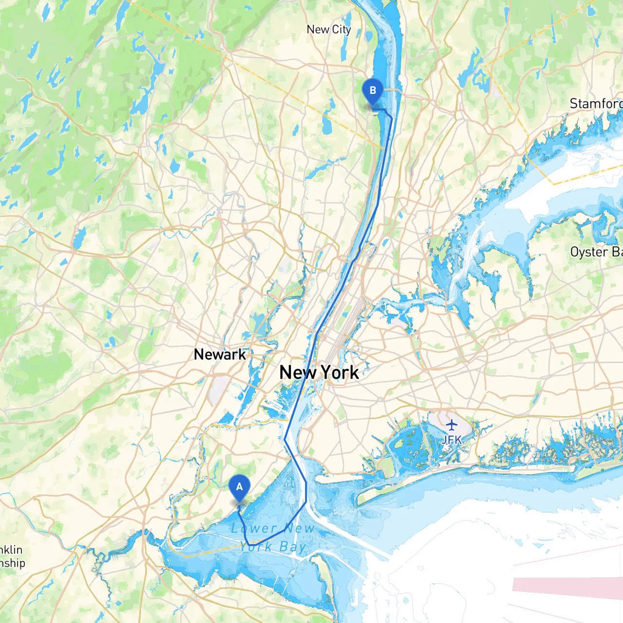
This pilotage plan will guide you on a delightful journey from Staten Island, NY to Piermont, NY. The route stretches across the beautiful New York Harbor, up the Hudson River, and offers various points of interest along the way. It's well-suited for intermediate to advanced boaters, thanks to the diverse navigational challenges and stunning landscapes. Safety is paramount, and this plan will keep you informed about potential hazards while leading you to beautiful spots where you can anchor or take a break if necessary.
Starting Point: Staten Island, NY (Lat: 40.5428, Long: -74.1398)
1. Departure from Staten Island: As you depart from Staten Island, carefully watch out for the local ferry traffic. The Staten Island Ferries are frequent and can be large, so maintaining a safe distance is essential. AIS (Automatic Identification System) can help you track nearby vessels.
2. Navigating the Upper New York Bay: Head towards the Verrazzano-Narrows Bridge, maintaining a course towards the Hudson River. The tidal currents can be strong in this area, particularly around the bridge. Keep an eye on the tide tables and plan your departure timing accordingly to avoid battling strong currents.
Notable Landmarks:
3. Entering the Hudson River: After passing under the Verrazzano Bridge, you'll start your course up the Hudson River. The Hudson can be busier than the Upper Bay, with recreational boaters, commercial vessels, and the occasional tugboat pushing barges. Maintain a lookout for navigational markers and buoys, especially those marking the channel.
Shelters Along the Way:
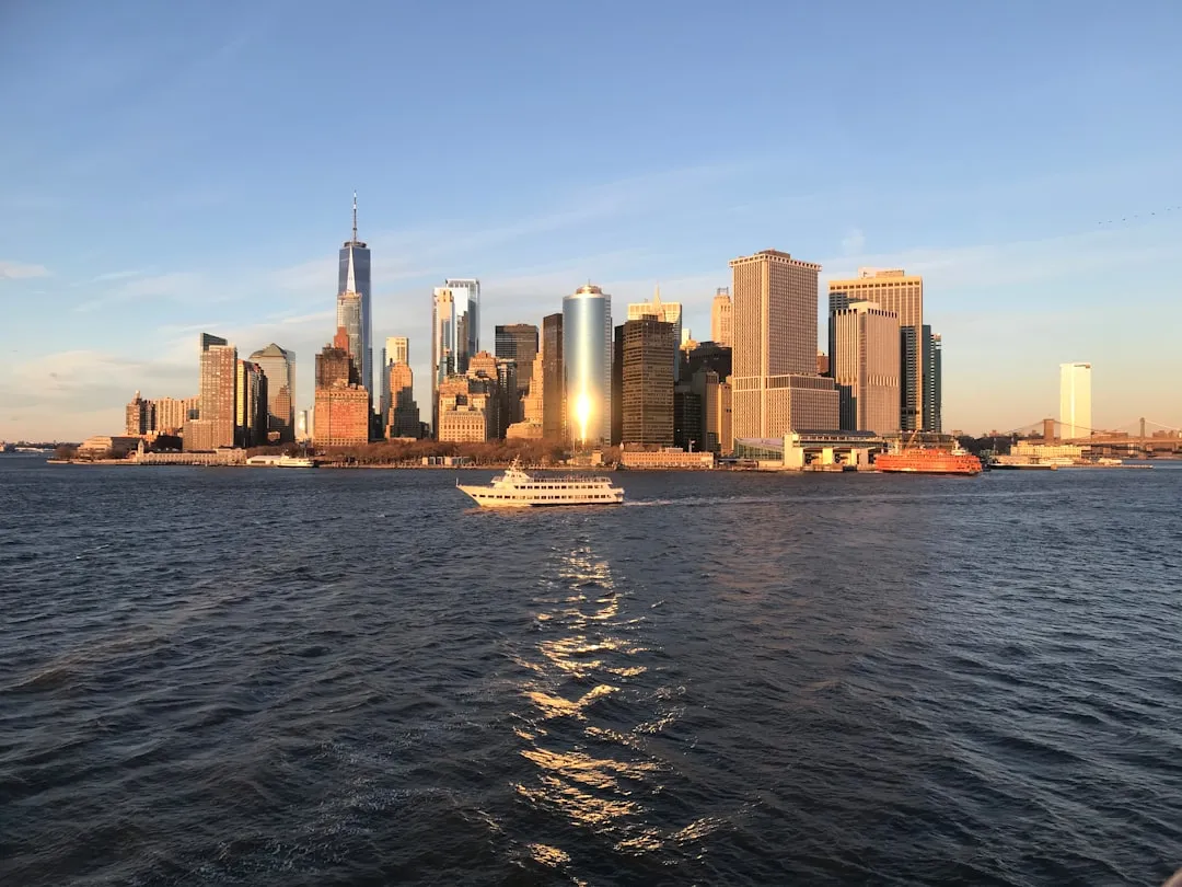
4. Battery Park City: As you cruise past the Battery Park area, take a moment to appreciate the beautiful skyline of Manhattan. This area is perfect for a brief stop; the parks along the waterfront provide fantastic views and photo ops.
5. Governor’s Island: Offering a bit of history and lush green spaces, it’s worth considering a detour to experience this serene retreat.
6. The George Washington Bridge: As you continue north, the George Washington Bridge looms majestically. The views provide a memorable backdrop, and although it might be tempting to anchor nearby, be aware of the strong currents in this area.
7. Entering Piermont: As you approach Piermont, take note of the shallow waters. Some spots can be less than 4 feet, particularly around the town dock. Use your depth sounder and charts to navigate safely.
8. Final Destination: Once docked in Piermont, you can enjoy local restaurants, quaint shops, and hike in the nearby Piermont Marsh. Beautiful views of the Tappan Zee Bridge and the surrounding natural beauty can provide a perfect end to your trip.
This route provides a splendid blend of safe boating and stunning scenery while keeping safety your top priority. Whether you’re an experienced sailor looking for adventure or a leisurely cruiser enjoying the sights, this trip has something for everyone. Embrace the journey and savor the landscapes along the way. Safe travels!