
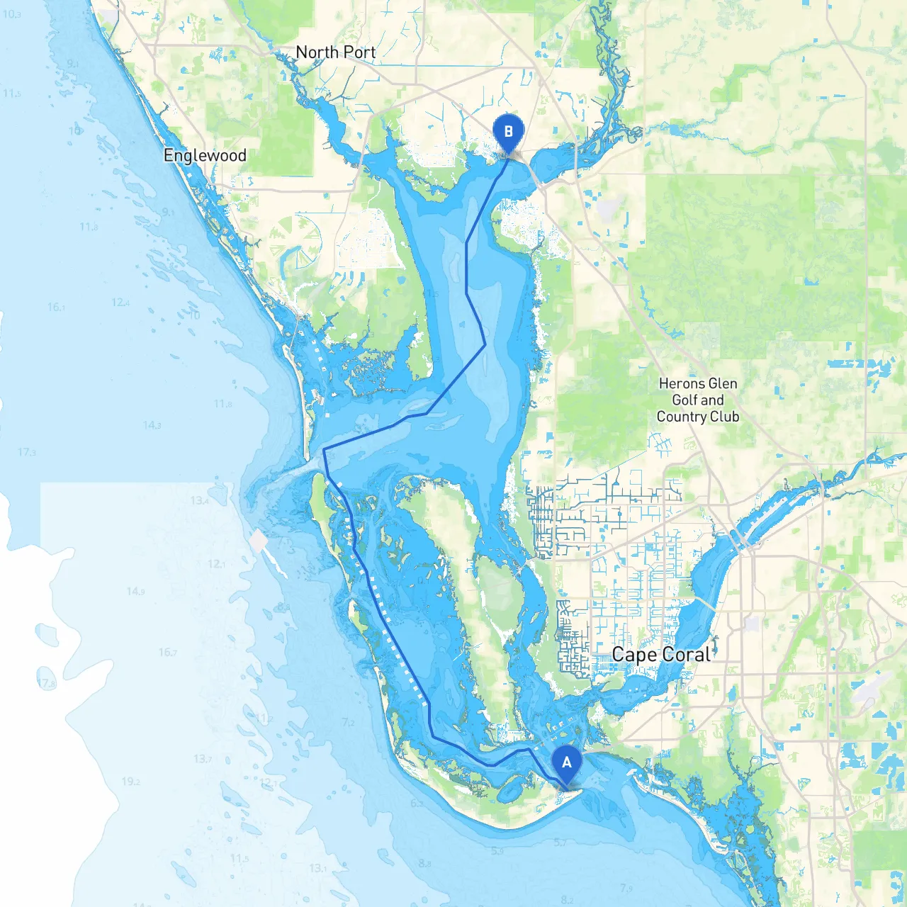
Pilotage Plan: Sanibel, Florida to Port Charlotte, Florida
Overview:This route from Sanibel to Port Charlotte offers a stunning array of coastal scenery, wildlife viewing, and charming stops along the way. It’s particularly suitable for coastal cruisers and those who appreciate a leisurely pace while prioritizing safety. The journey covers approximately 24 nautical miles, making it ideal for a day trip with plenty of time to explore.
Departure: Sanibel Island, FloridaStart your journey at the stunning Sanibel Island, known for its gorgeous beaches and vibrant wildlife. As you set off, be sure to confirm marina hours and local regulations specific to Sanibel.
Hazards:While navigating the waters near Sanibel, be cautious of shallow spots, especially around the Sanibel Causeway. Stay within marked channels to avoid these hazards.
Points of Interest:
Navigating the Waterway:
1. Channel Markings: Follow the buoys marking the Sanibel Pass to clear the waters safely. Always adhere to navigation aids, which are key in this busy marine environment.2. Periwinkle Way: While passing by, consider taking a brief stop to visit local shops or grab a meal.3. Entrance to Pine Island Sound: Keep watch for shifting sandbars and adjust your course accordingly. The sound is primarily well-marked, but it’s essential to remain alert.
Shelter Spots:As you progress through Pine Island Sound, you’ll find several bays that provide refuge from adverse weather:
Approaching Port Charlotte:As you prepare to enter Port Charlotte, keep an eye out for the entrance markers:
Key Navigational Aids:
Regulations and Safety Tips:
Arrival: Port Charlotte, FloridaUpon arrival, you’ll find a welcoming harbor with dining options and community activities. Explore the waterfront parks and perhaps even take your boat for a leisurely cruise around the harbor for some sightseeing.
This pilotage plan ensures a safe and enjoyable trip while highlighting the natural beauty of the Florida coast. Engage in leisurely activities, savor incredible landscapes, and take advantage of the sheltered bays along the way. As you navigate the water, remember to keep your safety gear at hand and stay aware of your surroundings—this adventure promises to be both exhilarating and serene!