
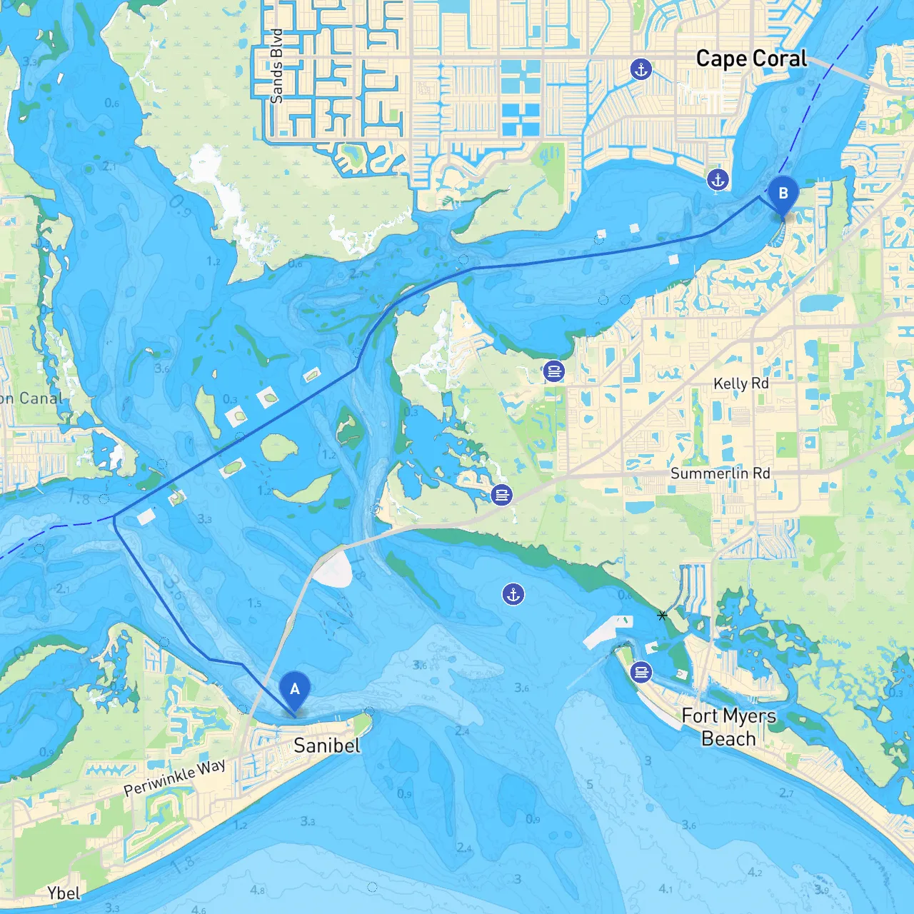
Pilotage Plan: Sanibel, Florida to Fort Myers, Florida
Departure Point: Sanibel, Florida Destination: Fort Myers, Florida
This route is an inviting journey that will hold the attention of any seasoned boater while providing a chance to soak in the stunning coastal scenery. Perfectly suitable for intermediate to experienced boaters, this trip will challenge your navigation skills while ensuring there are safe havens along the way.
As you embark from Sanibel, you'll glide through the tranquil waters of San Carlos Bay. The distance from Sanibel to Fort Myers is approximately 12 nautical miles, making it manageable for a day trip. The journey will primarily take you west and then southeast as you approach Fort Myers.
1. Sanibel Lighthouse: Before you head out, take a moment at the iconic Sanibel Lighthouse. It stands at the entrance to the Sanibel Channel and provides a picturesque backdrop to your departure.
2. Captiva Island: Along the way, keep an eye out for Captiva Island to your northwest. It's a fabulous place for some sightseeing, and you can discover the beautiful beaches and quaint shops there.
3. Bunch Beach Preserve: This is a great spot for shelling and bird-watching. The preserve is located south of San Carlos Bay and provides an excellent break point if you want to stretch your legs and enjoy nature.
Navigating from Sanibel to Fort Myers requires some attention to local aids and hazards.
Several bays along the route provide excellent shelter if the weather turns sour:
1. Bunche Beach: This area is sheltered and provides good protection from the winds and waves. It also allows for short excursions to explore the beach.
2. Fort Myers Beach: Located at the southern tip of Estero Island, this is a larger bay that is well-protected and populated with amenities if you need to take cover.
This route from Sanibel to Fort Myers might offer you a mix of adventure and relaxation, suitable for those who love to explore while maintaining safety as the priority. Keep your eyes peeled for wildlife, enjoy the beautiful coastal views, and do not rush—there’s plenty to see along the way.
For a comprehensive and user-friendly experience, consider using navigation apps like savvy navvy, along with other reliable boating apps to keep you informed about tides, weather conditions, and navigational hazards.
Prepare appropriately, stay safe, and relish every moment of this beautiful Floridian waterway!