Home
 /
 / 

San Francisco to Capitola by boat

San Francisco to Capitola

Distance - 75.0 Nm

Avg Speed
5 kts
10 kts
20 kts
30 kts
Time Estimate
14 hr 59 min
7 hr 29 min
3 hr 44 min
2 hr 29 min
San Francisco to Capitola

San Francisco to Capitola

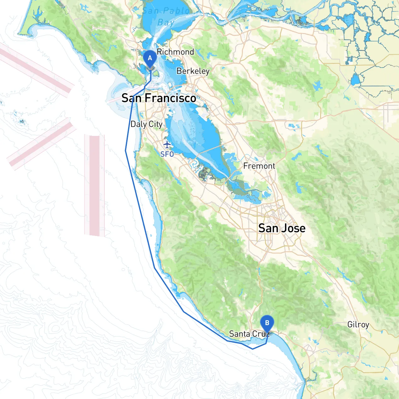
**Pilotage Plan: San Francisco, CA to Capitola, CA****Route Overview:**Embarking on a journey from San Francisco to Capitola, you’ll navigate the stunning coastline of California, weaving through picturesque bays and sheltered harbors. This route is particularly suitable for experienced boaters who appreciate the grandeur of the Pacific coastline while being mindful of changing weather conditions and navigation challenges.**1. Departure from San Francisco:**Starting at the coordinates (long/lat -122.4576, 37.8736), you will begin in the bustling San Francisco Bay. Before setting off:- **Weather Check:** Always monitor the weather forecast, especially for wind conditions, as they can change rapidly.- **Tidal Considerations:** Pay attention to the tidal currents in the bay, which can be strong and can affect your departure.- **Points of Departure:** The Golden Gate Bridge is a notable viewpoint and a fantastic photo opportunity as you leave the bay towards the open ocean.**2. Along the Route:**As you exit the bay, you’ll fare westward toward the Pacific Ocean. Here are key points and considerations to keep in mind:- **Point Reyes National Seashore:** Although slightly north of your route, this area represents a fantastic detour. The coastline is dramatic, with opportunities for wildlife spotting, including elephant seals and various seabirds. - **Half Moon Bay:** Approximately 15 nautical miles south of San Francisco, Half Moon Bay is an excellent stopover if conditions change. The harbor offers shelter and amenities, including fuel and restaurants. Beaches here provide a lovely spot for a break. **3. Navigational Aids:**As you navigate southward, the following landmarks and aids will assist in your passage:- **Buoys and Beacons:** Keep an eye out for navigational buoys marking safe channels. Familiarize yourself with their colors and numbers before departure.- **Landmarks:** Look for the Pigeon Point Lighthouse near Pescadero. Its towering structure is visible from sea, serving as a great reference point.- **Radar Systems:** Utilize radar if possible, especially in foggy conditions that can often envelop this stretch of coastline.**4. Local Regulations:**Be aware of marine protected areas you may pass, particularly near Año Nuevo State Park and the Monterey Bay National Marine Sanctuary. Fishing regulations and boating restrictions apply here, so ensure you are informed to avoid penalties. Always respect no-wake zones, especially when approaching harbors or during whale migration seasons.**5. Final Destination – Capitola:**Arriving at Capitola (long/lat -121.9534, 36.9695), you will find a charming seaside village. The beach, colorful storefronts, and a vibrant pier await you. Remember:- **Shelter Options:** The harbor at Capitola provides landing facilities and seeks a safe refuge from any oncoming storms.- **Local Attractions:** Take some time here to explore the vintage arcade, local shops, and eat fresh seafood from one of the waterfront restaurants. **Conclusion:**This pilotage plan guides you through captivating coastal scenery while prioritizing safety. It is perfect for seasoned boaters seeking a mix of adventure and tranquility. Always maintain a check on your onboard equipment, ensure your communication devices are functional, and consider utilizing navigation apps like Savvy Navvy to enhance your route planning and awareness while at sea. Enjoy your adventure while remaining vigilant to the dynamic nature of coastal boating!

More routes from San Francisco to Capitola

No items found.