
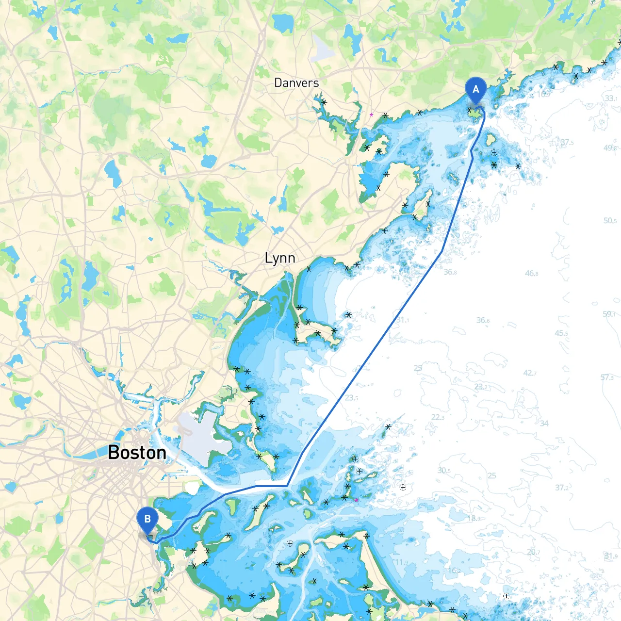
Starting Point: Salem, MA (Lat: 42.552083, Lon: -70.7975) Destination: Dorchester, MA (Lat: 42.306333, Lon: -71.052)
This journey will take you through some of the most picturesque coastal areas of Massachusetts, from the historical charm of Salem to the bustling urban waters of Dorchester. The route encompasses various points of interest, harbors for shelter, and ideal spots for exploration. It’s suitable for experienced boaters familiar with coastal navigation, offering a good mix of safe waters and vibrant attractions.
Start your journey by departing from Salem Harbor, a well-protected harbor that offers several amenities for boaters. Before you set out, check the local marine forecast for wind and tide conditions. Here, you’re greeted by the picturesque views of the Salem Maritime National Historic Site, with its historic buildings lining the waterfront. Ensure to navigate around the marked channels to avoid the shallow areas.
Navigational Considerations:
As you make your way along the coast, head towards Marblehead Harbor, roughly 4 nautical miles from Salem. This harbor is known for its stunning views and vibrant boating community, making it an excellent place for a brief rest.
Points of Interest:
Hazards:
From Marblehead, continue southward towards Nahant Bay, a detour that provides shelter along the way. The bay is about 6 nautical miles from Marblehead and is an excellent location to duck in should the weather turn.
Navigational Aids:
After rounding Nahant, set a course towards Boston Harbor. As you approach, be prepared for increased traffic, as this area is a hub for marine activity. The distance to the harbor from Nahant is approximately 10 nautical miles.
Safety Tips:
Highlights in Boston:
From Boston Harbor, follow the marked channel leading towards Dorchester. Keep in mind that as you enter the Neponset River area leading to Dorchester, the waters can get shallow; hence monitor your depth sounder closely.
Local Regulations:
Final Landmarks:
Should inclement weather arise, you can seek shelter at several bays and harbors along the route:
This planned route offers a delightful mix of historical sites, bustling maritime activity, and moments of tranquility. By focusing on safety while enjoying the rich marine anatomy of Massachusetts, this journey from Salem to Dorchester will be one for the books! Happy sailing!