
Pilotage Plan: Salem, MA to Chelsea, MA
Overview:Embarking on a journey from Salem, Massachusetts to Chelsea, Massachusetts offers a delightful mix of coastal cruising and rich maritime history. This route is perfect for seasoned boaters who appreciate the beauty of New England's coastline while remaining vigilant about safety and navigational challenges.
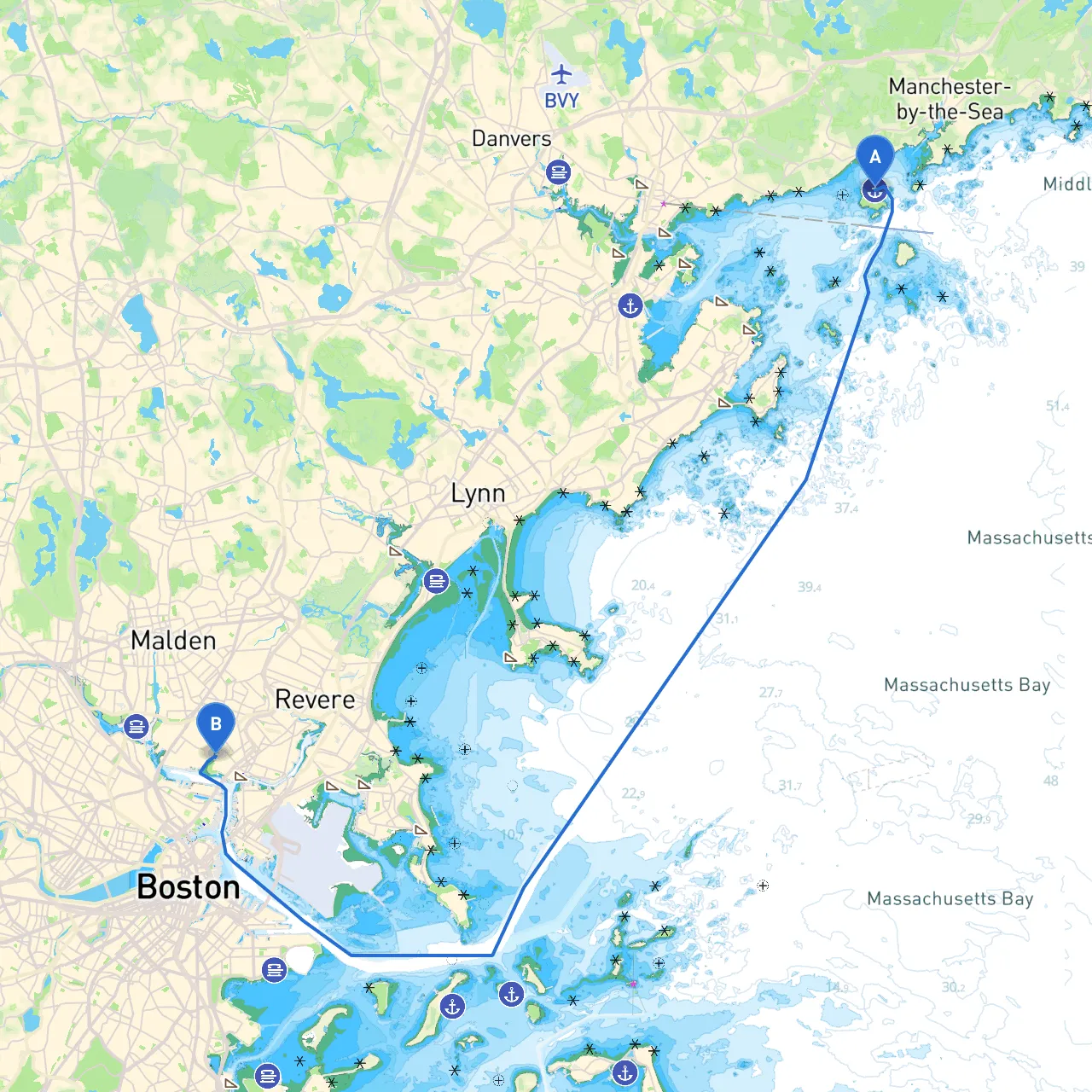
Route Description:The trip will cover approximately 18 nautical miles, taking you down the coastal waters of Massachusetts Bay and around the bustling harbor channels. Given the proximity to larger urban areas, it's imperative to stay alert and respect navigation rules, particularly in crowded waters.
Leg 1: Departing SalemStart at Salem Harbor, known for its rich history and vibrant surroundings. Prior to departure, ensure that you've checked the local weather forecasts—especially for wind and tidal patterns that can affect navigation. Salem's harbor is well-marked with buoys and navigation aids, enabling an easy exit. Pay attention to the Salem Channel, keeping a watchful eye for both commercial traffic and recreational vessels.
As you set sail, consider dropping by Winter Island Park just off Salem Harbor for a brief stop. Here, you can enjoy the scenic views of the coastline and potentially take a brisk walk or explore the Fort Pickering Lighthouse—one of the historical landmarks in the area.
Leg 2: Navigating to MarbleheadAs you head south, Marblehead’s waters will come into view. This area is beautiful but requires careful navigation due to rocky outcroppings and various moored boats. The entrance to Marblehead Harbor is marked with lighted buoys, guiding you safely in. Marblehead itself is a charming town, and the harbor offers a possible layover spot should weather conditions change suddenly. Sheltered from the open sea, Marblehead Harbor provides a safe haven with amenities for refueling and food.
Leg 3: Approaching Lynn and the Saugus RiverContinuing south, you’ll navigate past Lynn, where you should proceed with caution as the waters can be busier. Watch for local fishing boats and recreational crafts. The entrance to the Saugus River is another noteworthy spot, offering a unique diversion into more sheltered waters. If the weather becomes inclement, this area is a good break point, allowing for safe anchoring.
Leg 4: Into the Chelsea RiverAs you round the coast towards Chelsea, the navigation will shift towards more urban waters. The Chelsea River serves as the entrance to your destination and is marked well with navigation aids. Pay close attention to the traffic in this section, as both ferries and cargo vessels frequent these waters.
Before reaching Chelsea, you can take a detour into the Mystic River, which offers a serene boating experience away from the hustle and bustle of the harbor traffic. This is an excellent spot to appreciate the natural beauty of the area while seeking shelter if conditions become uncomfortable.
Local Points of Interest:
Navigational Aids and Regulations:
Safety Considerations:Safety must remain the top priority throughout this trip. Ensure you have life jackets for every passenger, a communication device, and verify that your boat is equipped with necessary safety equipment, including flares, a first-aid kit, and a fire extinguisher. Regularly check weather updates while underway and have a plan in case of sudden changes.
This route from Salem to Chelsea marries the thrill of open water navigation with the cultural enrichment of coastal Massachusetts. With careful planning and respect for maritime safety, this journey allows for both incredible sights and safe travels that cater to experienced boaters looking to enjoy the water responsibly.