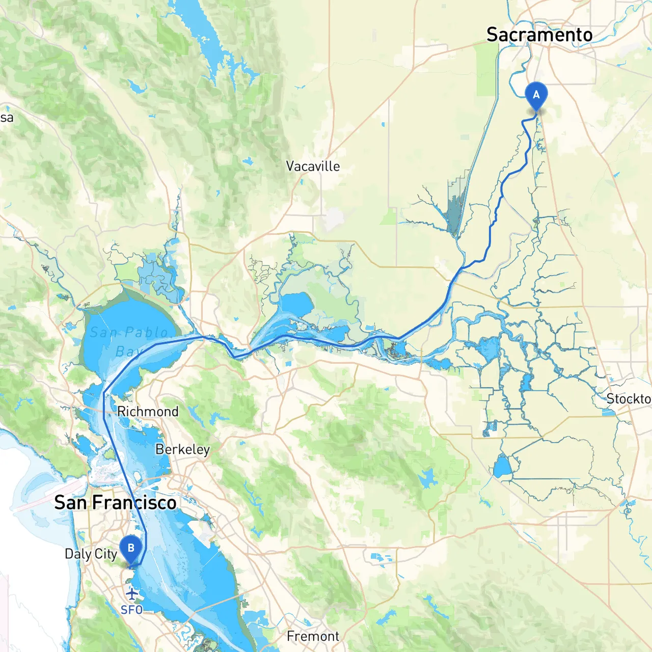
This itinerary will take you from the banks of the Sacramento River, through the San Francisco Bay, concluding at South San Francisco. This trip offers both thrilling navigation experiences and the opportunity to appreciate striking landscapes and vibrant local culture. It's suitable for experienced boaters who are comfortable managing tidal conditions and navigating busy waterways.
Coordinates: Longitude -121.500541, Latitude 38.444525
The journey begins in Sacramento, where the Sacramento River allows for smooth navigation. Before departing, ensure your vessel is equipped with all safety equipment, including life jackets, a marine radio, and navigation tools. Monitor the weather forecasts and tidal information because conditions can change rapidly.
As you motor south along the Sacramento River, keep a watchful eye on navigation markers. The river can be busy with traffic, so maintain proper lookout and require a steady speed.
Navigation Aids: Pay attention to buoys and day markers that delineate the channel, particularly around the confluence with the Sacramento-San Joaquin Delta.
Shelter Options: If the weather worsens or you need to make a stop, consider mooring at Delta marinas like Stockton or Isleton, both of which provide excellent shelter and services.
Points of Interest: Enjoy the scenic views of the Delta, rich with wildlife. It’s a great photo op with egrets, herons, and other birds frequently spotted along the shore.
Once you exit the Delta and enter the San Francisco Bay via the San Francisco shipping channel, your excitement will grow! The Bay is a busy navigational area, with commercial shipping traffic, ferries, and recreational boaters converging.
Hazards: Be aware of potential fog, especially in the morning. The Bay can also be subject to heavy tidal currents, so understanding the tides is crucial—check local tidal charts.
Navigation Aids: Keep an eye on the block island lights and buoys. The Red and Green Channel markers will guide you through the navigable waters toward your destination.
Shelter Options: If inclement weather strikes, consider seeking refuge in notable bays like Duxbury Reef or Marin County's Sausalito—both have adequate facilities and protection from rough waters.
Points of Interest: As you navigate through the Bay, enjoy the iconic views of the Golden Gate Bridge and Alcatraz Island. You may want to anchor for a brief exploration of Sausalito—known for its charming waterfront community, shops, and eateries.
As you approach your destination, you’ll navigate through South San Francisco Bay, which offers a mix of busy production docks and serene waterfront parks.
Hazards & Considerations: Pay particular attention to commercial shipping lanes, especially near the Port of San Francisco. Watch out for fishing vessels and recreational craft, as boat traffic can be dense.
Shelter Options: If you need to pause, Candlestick Point is a beautiful spot to rest a while, providing picturesque views of the Bay and the San Francisco skyline.
Final Approach: Upon nearing South San Francisco, keep in mind the local restrictions regarding mooring and anchoring. Many areas are regulated, so familiarize yourself with the local rules by consulting your NOAA charts.
This journey from Sacramento to South San Francisco perfectly blends safety and adventure—a trip that promises stunning views, diverse recreational options, and the excitement of navigating in busy waterways. For a successful outing, I recommend using boating apps, where Savvy Navvy is particularly useful in planning your route and monitoring weather conditions. Download it along with other navigation tools to ensure a smooth sailing experience.
Adhering to safety guidelines while staying aware of local regulations and possible hazards will help you enjoy every moment as you explore the beautiful waters of California. Happy boating!