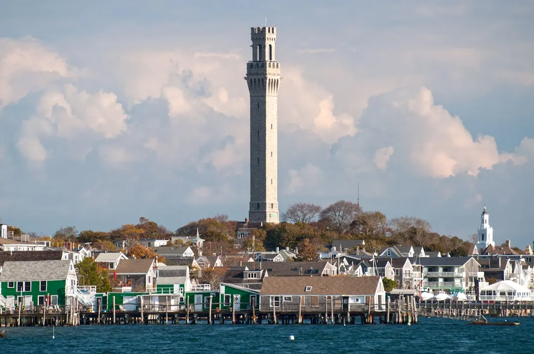
Departure Point: Provincetown, MA (Lat 42.0525, Long -70.1745)
Your journey begins in the charming fishing village of Provincetown, located at the northern tip of Cape Cod. Before casting off, ensure you top up on supplies and check the weather. Provincetown has a lively waterfront with plenty of attractions, including art galleries and restaurants if time allows.
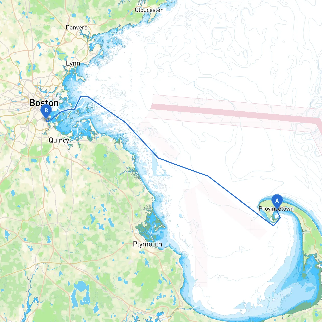
Leaving Provincetown, the first segment of your cruise will take you through Cape Cod Bay. The route will primarily follow the coastline southwards, passing several points of interest along the way.
As you navigate out of Provincetown Harbor, be aware of the shifting sands and shoals; maintaining awareness of local charts is crucial. Watch for tidal currents, especially around the mouth of the harbor, where they can be quite strong.
1. Race Point Lighthouse: A well-established navigational aid, visible from a distance. It stands stark against the backdrop of sandy beaches and is a perfect photo opportunity.
2. Wellfleet: An excellent spot for a pit stop, Wellfleet boasts beautiful beaches and a charming town center. A brief detour can lead you to the Wellfleet Bay Wildlife Sanctuary, perfect for nature walks.
3. Truro: As you continue southward, the scenic views of the Truro coastline captivate your senses. The historic Truro Center and Highland Light are worth a visit, offering breathtaking panoramic views.
4. Pamet Harbor: This sheltered harbor is ideal for taking refuge if adverse weather conditions arise. It offers a beautiful marina and the opportunity to explore nearby natural areas.
As you continue your route, you will need to monitor navigational aids, including:
Approaching Boston Harbor, be vigilant of the busy shipping channels, as it becomes a bustling waterway. Watch for commercial vessel traffic, especially as you near the numerous piers and marinas lining the shores.
This route is perfect for experienced and intermediate boaters who prioritize safety while still seeking adventure. With well-defined landmarks, navigational aids, and various options for seeking shelter, you can explore the stunning coastline of Massachusetts without compromising safety. As always, equip yourself with navigation apps like Savvy Navvy for real-time mapping, weather updates, and tidal information, ensuring you're ready for any challenges that may arise on your journey. Happy cruising!