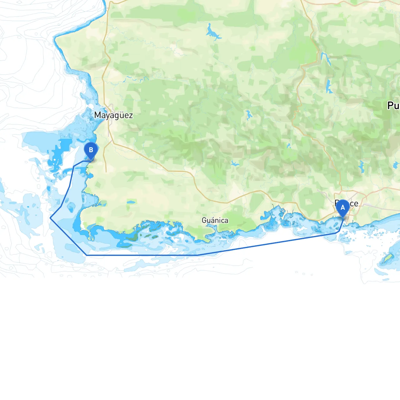
Pilotage Plan for Boat Trip from Ponce, Puerto Rico to Cabo Rojo, Puerto Rico
Route Overview:This trip from Ponce to Cabo Rojo offers a scenic waterway dotted with beautiful coastlines, playful marine life, and opportunities to explore local culture. This journey is well-suited for experienced sailors looking for a rewarding day on the water with the option for overnight stops.
Starting Point: Ponce, Puerto Rico Ending Point: Cabo Rojo, Puerto Rico
1. Departure from Ponce
Ponce, known as “La Perla del Sur,” boasts a robust marina, making it an attractive starting point. Before you embark, take a quick look at
Ponce Yacht and Fishing Club
for any last-minute provisions or fuel.
Safety Tip: Always check the weather forecast prior to departure. The Caribbean can be unpredictable; so, look out for sudden squalls or rough seas.
2. Key Landmarks on the Route
As you navigate towards Cabo Rojo, keep an eye out for these notable points of interest:
- Cayo Caribe: A small island along your route known for its crystal-clear waters and great snorkeling opportunities. A brief stop here can be refreshing and allows you to engage with local marine life.
- La Parguera: This quaint fishing village and mangrove area is famous for bioluminescent bays. A perfect spot for a pause and a meal, it presents local seafood restaurants along the coast.
- Cabo Rojo Lighthouse (El Faro de Los Morrillos): Upon approaching Cabo Rojo, be sure to look for this picturesque lighthouse, which offers stunning views of the surrounding landscape.
3. Potential Shelters
In case of inclement weather during your cruise, here are two sheltered bays to consider:
- Bahía Fosforescente: Especially noted for its luminescent waters, it’s also a safe haven in choppy weather. Secure anchorage can be found here.
- Bahía de La Parguera: Well-known for providing good protection from strong winds, this bay is frequented by sailors looking to ride out unexpected squalls.
4. Navigational Considerations
While navigating this route, focus on the following:
- Navigational Aids: Pay attention to channel markers along your route. The buoys and beacons are crucial for safe passage, especially when entering or leaving any ports.
- Local Regulations: Be aware of no-wake zones in populated areas, especially around La Parguera, as well as fishing restrictions in critical habitats. The use of snorkel gear may require permits in certain areas, so check local guidelines.
- Tides and Currents: Understanding tidal variations in the region can help in planning your approach to Cabo Rojo. The currents can be strong; hence a tide table should be readily available to assist in your navigation.
5. Recommended Apps
To help ensure a smooth sail, make use of the following apps:
- Savvy Navvy: This app is incredibly user-friendly for plotting your course, providing real-time weather updates, and offering navigation routes.
- Navionics: Offers detailed charts of the area, so you can keep track of your position relative to hazards and waypoints.
- Windy: A great forecasting tool to monitor wind patterns, helping you strategize when to make your moves on the water.
This journey promises breathtaking views coupled with exciting little detours that will make for memorable experiences while ensuring your safety on the water. By being prepared and mindful of the local conditions, you will not only enjoy the beautiful shores of Puerto Rico but also emerge as a more seasoned sailor through this lovely adventure. Happy sailing!