Pilotage Plan: Point Pleasant, NJ to City Island, NY
Embarking on a boat trip from Point Pleasant, New Jersey, to City Island, New York, offers an enriching experience with both natural beauty and bustling maritime activity. This route is well-suited for intermediate to experienced boaters who are comfortable navigating through busy waters, keen to learn about local hazards, and focused on safe boating practices.
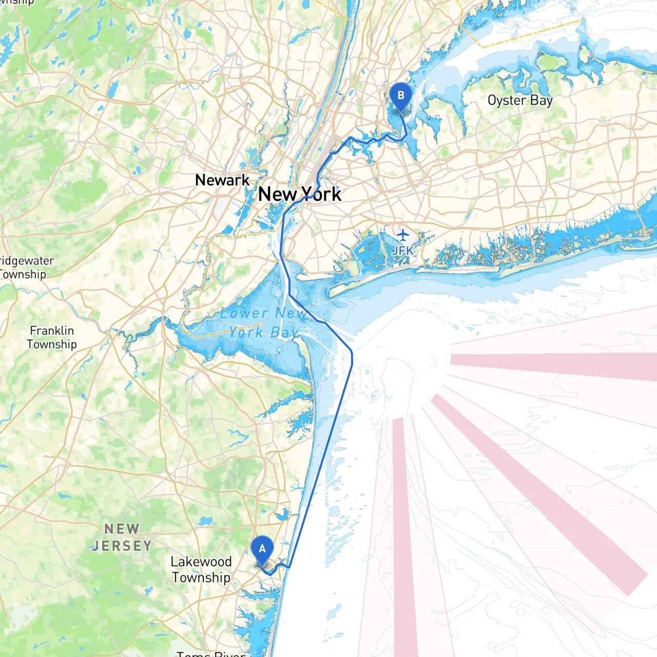
Route Overview
The planned route will take you along the scenic coastal waters, transitioning from the Manasquan River, through the Barnegat Bay into the Shrewsbury River, and finally navigating past several key landmarks towards your destination on City Island. The journey is approximately 30 nautical miles and offers opportunities to dock, drop anchor, and explore delightful bays should the weather turn unpredictable.
Key Leg of the Journey
1. Point Pleasant to Manasquan Inlet
- Distance: ~5 nautical miles
- Navigational Aids: Pay close attention to Marker “3” at the entrance of the Manasquan River. The buoy markings here guide the way in and out of the inlet.
- Hazards: Watch for shifting sandbars and swift currents around the inlet, especially during outgoing tides.
- Points of Interest: The Manasquan Reservoir is nearby and offers beautiful views, but note that anchoring here is generally prohibited.
2. Manasquan Inlet to Barnegat Bay
- Distance: ~8 nautical miles
- Navigational Aids: The Barnegat Lighthouse (Old Barney) is a significant landmark for navigation. Its light is a useful point of reference.
- Hazards: Be mindful of fishing boats and crab pots in this region. The water can also become choppy, especially on weekends when recreational traffic peaks.
- Shelter Opportunities: The nearby Forked River has several marinas and offer good shelter should weather conditions worsen.
3. Barnegat Bay to Shrewsbury River Intersection
- Distance: ~10 nautical miles
- Navigational Aids: Keep a close eye on navigational buoys, specifically the "RN" and "G" marks in the Shrewsbury River. The currents can be strong, especially around the changing tide.
- Hazards: Be aware of the high-speed ferry traffic near the Shrewsbury River entrance, with limited visibility at times.
- Shelter Opportunities: The Navesink River just northeast of the Shrewsbury offers safe anchorage and picturesque sceneries, ideal for a rest stop.
4. Shrewsbury River to City Island
- Distance: ~7 nautical miles
- Navigational Aids: Make note of the various fixed bridges along the way; the Sea Bright-Freeze Bridge is one of the hardest to navigate under due to clearance. It's paramount to understand your boat's height and tide levels.
- Hazards: Be wary of recreational traffic in these waters since numerous vessels cross here, leading to unexpected wakes and waves.
- Points of Interest: As you approach City Island, look for the picturesque waterfront homes and bustling seafood restaurants.
Important Navigational Policies
- Stay Updated: Always check the NOAA Marine Forecast and local advisories before setting out.
- Traffic Management: In busy waterways, keep a close eye on your speed and the wake you generate to ensure safety for all vessels.
- Regulated Areas: Be aware of no-wake zones, especially around marinas and moored boats in the Shrewsbury River. Secure your necessary navigational permits, especially if you plan on fishing.
Recommended Boating Apps
To enhance your navigation experience, consider using the following apps:
- Savvy Navvy: A fantastic tool offering route planning and live weather information specific to your location.
- Navionics: For detailed charts and community updates.
- Windy: To monitor real-time wind conditions which can greatly affect your journey.
Conclusion
This route from Point Pleasant to City Island provides a perfect balance of adventure, scenic beauty, and safety. Whether you're an intermediate boater seeking new experiences or a seasoned sailor enjoying a leisurely cruise, keep the focus on navigating wisely and respecting the marine environment. Prepare well, stay vigilant, and enjoy the journey ahead!