
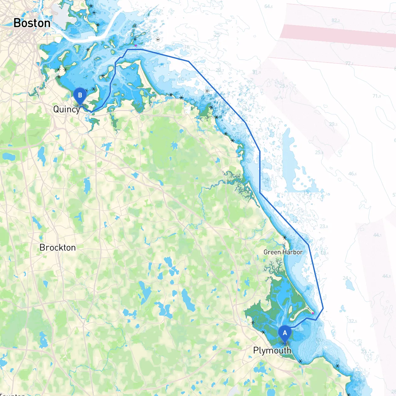
This boat trip from Plymouth, Massachusetts, to Quincy, Massachusetts, along the scenic South Shore of Massachusetts is not just a journey; it’s an adventure rich in possibility. The route traverses beautiful harbors, sheltered bays, and historic sites, providing ample opportunities for both safety and enjoyment. This trip is most suitable for recreational boaters seeking a mixture of tranquility and exploration.
Starting Point: Plymouth, MA (41.9650° N, 70.6464° W)Your voyage begins in the historic town of Plymouth, steeped in American heritage. Before setting off, take a moment to explore the renowned Plymouth Rock and the Mayflower II replica.
Leg 1: Plymouth Harbor to Kingston BayAs you depart, navigate out of Plymouth Harbor, where you’ll be guided by well-marked navigational aids. After clearing the outer harbor, set a course towards Kingston Bay. The breakwater leading into Kingston provides a safe passage, and should the weather worsen, Kingston Bay is an excellent place to seek shelter.
Points of Interest:
Leg 2: Kingston Bay to Duxbury BayFrom Kingston Bay, continue northeast to Duxbury Bay. The bay is well-marked, and you may encounter local boats and fishermen, so keep a lookout for any fishing vessels.
Points of Interest:
Leg 3: Duxbury Bay to Green HarborProceed along the shoreline towards Green Harbor. This section of the route may involve navigating through shallower waters, so ensure you have accurate charts on hand.
Shelter Options:
Leg 4: Green Harbor to MarshfieldAgain sailing northeast, you’ll enter the Marshfield area. Pay attention to the navigational buoys, especially as you approach the river mouth. Here you have the option to tether in a calm cove or continue your journey.
Points of Interest:
Leg 5: Marshfield to Quincy BayLeaving the Marshfield area, you will navigate towards Quincy Bay. The approach can be busy with commercial and recreational traffic, so maintaining situational awareness is essential.
Points of Interest:
Destination: Quincy, MA (42.2533° N, 70.9817° W)You will conclude your journey as you enter Quincy. Make sure to scan the horizon for local navigation aids and be aware of potential congestion in the harbor area.
Taking this trip from Plymouth to Quincy promises a balance of safety, enjoyment, and picturesque landscapes. Following this pilotage plan, you'll find countless opportunities for refuge and exploration, making it a desirable route for any boater looking for the charms of the Massachusetts coastline.