Pilotage Plan: Mooloolaba to Tin Can Bay
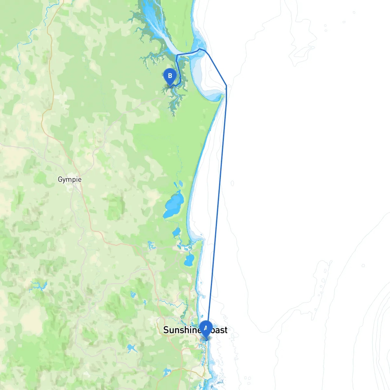
OverviewThis picturesque journey from Mooloolaba to Tin Can Bay offers a perfect blend of coastal cruising with opportunities to experience the natural beauty of Queensland’s waterways. The total distance is approximately 38 nautical miles, which can be covered comfortably within a day, making this trip suitable for weekend cruisers and more experienced visitors alike. However, safety is paramount, and we'll highlight several key considerations along the route.
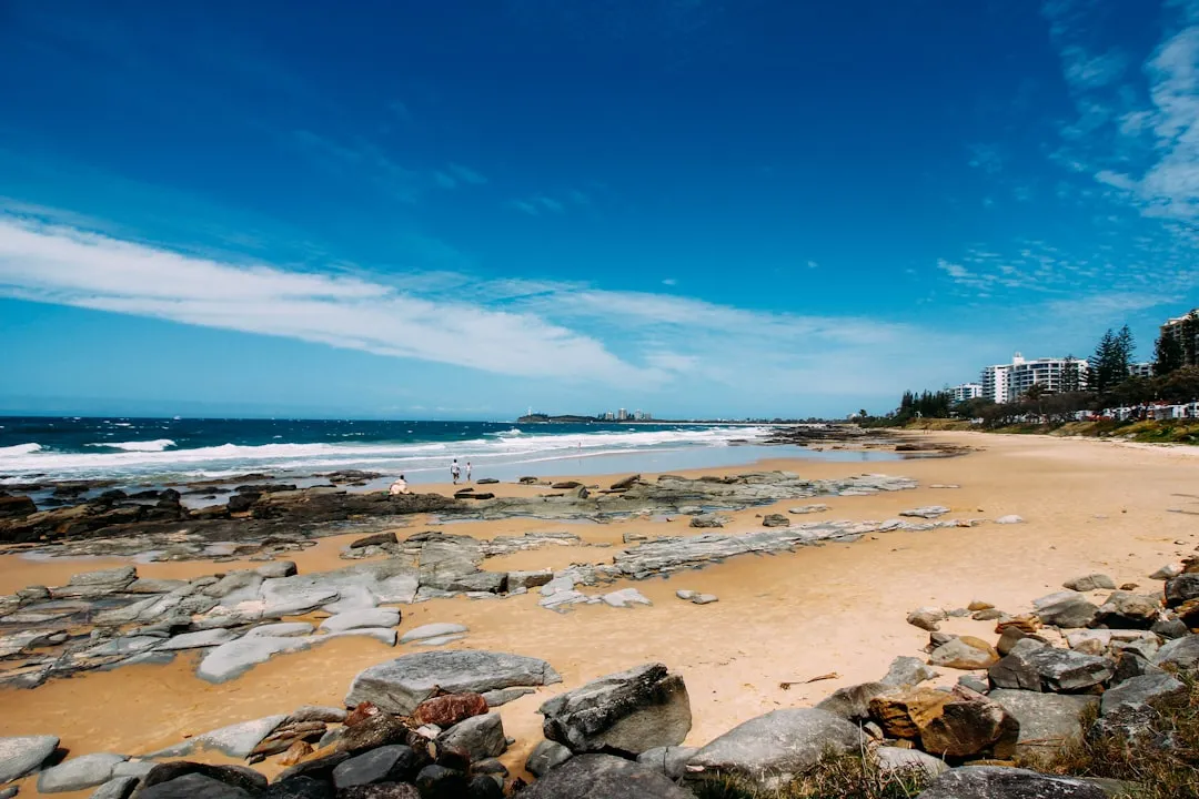
Departure from MooloolabaAs you set sail from Mooloolaba (Coordinates: 153.1292, -26.6853), start by navigating through the Mooloolah River with care. Be mindful of the shallow waters and shifting sandbanks near the river mouth. The river has a well-marked channel, so follow the navigation buoys closely.
Points of Interest:1. Mooloolaba Beach: Before heading out, consider a stop at the beach to enjoy a sunrise or a quick jog along the shore.2. Underwater World SEA LIFE: A family-friendly attraction; this may be an entertaining stop if you have time before departure.
Navigating to Caloundra BarAs you progress north along the coast, you’ll find the Caloundra Bar, an essential navigational point. The bar can be tricky, especially if there's a significant swell. Ensure to check local conditions and favor a departure near high tide if possible. A good tip is to maintain a course of about 310° from Mooloolaba towards the bar.
Shelter Opportunities:If the weather takes a turn, the Bulcock Beach in Caloundra provides excellent shelter. It’s a picturesque spot for a break, with soft beaches and cafes onshore.
Pumicestone PassageAfter successfully crossing Caloundra Bar, you’ll enter the serene waters of the Pumicestone Passage. This narrow stretch is flanked by stunning marine parks and untamed wilderness, providing a calm contrast to the open sea. Here, you may want to reduce your speed as you encounter wildlife, such as dolphins and various bird species.
Navigational Aids:Look out for the prominent navigation markers in Pumicestone Passage: the North and South Beacons are pivotal to delineate safe navigable channels. Make sure to update your charts regularly, as they guide you through this area.
Navigating Towards Tin Can BayAs you exit the passage, head towards the Wide Bay Bar. Similar to Caloundra, conditions can change rapidly here. Always check the latest reports and consider local expertise or advice for best crossing times. Ideally, aim to cross during high slack water.
Points of Interest Along This Leg:
Approaching Tin Can BayAs you begin to approach Tin Can Bay (Coordinates: 153.0063, -25.9069), pay attention to the shallow waters and tidal flows. Entry into the bay is marked, but be vigilant for local boat traffic, particularly from fishing vessels.
Final Stages & ArrivalYou will find a marina at Tin Can Bay, well-equipped for docking and providing facilities for overnight stays. The area is renowned for its friendly wild dolphin encounters, offering a unique experience after a day’s journey.
Safety Precautions:
This pilotage plan for the Mooloolaba to Tin Can Bay route is designed with the coastal boater's safety and exploration in mind. With careful navigation and attention to local conditions, you can enjoy a rewarding experience, taking in the stunning scenery and local marine life along the way. Happy cruising!